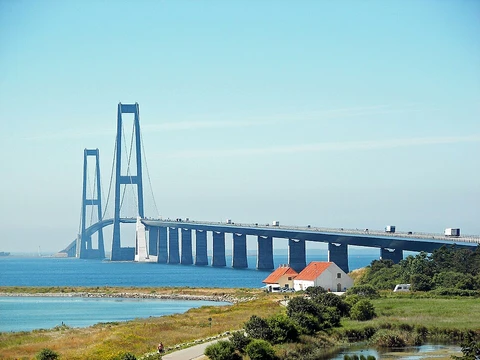
The Oresund Bridge
Combined road and rail link connecting Denmark and Sweden.
Last updated

Ank Kumar · CC BY-SA 4.0
Where it is
Coordinates: 55°34′16″N 12°50′56″E (55.5710, 12.8490) · Open in OpenStreetMap
Coordinates and connected clubs: the infobox of Wikipedia: Øresund Bridge (CC BY-SA 4.0). Map: drawn by Codexery from OpenStreetMap tiles.
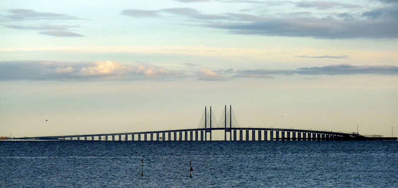
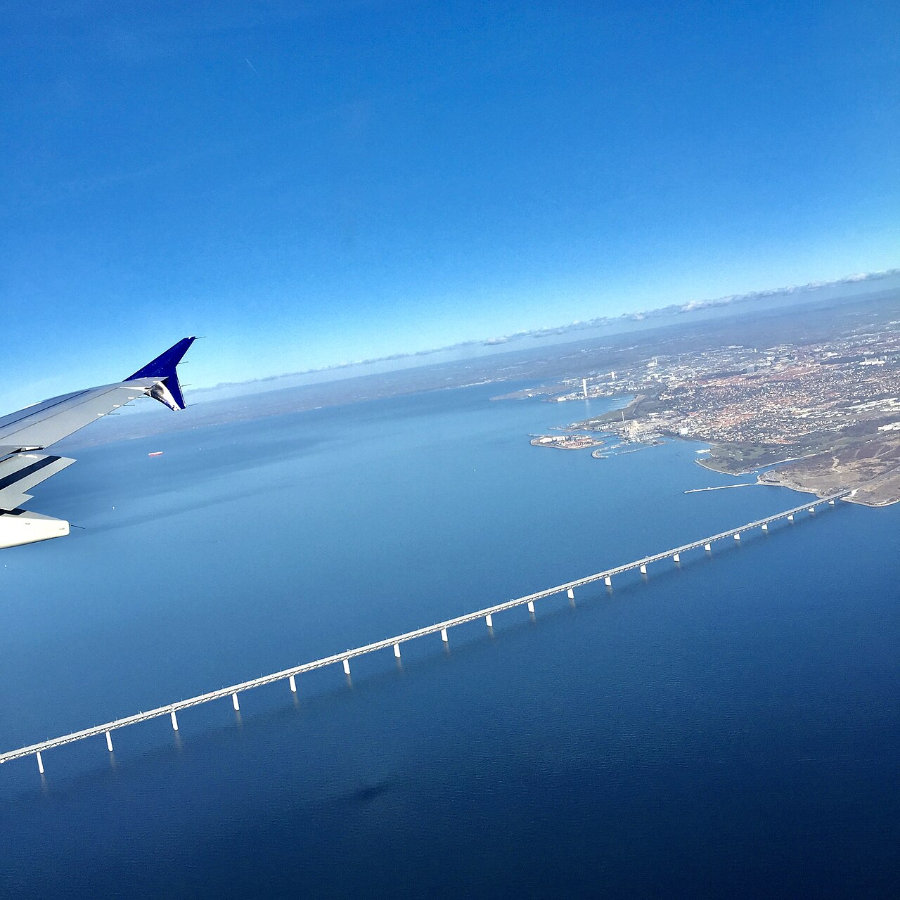
The Øresund Bridge is a combined road and rail link that connects Sweden to Denmark across the Øresund strait.[1][2] The Øresund Link comprises the bridge, a tunnel, and the artificial island Peberholm.[1][3]
Geography and history
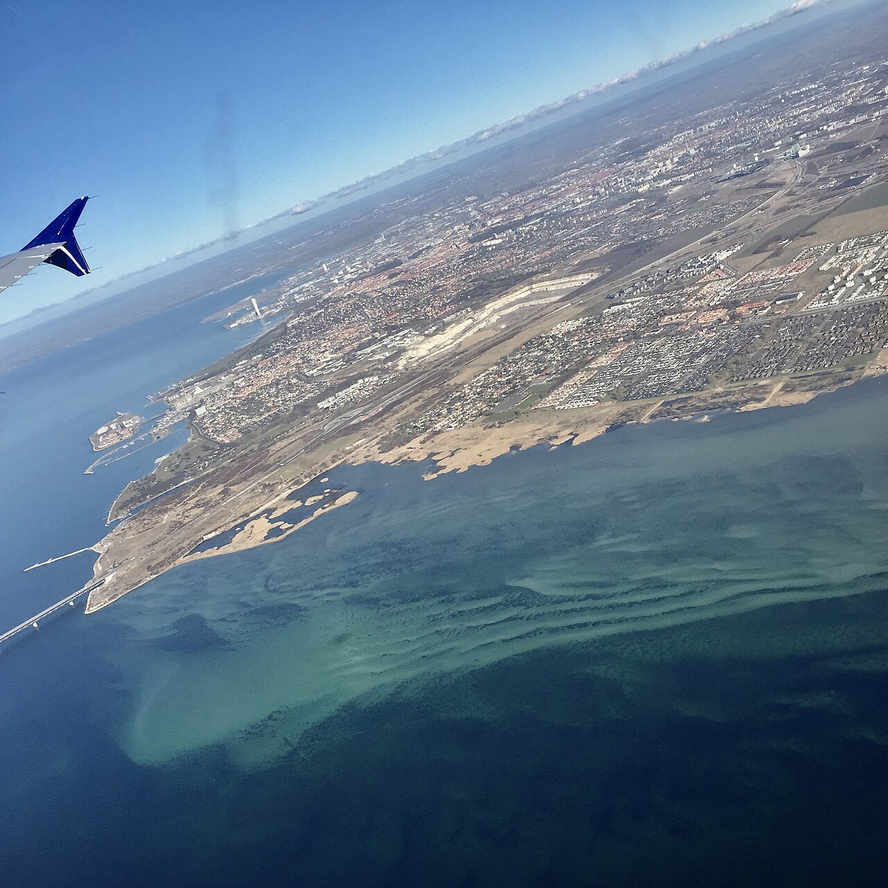
In 1910, a proposal for a railway tunnel across the strait was put to the Swedish Parliament.[4] The Danish and Swedish governments signed an agreement to build a fixed link in 1973, but that project was cancelled in 1978.[5][6] A tunnel was chosen for part of the route to avoid interfering with air traffic from Copenhagen Airport and to provide a clear channel for ships.[7] The artificial island Peberholm was built just south of Saltholm.[8][9]
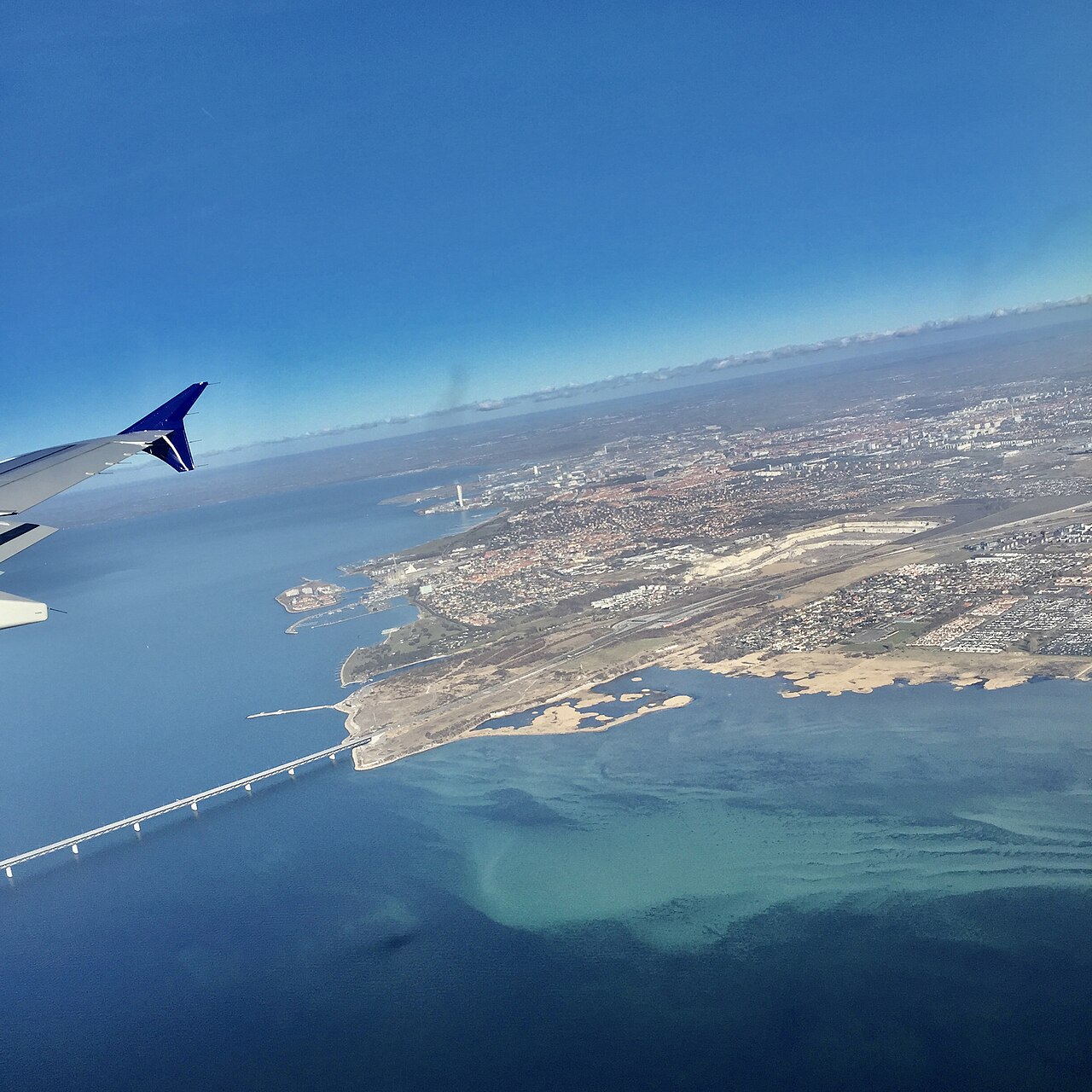
Via the Great Belt Fixed Link, the bridge links the Scandinavian Peninsula's road and rail systems to those of Mainland Europe.[1] A formal proposal for a bridge was initially made in 1936 by a group of engineering companies.[4] In 1991, a fresh accord was reached, selecting a path linking Limhamn and Kastrup.[6][10] Jørgen Nissen, Klaus Falbe Hansen, Niels Gimsing, and Georg Rotne were the designers of the bridge.[7]
What the cited sources add
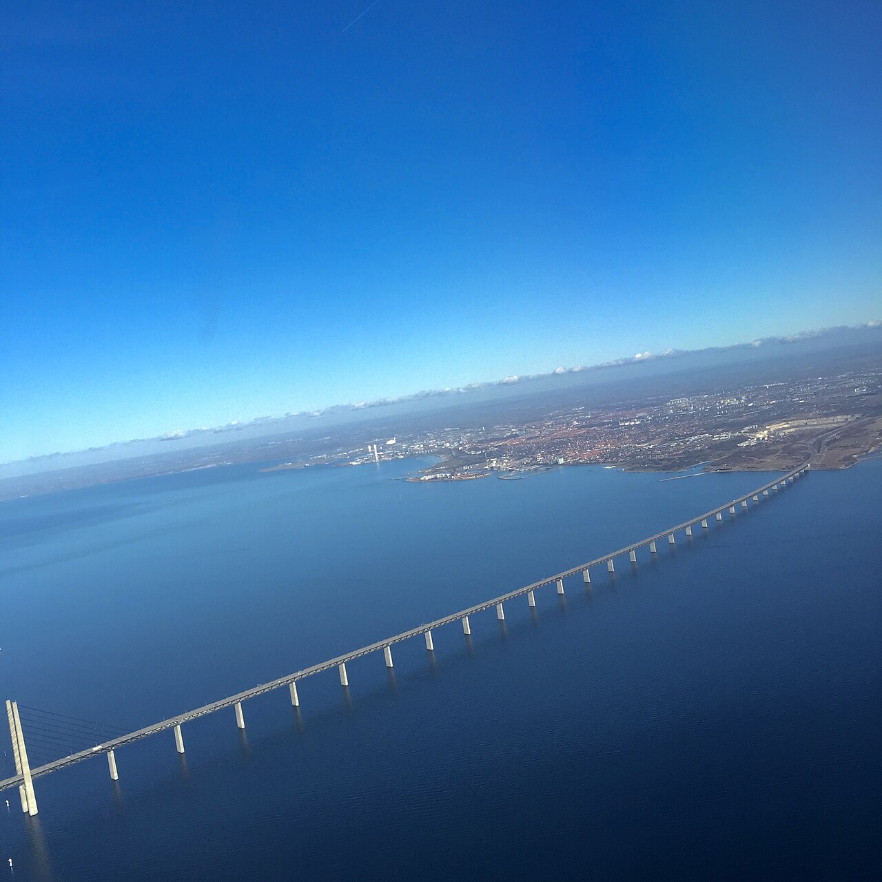
A 2020 article from nordics.info notes that the bridge's opening had a huge social and economic impact on both Denmark and Sweden.[2] The same source reports that 16 unexploded bombs were found in the Sound during construction.[2] The Øresundsbro Konsortiet website describes the company as a Danish-Swedish entity equally owned by A/S Øresund and Svensk-Danska Broförbindelsen SVEDAB AB.[11] According to the 1999 article "Absolut bro", the Øresund Bridge holds the record as the longest cable-stayed bridge in the world that carries both road and rail traffic.[9][12]
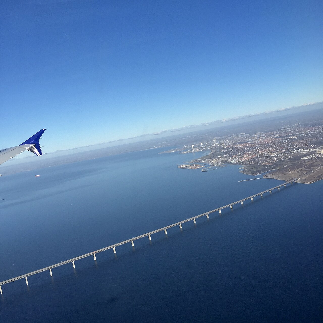
The bridge's official website reports that the high bridge has a free span of 490 meters and pylons that are 203.5 meters tall.[3]
References
- Wikipedia, "Øresund Bridge" (CC BY-SA 4.0), which cites: Hoge, "Link Finally Anchors Sweden to the Rest of Europe (Published 1999)", The New York Times, 1999-09-05; "Copenhagen Is Linked To the Continent (Published 1997)", The New York Times, 1997-06-08; cnplus, "21Jun91 SWEDEN: ORESUND LINK PROJECT TO SYMBOLISE END OF SWEDISH ISOLATION FROM EC.", Construction News, 1991-06-20; "New Baltic data cable plan unfolding", Yle yhtiönä, 11 December 2013 (original not read by us) en.wikipedia.org
- "A short history of the Oresund Bridge", nordics.info Aarhus University, 21 April 2020. facts only, no text reused. nordics.info
- "Bridge, pylons, and cable stays", oresundsbron.com. facts only, no text reused. oresundsbron.com
- Wikipedia, "Øresund Bridge" (CC BY-SA 4.0), which cites: "Øresundsbron's history", Øresundsbron; "A Submarine Military Tunnel". Scientific American, 6 August 1910, p. 104; Boge, "Votes Count but the Number of Seats Decides: A comparative historical case study of 20th century Danish, Swedish and Norwegian road policy.", DBI Norwegian School of Management, 2006; Marstrand, "Det Store Vej - og broprojekt Motorveje med broer over storebælt og Øresund", Ingeniøren, 14 March 1936, p. 67–70 (original not read by us) en.wikipedia.org
- Wikipedia, "Øresund Bridge" (CC BY-SA 4.0), which cites: Boge, "Votes Count but the Number of Seats Decides: A comparative historical case study of 20th century Danish, Swedish and Norwegian road policy.", DBI Norwegian School of Management, 2006; OECD, "OECD Territorial Reviews OECD Territorial Reviews: Oresund, Denmark/Sweden 2003", OECD Publishing, 2003, p. 77; Defense Transportation Journal, Vol. 29, No. 6 (November/December, 1973), p. 7 (original not read by us) en.wikipedia.org
- Wikipedia, "Øresund Bridge" (CC BY-SA 4.0), which cites: "Strait crossings 2001: proceedings of the Fourth Symposium on Strait Crossings, Bergen, Norway, 2 - 5 September 2001", CRC Press, 1 January 2001; Centre for Mega Projects in Transport and Development, "Project Profile: Sweden, The Oresund Link", Omega Case Studies, 2014 (we also read that source) en.wikipedia.org
- Wikipedia, "Øresund Bridge" (CC BY-SA 4.0), which cites: "Getting the balance right. The Øresund Bridge - Design", 1999, p. 417–426 (we also read that source) en.wikipedia.org
- Wikipedia, "Øresund Bridge" (CC BY-SA 4.0), which cites: "Øresundsbro Konsortiet", Øresundsbron; "Absolut bro", Forskning & Framsteg, June 1999 (we also read that source) en.wikipedia.org
- "Absolut bro", Forskning & Framsteg, June 1999. facts only, no text reused. fof.se
- Wikipedia, "Øresund Bridge" (CC BY-SA 4.0), which cites: "Proposition 1990/91:158 med anledning av ett avtal mellan Sverige och Danmark om en fast förbindelse över Öresund", Sveriges Riksdag (original not read by us) en.wikipedia.org
- "Øresundsbro Konsortiet", Øresundsbron. facts only, no text reused. oresundsbron.com
- Wikipedia, "Øresund Bridge" (CC BY-SA 4.0), which cites: "Absolut bro", Forskning & Framsteg, June 1999 (we also read that source) en.wikipedia.org
Each numbered sentence above was checked against the source it cites before publication. Sentences citing Wikipedia adapt text from the English Wikipedia article Øresund Bridge (contributors), used under CC BY-SA 4.0; this entry is available under the same licence. Other sources were used for facts only; no text or images are copied from them.
Ranked in
More in Great Bridges
Sources
Compiled from Wikipedia and the sources listed below. Text from Wikipedia is available under CC BY-SA 4.0; this entry is adapted from it.
- Wikipedia: Øresund Bridge (CC BY-SA 4.0).
- Currency conversion: European Central Bank euro reference rates, rates of 2 October 2026.
Spotted an error? Know more?
Reader corrections go straight into our review queue. Suggest an edit · How this site is sourced