New Town, Edinburgh
Georgian planned extension of Edinburgh, a UNESCO World Heritage Site.
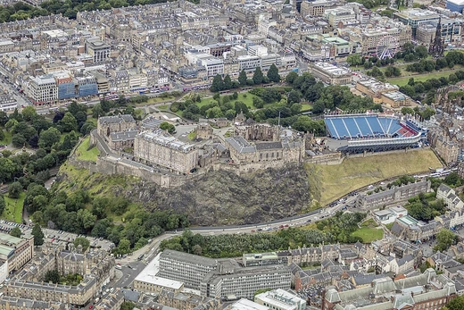
The New Town is a central area of Edinburgh, the capital of Scotland. It was built in stages between 1767 and around 1850, and retains much of its original neo-classical and Georgian architecture. Its best-known street is Princes Street, facing Edinburgh Castle and the Old Town across the geological depression of the former Nor Loch. The combined New Town, Old Town, and West End were designated a UNESCO World Heritage Site in 1995.
Quick Facts
- Location
- Edinburgh, Scotland
- Part of
- Old and New Towns of Edinburgh
Facts from the source article.
Did You Know?
- The first building in the New Town was Thistle Court, built by John Young in 1767, who received a £20 premium to be the first builder on site.
- Dundas House, built on the intended site for St. Andrew's Church, was completed in 1774 and is now the registered office of the Royal Bank of Scotland.
- A section of Glenfinlas Street at the north-west corner of Charlotte Square was not completed until 1990.
Proposal and planning
The idea of a New Town was first suggested in the late 17th century when the Duke of Albany and York, later King James VII and II, encouraged extending the city northward and building a North Bridge while serving as Royal Commissioner at Holyrood Palace. He granted the city the right to purchase land and establish a regality, but after he left in 1682, became king in 1685, and lost the throne in 1688, the project was delayed. The city fathers later decided to construct a New Town due to overcrowding within the Old Town walls and to prevent wealthy citizens from moving to London. The Age of Enlightenment had arrived, and the outdated city fabric no longer suited the professional and merchant classes. Lord Provost George Drummond extended the royal burgh boundary to include fields north of the Nor Loch, a heavily polluted body of water. A scheme to drain the loch began, though it was not fully completed until 1817. Crossing points were built: the North Bridge in 1772 and the Earthen Mound, which started as a tip for excavation material and reached its present proportions in the 1830s. As successive stages developed, affluent classes moved from cramped Old Town tenements into grand Georgian homes on wide roads, while the working classes and poor remained in the Old Town.
The First New Town
A design competition in January 1766 was won by 26-year-old James Craig, who proposed a simple axial grid following the land's natural contours, with a principal thoroughfare along the ridge linking two garden squares. Two other main roads ran downhill to the north and south, with two minor streets between and several mews for stable lanes. Three north-south cross streets completed the grid. Craig's original plan has not survived, but a 1766 map by John Laurie may indicate it, showing a diagonal layout with a central square echoing the Union Flag. A simpler revised design named streets and civic spaces to reflect Hanoverian British patriotism: George Street after King George III, Queen Street after his wife, and St. Giles Street after the city's patron saint. St Andrew Square and St. George's Square represented the union of Scotland and England, with Thistle Street and Rose Street for their national emblems. King George rejected St. Giles Street because St Giles was patron saint of lepers and also a slum name in London, so it was renamed Princes Street after his eldest son. St. George's Square became Charlotte Square after the queen to avoid confusion with an existing George Square. Thistle Street was shortened by renaming its western blocks Hill Street and Young Street. The remaining streets—Castle, Frederick, and Hanover—were named for the castle view, Prince Frederick, and the House of Hanover.
Northern, or Second, New Town and extensions
After 1800, the first New Town's success sparked even more ambitious plans. William Sibbald's early designs kept to Craig's grid pattern, with whole streets raised as single projects. Construction pushed north along Dundas Street, which continued from Hanover Street, and Pitt Street (renamed Dundas Street in the 1960s), stretching nearly a kilometre to Canonmills, where Bellevue Crescent became the development's northern boundary. Great King Street served as the main thoroughfare, with Drummond Place at its east end and Royal Circus at the west. Northumberland Street and Cumberland Street ran as smaller roads to the south and north. Heriot Row and Abercromby Place, each built on only one side, sat at the southern edge overlooking Queen Street Gardens. East-west streets held townhouses, while north-south streets featured tenement flats; shops mostly occupied the ground floors of the wider north-south roads. The Picardy Place extension, covering Broughton Street, Union Street, and East London Street, was largely complete by 1809. Shandwick Place, stretching Princes Street westward, began in 1805, followed by Melville Street and the area north of Shandwick Place in 1825. The Gayfield Estate extension, including Gayfield Square, was designed in 1807. Around 1813, the New Town started absorbing the old village of Stockbridge. Painter Henry Raeburn purchased the Deanhough estate in the northwest, beginning development in 1813 with Ann Street, named for his wife.
Eastern, or Third, New Town
Before Regent Bridge was finished, Edinburgh Town Council had already begun planning the Eastern New Town. This area was to run from the slopes of Calton Hill north to Leith, sitting between Leith Walk and Easter Road. In 1811, the Lord Provost reached an agreement with the main landowners. Initial surveying followed, and an architectural competition was held on 1 January 1813, but its results were not decisive. Several well-known architects were then asked for their views, including William Stark, James Gillespie, Robert Burn and his son William Burn, John Paterson, and Robert Reid. Stark’s ideas were especially respected, and he expanded them in a report published after his death in 1814. The commissioners later chose Stark’s pupil, William Henry Playfair, who was appointed in February 1818. His plan, delivered in April 1819, closely followed Stark’s advice. Playfair aimed to create a New Town even grander than Craig’s. Regent Terrace, Carlton Terrace, and Royal Terrace were built on Calton Hill, along with Hillside Crescent and a few nearby streets, but the development further north toward Leith was never finished. On the south side of Calton Hill, several monuments and the Royal High School, a Greek revival design by Thomas Hamilton, were erected.
More in World Heritage Sites in Scotland
Spotted an error? Know more?
Reader corrections go straight into our review queue. Suggest an edit · How this site is sourced