
Cotopaxi
Active stratovolcano in Ecuador, second highest summit in the country.
Last updated
Where it is
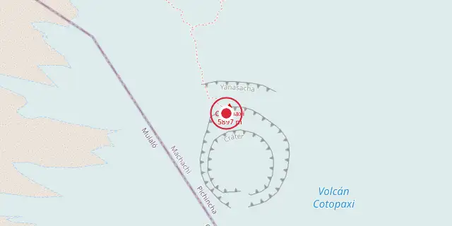
Coordinates: 0°40′52″S 78°26′17″W (-0.6810, -78.4380) · Open in OpenStreetMap
Coordinates and connected clubs: the infobox of Wikipedia: Cotopaxi (CC BY-SA 4.0). Map: drawn by Codexery from OpenStreetMap tiles.
Cotopaxi is an active stratovolcano in the Andes Mountains of Ecuador, located in Cotopaxi National Park about 50 km south of Quito. It is the second highest summit in Ecuador, reaching 5,897 m, and is among the highest active volcanoes in the world. Known for its nearly symmetrical cone and equatorial glacier, Cotopaxi has erupted 87 times, with lahars creating numerous valleys. Its most recent significant eruption began in August 2015.
Lore & Background
Cotopaxi's name derives from Quechua and Aymara words meaning 'neck of the moon,' referring to its crescent-shaped crater. The mountain was honored as a sacred rain sender by local Andean people before the Inca invasion in the 15th century. Its summit was revered as a place where gods lived. The first recorded eruption was in 1534, and its most violent historical eruptions occurred in 1742, 1744, 1768, and 1877, with the 1877 event melting the entire ice cap and sending lahars over 100 km to the Pacific Ocean.
Climbing history includes Alexander von Humboldt's failed attempt in 1802, the first successful summit by Wilhelm Reiss and Angel Escobar in 1872, and later ascents by Edward Whymper and others. The José F. Ribas Refuge was built in 1971 at 4,864 m. A tragedy occurred on Easter Sunday 1996 when an avalanche partially buried the refuge, killing 13 people. Cotopaxi was also the location of a NASA Minitrack satellite tracking station from 1957 to 1981.
Reader's Guide
Cotopaxi is significant as one of the world's highest active volcanoes and a key feature of Ecuador's landscape. Its 87 known eruptions make it one of Ecuador's most active volcanoes, posing high risk to local populations due to potential lahars from glacier melt. The volcano's activity is closely monitored by the Geophysical Institute of Ecuador, which reported around 8,000 earthquakes from October 2022 to February 2023. Cotopaxi's eruptions have historically destroyed towns like Latacunga, and future eruptions threaten an estimated 300,000 people in surrounding provinces.
The volcano is also a major tourist destination for climbing, with up to 100 climbers attempting the summit on weekends. Its equatorial glacier and symmetrical cone make it a distinctive natural landmark, visible from Quito and Latacunga on clear days. The 2015 phreatic eruptions and the ongoing 2022 eruption highlight its continued volatility and the need for preparedness.
Did You Know?
- Cotopaxi has one of the few equatorial glaciers in the world, starting at 5,000 m.
- The volcano's crater is 800 m × 550 m wide and 250 m deep, with two concentric rims.
More in Volcanoes
Sources
Compiled from Wikipedia and the sources listed below. Text from Wikipedia is available under CC BY-SA 4.0; this entry is adapted from it.
- Wikipedia: Cotopaxi (CC BY-SA 4.0).
- Word definitions: the Codexery glossary, each quoted from its Wikipedia article.
Spotted an error? Know more?
Reader corrections go straight into our review queue. Suggest an edit · How this site is sourced