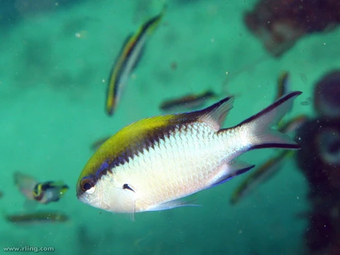
Where Barrier reef chromis has been recorded
GBIF occurrence records for Chromis nitida, mapped and tabulated by country.

1,881 georeferenced occurrence records with coordinates are published for Chromis nitida through GBIF, from 4 countries or marine areas. This page maps those records and lists where they come from. Occurrence records reflect where people have looked as well as where the species lives, so well-surveyed coastlines are over-represented.
- Georeferenced records
- 1,881
- Countries / areas
- 4
- Mapped locations
- 70
- Records sampled for the map
- 1,881
- Inland records omitted
- 10
- Gbif taxonkey
- 5212150
Countries and areas with the most records (GBIF)
Australia — 1,878 records; New Caledonia — 1 records; Philippines — 1 records; Solomon Islands — 1 records.
Source: GBIF Occurrence Search (taxonKey 5212150) — https://www.gbif.org/occurrence/search?taxon_key=5212150&has_coordinate=true (records CC0 / CC BY). Accessed 2026-09-23.
How to read this map
The map plots a sample of 1,881 of the 1,881 records, deduplicated to a half-degree grid, so dense areas do not merge into one blob. The sample covers 4 of the 4 countries or areas with records; the areas absent from the sample hold 0 records in total.
10 records plotting inland were omitted: for a marine species those are almost always the holding institution's coordinates rather than a collection site.
Records show where the species has been observed and reported, not a modelled range.
Source: GBIF Occurrence Search (taxonKey 5212150) — https://www.gbif.org/occurrence/search?taxon_key=5212150&has_coordinate=true (records CC0 / CC BY); WoRMS distribution records (MarineRegions) — https://www.marinespecies.org/aphia.php?p=taxdetails&id=273744 (CC BY 4.0); Natural Earth 110m basemap — https://www.naturalearthdata.com/ (public domain). Accessed 2026-09-23.
Frequently Asked Questions
How many Barrier reef chromis sightings are logged?
The GBIF database currently tracks 1,881 coordinate-tagged observations of Chromis nitida. These span 4 separate countries or marine regions and form the backbone of the distribution map on this page.
In which countries or ocean regions has Barrier reef chromis been confirmed?
Records place the species in 4 countries or marine areas, with 70 individual mapped spots drawn from the full dataset. A small number of inland entries (10 in total) were filtered out as they don't represent genuine marine sightings.
Why does the Barrier reef chromis map look lopsided in some regions?
The density of dots on the map tells you as much about survey effort as it does about actual population. Coastlines that have been heavily studied by divers and researchers will naturally show up with more records than equally suitable but less-visited reefs.
What's the GBIF ID I'd use to download Barrier reef chromis data?
The species is catalogued under taxon key 5212150 in the GBIF system. Searching that number will pull up all 1,881 available georeferenced records for Chromis nitida.
Are all Barrier reef chromis records shown on the distribution map?
The map plots all 1,881 sampled records, minus 10 inland points that were removed because they don't correspond to real reef habitats. So what you see is essentially the complete georeferenced picture currently available.
Related in Barrier reef chromis
Links follow this subject's own source article.
Elsewhere in Barrier reef chromis
Spotted an error? Know more?
Reader corrections go straight into our review queue. Suggest an edit · How this site is sourced