Treaty of Zaragoza
1529 treaty dividing Asian spheres between Portugal and Spain.
Signed on 22 April 1529 in the Aragonese city of Zaragoza, the Treaty of Zaragoza, also known as the Capitulation of Zaragoza, was a peace agreement between King John III of Portugal and Emperor Charles V. It settled the Moluccas issue by setting Castilian and Portuguese zones of influence in Asia, ending a dispute where both kingdoms claimed the Spice Islands under the 1494 Treaty of Tordesillas.
Quick Facts
- Date signed
- 22 April 1529
- Location signed
- Zaragoza, Aragon
Facts from the source article.
Background
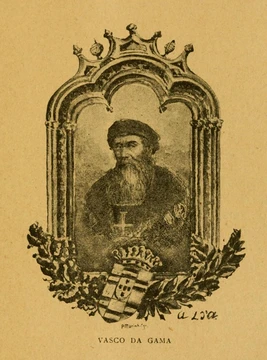
The Treaty of Tordesillas of 1494 had established a meridian in the Atlantic Ocean, with lands west of it reserved for Spain and those east for Portugal, but the precise line was never fixed, and each side interpreted it to its own advantage. Portuguese expansion into Asia accelerated after Vasco da Gama reached India in 1498; the India Armadas subdued Calicut at Cochin in 1504 and defeated Gujarat and its allies at Diu in 1509. Afonso de Albuquerque captured Malacca in 1511 and, learning the location of the Spice Islands—the Bandas, Ternate, and Tidore in the Malukus—sent António de Abreu there in early 1512. After a shipwreck, Abreu's lieutenant Francisco Serrão reached Ternate, where he obtained permission to build a Portuguese factory and fortress. Serrão's letters to Ferdinand Magellan helped persuade the Spanish crown to finance the first circumnavigation; Magellan's fleet, under Juan Sebastián Elcano, reached the Moluccas from the east on 6 November 1521. Both Serrão and Magellan died before they could meet.
Conference of Badajoz–Elvas
In 1524, both kingdoms organized the Junta de Badajoz–Elvas to resolve the dispute. Each crown appointed three astronomers, cartographers, pilots, and mathematicians to form a committee tasked with establishing the exact location of the antimeridian of Tordesillas, with the intention of dividing the whole world into two equal hemispheres. The Portuguese delegation included António de Azevedo Coutinho, Diogo Lopes de Sequeira, and cartographer Lopo Homem; the Spanish delegation included Count Mercurio Gâtine, Garcia de Loaysa, Bishop of Osma, and García de Padilla, grand master of the Order of Calatrava. Former Portuguese cartographer Diogo Ribeiro served on the Spanish side. According to contemporary writer Peter Martyr d'Anghiera, a small boy stopped the Portuguese delegation and, upon learning they intended to divide the world, bared his backside and suggested they draw their line through his intergluteal cleft. The board met several times at Badajoz and Elvas without reaching agreement, as geographic knowledge was inadequate for accurate longitude assignment, and each group used maps showing the islands in their own hemisphere. John III and Charles V then agreed to halt further expeditions to the Moluccas until the matter was settled. Between 1525 and 1528, Portugal sent several expeditions to the area; Gomes de Sequeira and Diogo da Rocha reached the Caroline Islands, and Jorge de Meneses landed on northwestern Papua New Guinea.
Treaty
The Treaty of Zaragoza set the eastern boundary between Spanish and Portuguese spheres at 297.5 leagues (1,763 kilometers, or 952 nautical miles) east of the Maluku Islands, which placed the islands themselves under Portuguese control. Portugal’s king paid Emperor Charles V 350,000 gold ducats for this arrangement. A safeguard clause allowed the emperor to cancel the deal whenever he wished, requiring Portugal to be repaid, but Charles V never exercised this option because he urgently needed the money to fight the War of the League of Cognac against his rival Francis I of France. The treaty did not change or clarify the earlier Tordesillas line, nor did it confirm Spain’s claim to two equal hemispheres of 180 degrees each. Instead, the two lines split the Earth unevenly: Portugal’s share covered about 191 degrees of the globe’s circumference, Spain’s about 169 degrees, with a possible error of plus or minus 4 degrees due to uncertainty over the Tordesillas line’s exact location. Portugal gained all lands and seas west of the new line, including all of Asia and its discovered islands, leaving Spain with most of the Pacific Ocean. Although the Philippines went unmentioned, Spain implicitly gave up any claim to it because it fell well west of the line. Nonetheless, Charles V decided to colonize the Philippines by 1542, betting Portugal would not object since the archipelago lacked spices. His attempt failed, but King Philip II succeeded in 1565, founding a Spanish trading post at Manila with little Portuguese resistance. Later, during the Iberian Union, Portuguese settlement in Brazil pushed far west of the Tordesillas line, and the 1750 Treaty of Madrid redrew the boundaries to match Brazil’s current limits.
More in Spanish Exploration in the Age of Discovery
Spotted an error? Know more?
Reader corrections go straight into our review queue. Suggest an edit · How this site is sourced