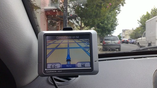
Global Positioning System
A satellite navigation system providing global positioning and timing.
The Global Positioning System (GPS) is a satellite-based navigation system that uses hyperbolic positioning. It is owned by the United States Space Force and operated by Mission Delta 31. As one of the global navigation satellite systems (GNSS), it supplies location and time data to any GPS receiver on or near Earth, provided the signal is strong enough. Users do not need to transmit any information, and the system works without phone or internet connections, although those services can improve its usefulness. GPS delivers essential positioning for military, civilian, and commercial users worldwide. While the U.S. government created, controls, and maintains the system, it is free for anyone with a GPS receiver to use.
Quick Facts
- Country
- United States
- Operator
- US Space Force (Mission Delta 31)
- Coverage
- Global
- Precision
- 30–500 cm / 0.984–16.4 ft; 0.984–16.4 ft
- Satellites nominal
- 24
- Satellites current
- 31 operational
- First launch
- 22 February 1978
- Last launch
- 21 April 2026
Facts from the source article.
Lore & Background
The GPS project was launched in the United States in 1973 to overcome the limitations of previous navigation systems, combining ideas from several predecessors, including classified engineering design studies from the 1960s. The U.S. Department of Defense developed the system, which originally used 24 satellites, for use by the United States military, and became fully operational in 1993. Civilian use was allowed from the 1980s. Roger L. Easton of the Naval Research Laboratory, Ivan A. Getting of The Aerospace Corporation, and Bradford Parkinson of the Applied Physics Laboratory are credited with inventing it. The work of Gladys West of the Ballistic Sciences Branch at Dahlgren Naval Proving Ground on the creation of the mathematical geodetic Earth model is credited as instrumental in the development of computational techniques for detecting satellite positions with the precision needed for GPS.
After Korean Air Lines Flight 007 was shot down when it mistakenly entered Soviet airspace, President Ronald Reagan determined that the GPS system would be made available for civilian use as of 1988; however, initially this civilian use was limited to an average accuracy of 100 m by use of Selective Availability (SA), a deliberate error introduced into the GPS data for which military receivers could correct. As civilian GPS usage grew, there was increasing pressure to remove this error. The SA system was temporarily disabled during the Gulf War, as a shortage of military GPS units meant that many US soldiers were using civilian GPS units sent from home. In the 1990s, differential GPS systems from the US Coast Guard, Federal Aviation Administration, and similar agencies in other countries began to broadcast local GPS corrections, reducing the effect of both SA degradation and atmospheric effects. The U.S. military had also developed methods to perform local GPS jamming, meaning that the ability to globally degrade the system was no longer necessary. As a result, United States president Bill Clinton signed a bill ordering that Selective Availability be disabled on May 1, 2000; and, in 2007, the US government announced that the next generation of GPS satellites would not include the feature.
Reader's Guide
GPS was funded during the Cold War arms race because the nuclear threat to the existence of the United States justified the cost in the view of the United States Congress. The nuclear triad consisted of the United States Navy's submarine-launched ballistic missiles (SLBMs) along with United States Air Force (USAF) strategic bombers and intercontinental ballistic missiles (ICBMs). Accurate determination of the SLBM launch position was a force multiplier, and precise navigation would enable United States ballistic missile submarines to get an accurate fix of their positions before they launched their SLBMs. The USAF also had requirements for a more accurate and reliable navigation system. The U.S. Navy and U.S. Air Force were developing their own technologies in parallel to solve what was essentially the same problem. Advances in technology and new demands on the existing system have led to efforts to modernize GPS and implement the next generation of GPS Block III satellites and Next Generation Operational Control System (OCX) which was authorized by the U.S. Congress in 2000. When Selective Availability was discontinued, GPS was accurate to about 5 m. GPS receivers that use the L5 band have much higher accuracy of 30 cm, while those for high-end applications such as engineering and land surveying are accurate to within 2 cm and can even provide sub-millimeter accuracy with long-term measurements. Consumer devices such as smartphones can be accurate to 4.9 m or better when used with assistive services like Wi-Fi positioning.
Did You Know?
- The design of GPS corrects for relativistic effects: clocks on GPS satellites run 38 microseconds faster per day than those on Earth as observed from Earth.
- The first prototype GPS satellite was launched in 1978, and the full constellation of 24 satellites became operational in 1993.
From Concept to Constellation: The Block I Pioneers
The story of GPS begins with a 1974 contract to Rockwell International to build the first eight satellites for the Global Positioning System. That order was expanded in 1978 to include three more spacecraft, and the very first, Navstar 1, lifted off on 22 February 1978 under the United States Air Force. Over the following years, ten Block I satellites reached orbit, though Navstar 7 was lost in a failed launch on 18 December 1981. These spacecraft rode Atlas rockets—converted intercontinental ballistic missiles—launched from Vandenberg Air Force Base, and were assembled at Rockwell's Seal Beach, California plant, the same facility that had built the S-II second stages for Saturn V. The Block I fleet served as a proving ground; lessons learned were folded directly into the next generation. Each satellite carried dual solar arrays producing over 400 watts, nickel-cadmium batteries for shadow operations, and a hydrazine propulsion system for orbital corrections. Navigation signals broadcast on two L-band frequencies, 1575.42 and 1227.60 MHz. Although the final Block I launch occurred on 9 October 1985, the last of these pioneers was not retired until 18 November 1995, well past its five-year design life.
The Block II Leap into Full Operations
The Block II series marked GPS's transition from experimental concept validation to full-scale operational service. Designed to sustain fourteen days of autonomous operation without any contact from ground control, these spacecraft represented a significant engineering step forward. Rockwell International, which had built the Block I fleet, produced a qualification vehicle before receiving a 1983 contract for twenty-eight Block II and IIA satellites. The Block II spacecraft were three-axis stabilized using reaction wheels, powered by solar arrays delivering 710 watts, and carried an impressive complement of timing hardware: two rubidium clocks and two cesium clocks. Each also housed nuclear detonation detection sensors, contributing to a launch mass of 1,660 kilograms. Nine Block II satellites were deployed between 14 February 1989 and 1 October 1990, with the final one not decommissioned until 15 March 2007—far beyond the 7.5-year design life. The closely related Block IIA series stretched autonomous operation to 180 days and saw nineteen satellites launched between 1990 and 1997. Two of them, SVN-35 and SVN-36, carried laser retro-reflectors enabling independent tracking separate from radio signals. The last Block IIA, SVN-34, was removed from service in October 2019 and held as an on-orbit spare until April 2020.
Replenishment, Follow-On, and the Push for New Signals
As the original operational fleet aged, successive replenishment and follow-on blocks kept the constellation current. Lockheed Martin took over production with the Block IIR series, each satellite weighing 2,030 kg at launch and 1,080 kg once in orbit. The program's start was marred by a Delta II rocket that exploded twelve seconds after liftoff on 17 January 1997, but the first successful IIR launch followed on 23 July 1997. Twelve IIR satellites were ultimately deployed, at least ten of them carrying an experimental S-band search-and-rescue payload called the Distress Alerting Satellite System. The Block IIR-M series, also built by Lockheed Martin and launched between September 2005 and August 2009, introduced a new military signal alongside the more robust civil L2C signal across eight spacecraft. Boeing then developed the Block IIF follow-on satellites, designed from the outset around the operational L5 signal. At 1,630 kg and with a 12-year design life, the twelve IIF vehicles were launched on Delta IV rockets between May 2010 and February 2016.
Third Generation and the Road Ahead
GPS Block III represents the first third-generation series in the system's history, introducing new signals such as L1C and broadcasting at higher power levels. Its 15-year design life triples that of the original Block I satellites. The first Block III vehicle was launched on 23 December 2018 aboard a SpaceX Falcon 9 Full Thrust rocket, and the final satellite in the initial Block III run, SV10, is scheduled for April 2026. Looking further ahead, the Block IIIF series will comprise up to twenty-two additional space vehicles, with launches expected to begin no earlier than 2027 and continue through 2037. Today, the entire constellation orbits at roughly 20,000 kilometers above Earth's surface, completing two full revolutions each day. The system is operated by the 2nd Navigation Warfare Squadron of Mission Delta 31 within the United States Space Force, a unit that has inherited the operational stewardship from the Air Force that launched the very first Navstar satellite nearly five decades earlier.
More in Satellite Navigation and GPS
Spotted an error? Know more?
Reader corrections go straight into our review queue. Suggest an edit · How this site is sourced