GLONASS
Russian satellite navigation system offering global coverage and comparable precision to GPS.
GLONASS, short for Global Navigation Satellite System, is Russia’s answer to GPS, and it was the second satellite navigation network to achieve worldwide coverage with similar accuracy. When a device picks up signals from both GPS and GLONASS, it has more satellites to work with, which helps it lock onto a position faster and more reliably—especially in dense cities where tall buildings can block the view of the sky. Because GLONASS satellites orbit at a steeper angle, adding them to a GPS setup also sharpens positioning near the North and South Poles.
The system got its start in the Soviet Union back in 1976. The first satellite launch happened on October 12, 1982, and a series of rocket launches built up the constellation until it was complete in 1995. After a slump in the late 1990s, when the network lost capacity, Russia made restoring it a top government priority in 2001 and poured in much more funding. By 2010, GLONASS had become the most expensive project for Roscosmos, eating up a third of its budget that year. Full coverage of Russia came in 2010, and by October 2011, the full set of 24 satellites was back in orbit, giving the system global reach. The satellites themselves have been upgraded over time, with the latest version, GLONASS-K2, launching in 2023.
GLONASS works in a middle circular orbit about 19,100 kilometers up, tilted at 64.8°, and each satellite takes 11 hours and 16 minutes to circle Earth. Because of that tilt, the system is especially useful at high latitudes, where GPS signals can struggle. The constellation uses three orbital planes, with eight satellites evenly spaced in each. A full global setup needs 24 satellites, while 18 are enough to cover Russia. A receiver needs at least four satellites in view to calculate a position.
The satellites send out two kinds of signals: an open standard-precision signal (called L1OF and L2OF) and a scrambled high-precision signal (L1SF and L2SF). These signals use the same digital encoding and modulation as GPS. All GLONASS satellites share the same code for the standard signal, but each one broadcasts on its own frequency, using a method called FDMA. The L1 band centers around 1,602 MHz, with each satellite’s frequency offset by 0.5625 MHz times a channel number (from -6 to 6). The L2 band works similarly, centered around 1,246 MHz with a 0.4375 MHz offset.
Quick Facts
- Country
- Soviet Union; Russia
- Operator
- Roscosmos
- Coverage
- Global
- Precision
- 2.8–7.38 metres
- Satellites nominal
- 24
- Satellites current
- 25
- First launch
- 12 October 1982
- Last launch
- 2 March 2025
Facts from the source article.
Lore & Background
Development of GLONASS began in the Soviet Union in 1976. Beginning on 12 October 1982, numerous rocket launches added satellites to the system until the completion of the constellation in 1995. In 2001, after a decline in capacity during the late 1990s, the restoration of the system was made a government priority, and funding increased substantially. GLONASS is the most expensive program of Roscosmos, consuming a third of its budget in 2010. By 2010, GLONASS had achieved full coverage of Russia's territory. In October 2011, the full orbital constellation of 24 satellites was restored, enabling full global coverage. The GLONASS satellites' designs have undergone several upgrades, with the latest version, GLONASS-K2, launched in 2023.
The satellites are located in middle circular orbit at 19100 km altitude with a 64.8° inclination and an orbital period of 11 hours and 16 minutes. GLONASS's orbit makes it especially suited for usage in high latitudes, where getting a GPS signal can be problematic. The constellation operates in three orbital planes, with eight evenly spaced satellites on each. A fully operational constellation with global coverage consists of 24 satellites, while 18 satellites are necessary for covering the territory of Russia. To get a position fix the receiver must be in the range of at least four satellites.
GLONASS uses a coordinate datum named PZ-90 (Earth Parameters 1990), in which the precise location of the North Pole is given as an average of its position from 1990 to 1995. This is in contrast to the GPS's coordinate datum, WGS 84. As of 17 September 2007, the PZ-90 datum has been updated to version PZ-90.02 which differ from WGS 84 by less than 400 mm in any given direction. Since 31 December 2013, version PZ-90.11 is being broadcast, which is aligned to the International Terrestrial Reference System and Frame 2008 at epoch 2011.0 at the centimetre level.
Reader's Guide
GLONASS provides real time position and velocity determination for military and civilian users. Its standard-precision signal offers horizontal positioning accuracy within 5–10 metres, vertical positioning within 15 m, a velocity vector measuring within 100 mm/s, and timing within 200 nanoseconds, based on measurements from four first-generation satellites simultaneously; newer satellites such as GLONASS-M improve on this. The system's FDMA signals use similar DSSS encoding and binary phase-shift keying modulation as GPS signals. All GLONASS satellites transmit the same code as their standard-precision signal, but each transmits on a different frequency using a 15-channel frequency-division multiple access technique. The 24-satellite constellation is accommodated with only 15 channels by using identical frequency channels to support antipodal satellite pairs, as these satellites are never both in view of an Earth-based user at the same time. Since 2008, new CDMA signals are being researched for use with GLONASS, with interface control documents published in August 2016. The high-precision signal is available for authorized users, such as the Russian military, and unlike the United States P(Y) code, which is modulated by an encrypting W code, the GLONASS restricted-use codes are broadcast in the clear using only security through obscurity. The details of the high-precision signal have not been disclosed.
One of Four: GLONASS in the Global Constellation
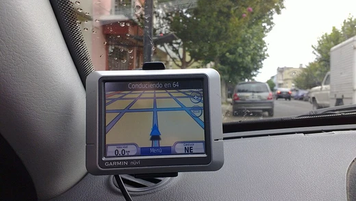
GLONASS occupies a distinct seat at the table of global satellite navigation. Alongside the United States' GPS, the European Union's Galileo, and China's BeiDou, it forms one of the four systems that collectively make up the GNSS family. What sets GLONASS apart in practical terms is not that it stands alone, but that it is routinely combined with the others. Modern satellite navigation devices are designed to pull location and time data from one or more of these systems simultaneously, and the combined use of multiple constellations is a well-established method for sharpening positioning accuracy and broadening availability. In other words, a receiver locked onto GLONASS satellites alongside GPS or BeiDou satellites gains a geometrically richer picture of the user's position than any single constellation could provide on its own. This cooperative architecture means that GLONASS is not a competitor to be excluded but a complementary layer in the global positioning stack, contributing its orbital geometry to the collective solution that a driver, hiker, or pilot ultimately sees on a screen.
Frequently Asked Questions
How does GLONASS work alongside GPS in my phone?
When your receiver locks onto both constellations at once, it simply has more satellites to triangulate from, which speeds up the initial fix and steadies the position in urban canyons where buildings block sky views. The two systems are complementary rather than competing.
Why is GLONASS especially useful near the poles?
GLONASS satellites orbit at a steeper inclination of roughly 65 degrees versus GPS's about 55 degrees. That higher tilt puts more GLONASS satellites overhead in polar regions, tightening the geometric spread and sharpening position accuracy where GPS geometry is weakest.
What are GLONASS's key orbital parameters?
The constellation sits at about 19,100 km altitude spread across three orbital planes, with each satellite completing an orbit in roughly 11 hours and 16 minutes. The 64.8-degree inclination is the defining geometric distinction from GPS's 55-degree planes.
More in Satellite Navigation and GPS
Spotted an error? Know more?
Reader corrections go straight into our review queue. Suggest an edit · How this site is sourced