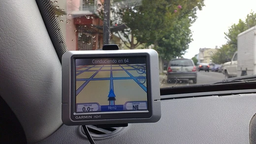
Automatic vehicle location
Automatic vehicle location determines and transmits a vehicle's geographic position.
Automatic vehicle location, or AVL, is a technology that automatically determines where a vehicle is and sends that geographic information elsewhere. This data forms the basis of vehicle tracking systems, which are a key part of fleet telematics and location-based services within the Internet of Things (IoT). The most common way to pinpoint a vehicle is with a GNSS receiver, like a GPS unit, which gets positioning data from satellites. That location data is then sent over a wireless network—usually cellular or satellite—to a central server. The server processes the information and makes it available for many uses, such as dispatching emergency vehicles or giving public transit riders real-time arrival updates. AVL is frequently combined with other vehicle systems to gather more data as part of a broader telematics setup.
Quick Facts
- Primary positioning method
- GNSS receiver (e.g., GPS)
- Common transmission methods
- Cellular (GPRS, LTE, 5G) or satellite
Facts from the source article.
Lore & Background
Automatic vehicle location technologies developed from early radio-based systems to the satellite-based standard used today. Before satellite navigation, early forms of AVL relied on terrestrial radio systems. One of the first methods was radio direction finding (RDF), which used triangulation to estimate the location of a vehicle's transmitter based on its signal's bearing from two or more fixed radio sites. While functional, its accuracy was limited. In the 1970s, some systems were developed that adapted the marine-based LORAN-C navigation system for vehicle use. A LORAN receiver in the vehicle would calculate its latitude and longitude and transmit the data via a two-way radio to a central dispatch, where the location would be plotted on a map. These systems were functional in coastal areas but were often susceptible to electrical interference in urban environments, which could disrupt the low-frequency radio signals. For vehicles operating on fixed routes, such as public transit buses or trains, signpost systems were used.
Reader's Guide
Automatic vehicle location has several applications across commercial, public, and consumer sectors. In commercial fleet management, AVL enables a fleet telematics system to function, improving operational efficiency by allowing dispatchers to view real-time vehicle locations, assign the nearest driver to a new job, optimize routes, and monitor deliveries. It enhances safety and security through alerts for unsafe driving behaviors and assists in gasoline theft prevention and stolen vehicle recovery. AVL data is also used to automate record-keeping for mileage, hours of service, and proof of service. In public transit, AVL feeds real-time location data into intelligent transportation systems, enabling real-time passenger information, schedule adherence monitoring, and automated next-stop announcements. Emergency services use AVL with computer-aided dispatch (CAD) systems to identify and dispatch the closest unit to an incident. Taxi and ride-hailing platforms such as Uber and Bolt use AVL to match passengers with the nearest available driver, provide accurate ETAs, and calculate fares. Carsharing services rely on AVL to allow users to locate and reserve vehicles, enable keyless entry, track usage for billing, and recover vehicles. Consumer and OEM services include locating a car in a parking lot, remote diagnostics, emergency assistance via eCall, stolen vehicle recovery, and usage-based insurance. In construction, AVL is used for asset tracking of heavy equipment to prevent theft and monitor utilization. In precision agriculture, AVL on tractors and harvesters enables automated steering, yield mapping, and fleet management.
Did You Know?
- AVL systems typically function in three stages: position determination, data transmission, and data integration.
- In urban environments, positioning data can be supplemented with cellular triangulation or Wi-Fi positioning when satellite signals are obstructed.
- Stolen vehicle recovery systems can include geofencing, unauthorized movement alerts, and remote immobilization.
Frequently Asked Questions
What is Automatic Vehicle Location (AVL)?
AVL is a technology system that continuously works out where a vehicle is on the globe and pushes that geographic data to a remote destination. It serves as the backbone for vehicle tracking, fleet telematics, and location-based services within the broader IoT ecosystem.
How is the location data transmitted from the vehicle to a central server?
Once the GNSS receiver produces a fix, the data travels over a wireless link, most often cellular networks such as GPRS, LTE, or 5G, though satellite uplinks handle remote or off-grid scenarios. A central server then receives, processes, and makes the information available to operators or end users.
What are the main real-world applications of AVL?
AVL powers fleet management, public transit tracking, emergency-service dispatch, taxi and ride-hailing operations, carsharing, anti-theft systems, and even agriculture and construction equipment monitoring. It is essentially the location engine behind a wide range of commercial and public-sector use cases.
More in Satellite Navigation and GPS
Spotted an error? Know more?
Reader corrections go straight into our review queue. Suggest an edit · How this site is sourced