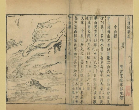
Congo River
Second-longest African river, deepest in the world, crossing the equator twice.

EdwinAlden.1995 · CC BY-SA 4.0
The Congo River, once called the Zaire River, is Africa’s second-longest river—only the Nile is longer—and ranks third globally in discharge volume, behind the Amazon and the Ganges–Brahmaputra. It holds the record as the world’s deepest river, with measured depths reaching about 220 meters (720 feet). The Congo–Lualaba–Luvua–Luapula–Chambeshi system stretches 4,700 kilometers (2,900 miles), making it the ninth-longest river system on Earth. The Chambeshi feeds the Lualaba, which is the Congo’s name upstream of Boyoma Falls, running 1,800 kilometers (1,100 miles). Measured with the Lualaba, the Congo itself is 4,370 kilometers (2,720 miles) long. It is the only major river that crosses the equator twice. Its basin covers roughly 4,000,000 square kilometers (1,500,000 square miles), or 13% of Africa’s landmass.
The name “Congo” comes from the Kingdom of Kongo, which once sat on the river’s southern bank. That kingdom was named after the Bantu Kongo people, called “Esikongo” in the 17th century. South of it lay the Kakongo kingdom, mentioned in 1535. On his 1564 world map, Abraham Ortelius labeled “Manicongo” as the city at the river’s mouth. The tribal name may derive from a word for a public gathering. The modern term “Kongo people” or “Bakongo” came into use in the early 20th century. “Zaire” is a Portuguese adaptation of the Kikongo word *nzere* (“river”), a shortening of *nzadi o nzere* (“river swallowing rivers”). The river was called Zaire in the 16th and 17th centuries; “Congo” gradually replaced it in English during the 18th century and became standard in 19th-century literature, though references to Zahir or Zaire remained common. The Democratic Republic of the Congo and the Republic of the Congo are named after it, as was the earlier Republic of the Congo (independent from Belgian Congo in 1960). The Republic of Zaire (1971–1997) also took its name from the river’s French and Portuguese name.
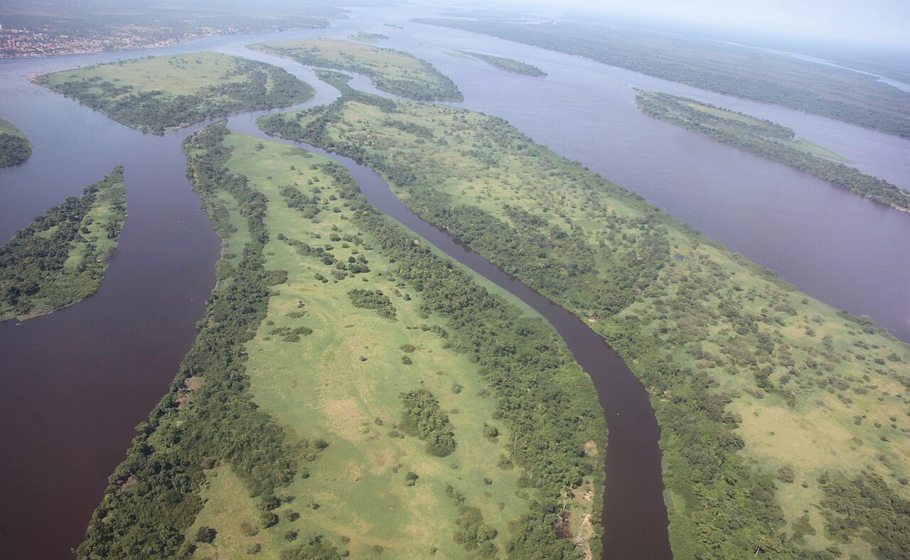
The Congo’s drainage basin covers 4,014,500 square kilometers (1,550,000 square miles), nearly the size of the European Union. Its discharge at the mouth ranges from 23,000 to 75,000 cubic meters per second (810,000 to 2,650,000 cubic feet per second), averaging 41,000 cubic meters per second (1,400,000 cubic feet per second). Each year, the river carries 86 million tonnes of suspended sediment and an additional 6% as bedload to the Atlantic. The river and its tributaries flow through the Congo rainforest, the world’s second-largest, after the Amazon. With an average discharge of 41,860 cubic meters per second at the mouth, it is the third-largest river by volume, after the Amazon (219,530 m³/s) and the Ganges–Brahmaputra–Meghna (43,950 m³/s at the delta). Its basin is the second-largest drainage area, behind the Amazon, and the river is among the deepest, exceeding 220 meters. Because its basin straddles both sides of the equator, its flow stays steady—at least one part of the river is always in a rainy season.
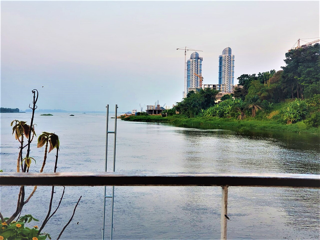
The Congo’s sources lie in the highlands and mountains of the East African Rift, along with Lake Tanganyika and Lake Mweru, which feed the Lualaba River. Below Boyoma Falls, the Lualaba becomes the Congo. The Chambeshi River in Zambia is generally considered the ultimate source, following the common practice of using the longest tributary, as with the Nile. From Kisangani, just below Boyoma Falls, the Congo flows northwest, then gradually bends southwest past Mbandaka, joins the Ubangi River, and enters Pool Malebo (Stanley Pool). Kinshasa (formerly Léopoldville) and Brazzaville sit on opposite sides of the river at this pool, where the river narrows and drops through a series of cataracts in deep canyons—collectively called Livingstone Falls—then runs past Matadi and Boma, emptying into the sea at Muanda.
The Lower Congo stretches from the Atlantic mouth to the twin capitals of Brazzaville and Kinshasa. In this section, two significant tributaries enter on the left (south) side: the Kwilu River, which rises near the Angolan border and joins the Congo about 100 kilometers upstream from Matadi, and the Inkisi River, which flows north from Angola’s Uíge Province to meet the Congo at Zongo, about 80 kilometers downstream from the capitals. Because of numerous rapids, especially Livingstone Falls, this section is not navigable by continuous riverboat traffic.
The Congo basin spans ten countries and covers about 13% of Africa. Its highest point is in the Ruwenzori Mountains, at roughly 4,340 meters (14,240 feet) above sea level. The basin area is distributed among countries as follows: [list omitted for brevity, but retained in original source]. Discharge data for Kinshasa and Brazzaville, as well as width and depth measurements, are included in the source. Major tributaries of the Lower Congo (from the mouth to Kinshasa) include the M’pozo (left), Kwilu (left), Inkisi (left), Foulakary (right), and Djoué (right). The Middle Congo (from Kinshasa to Boyoma Falls) has tributaries such as the Nsele (left), Lufimi (left), Mary (right), Kwa–Kasai (left) and its sub-tributaries (Fimi, Lukenie, Lokoro—Lake Mai-Ndombe, Kwango, Culio, Wamba, Kwilu, Kwenge, Inzia, Loange, Sankuru, Lubilanji, Lubefu, Lubudi, Lulua, Chicapa, Luachimo, Lubembe, Chiumbe), the Léfini (right), Nkeni (right), Alima (right), Likouala-Mossaka (right), Sangha (right) with its sub-tributaries (Likouala aux Herbes, Ngoko, Boumba, Kadéï—570 km, 41,000 km², 466 m³/s—and Mambéré), and the Ubangi (right).
- length
- 4,370 km (2,720 mi) along with the Lualaba; overall system 4,700 km (2,900 mi)
- discharge
- average 41,000 m³/s (1,400,000 cu ft/s) at mouth
- depth
- deepest recorded at around 220 m (720 ft)
- basin area
- about 4,000,000 km² (1,500,000 mi²), or 13% of Africa
- countries in basin
- ten countries
- crosses equator
- twice, the only major river to do so
Verified Timeline
Lore & Background
The name Congo/Kongo originates from the Kingdom of Kongo once located on the southern bank of the river. The kingdom in turn was named after the indigenous Bantu Kongo people, known in the 17th century as "Esikongo". South of the Kingdom of Kongo proper lay the similarly named Kakongo kingdom, mentioned in 1535. Abraham Ortelius labelled "Manicongo" as the city at the mouth of the river in his world map of 1564. The modern name of the Kongo people or Bakongo was introduced in the early 20th century. The name Zaire is from a Portuguese adaptation of a Kikongo word, nzere ("river"), a truncation of nzadi o nzere ("river swallowing rivers"). The river was known as Zaire during the 16th and 17th centuries; Congo seems to have replaced Zaire gradually in English usage during the 18th century, and Congo is the preferred English name in 19th-century literature, although references to Zahir or Zaire as the name used by the inhabitants remained common. The Democratic Republic of the Congo and the Republic of the Congo are named after it, as was the previous Republic of the Congo which had gained independence in 1960 from the Belgian Congo. The Republic of Zaire during 1971–1997 was also named after the river's name in French and Portuguese.
Reader's Guide
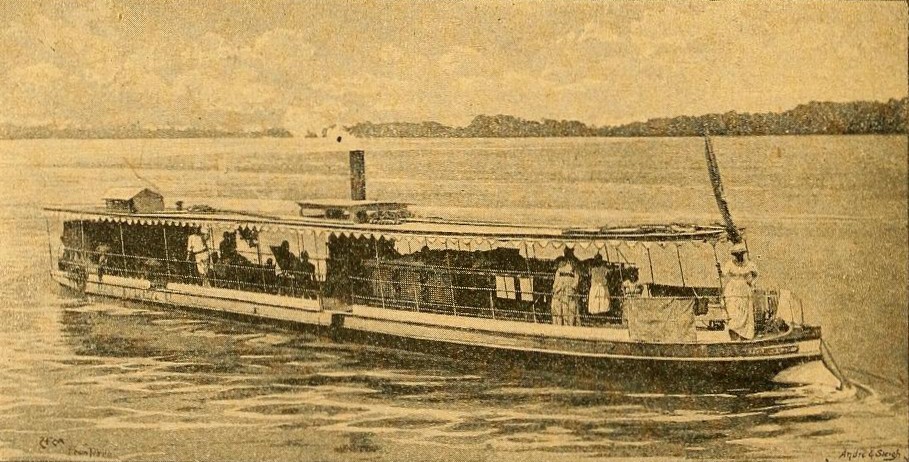
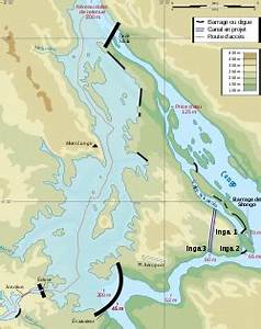
The Congo River is a lifeline in a land with few roads or railways. Although the Livingstone Falls prevent access from the sea, nearly the entire Congo above them is readily navigable in sections, especially between Kinshasa and Kisangani. Large river steamers worked the river until quite recently. Railways now bypass the three major falls, and much of the trade of Central Africa passes along the river, including copper, palm oil (as kernels), sugar, coffee, and cotton. The Congo River is the most powerful river in Africa. During the rainy season over 50,000 cubic metres (1,800,000 cu ft) of water per second flows into the Atlantic Ocean. Scientists have calculated that the entire Congo Basin accounts for 13 percent of global hydropower potential, sufficient to power all of Sub-Saharan Africa's electricity needs. Currently, there are about 40 hydropower plants in the Congo Basin. The largest are the Inga dams, about 200 kilometres (120 mi) southwest of Kinshasa. The project was launched in the early 1970s, when the first dam was completed. To date only the Inga I and Inga II dams have been built, generating 1,776 MW. In February 2005, South Africa's state-owned power company, Eskom, announced a proposal to expand generation through improvements and the construction of a new hydroelectric dam, which would bring the maximum output of the facility to 40,000 megawatts (MW). The current course of the Congo River formed between 1.5 and 2 million years BP, during the Pleistocene. Because its drainage basin includes areas both north and south of the Equator, its flow is stable, as there is always at least one part of the river experiencing a rainy season.
Did You Know?
- The Congo River is the only major river to cross the equator twice.
- The Congo–Lualaba–Luvua–Luapula–Chambeshi River system has an overall length of 4,700 km (2,900 mi), making it the world's ninth-longest river.
- The river transports annually 86 million tonnes of suspended sediment to the Atlantic Ocean, plus an additional 6% of bedload.
- The highest point in the Congo basin is in the Ruwenzori Mountains, at an altitude of around 4,340 m (14,240 ft) above sea level.
- The Congo's formation may have led to the allopatric speciation of the bonobo and the common chimpanzee from their most recent common ancestor.
Hydrological Magnitude and Global Standing
The Congo River occupies a remarkable position in the world's hydrological hierarchy. While it ranks as Africa's second-longest waterway behind only the Nile, its true distinction lies in the sheer volume of water it carries. With an average discharge of roughly 41,000 cubic meters per second at its mouth, it stands as the third-greatest river on Earth by flow, trailing only the Amazon and the Ganges–Brahmaputra system. The river also claims the title of the world's deepest recorded river, with measured depths exceeding 220 meters. Its flow remains remarkably stable year-round because the basin straddles both sides of the Equator, ensuring that at least one region is perpetually in its rainy season. Each year, the river delivers approximately 86 million tonnes of suspended sediment into the Atlantic, along with an additional six percent in bedload material. The full Congo–Lualaba–Luvua–Luapula–Chambeshi system stretches about 4,700 kilometers, placing it ninth among the longest rivers globally.
A Name Woven from Indigenous Heritage
The river's identity carries layers of linguistic and political history. The name Congo, or Kongo, traces back to the Kingdom of Kongo that once occupied the southern bank, itself named after the indigenous Bantu Kongo people, referred to in the seventeenth century as Esikongo. The tribal term may derive from a Kongo word meaning a public gathering or assembly. A neighboring Kakongo kingdom, documented in 1535, shares this linguistic root. The alternative name Zaire emerged from a Portuguese rendering of the Kikongo word nzere, meaning river, a shortened form of nzadi o nzere, describing a river that swallows other rivers. During the sixteenth and seventeenth centuries, European maps favored Zaire, but Congo gradually supplanted it in English usage by the eighteenth century. The legacy endures in modern geopolitics: both the Democratic Republic of the Congo and the Republic of the Congo bear the river's name, as did the short-lived Republic of Zaire between 1971 and 1997.
A Journey from Rift Highlands to the Atlantic
The Congo's sources lie in the highlands and mountains of the East African Rift, fed by Lake Tanganyika and Lake Mweru, which together nourish the Lualaba River. Below the Boyoma Falls, the Lualaba becomes the Congo proper. From Kisangani, the river flows generally northwest before gradually bending southwest past Mbandaka, where it receives the Ubangi. The water then enters Pool Malebo, the narrow stretch where Kinshasa and Brazzaville sit on opposite banks. Beyond this point, the river plunges through a series of cataracts in deep canyons known collectively as the Livingstone Falls, passing Matadi and Boma before reaching the sea at Muanda. The lower section, from the mouth to the twin capitals, is punctuated by the Kwilu and Inkisi tributaries on the southern side. The profusion of rapids, especially the Livingstone Falls, prevents continuous riverboat navigation through this stretch. The Chambeshi River in Zambia is conventionally recognized as the ultimate source, following the global practice of tracing the longest tributary.
A Basin That Defines a Continent's Heart
The Congo's drainage basin spans approximately 4,014,500 square kilometers, an area nearly matching that of the European Union, and stretches across ten nations. It accounts for roughly 13 percent of the entire African landmass, making it the second-largest river basin on Earth behind only the Amazon. The basin's highest point reaches about 4,340 meters in the Ruwenzori Mountains. Within this vast catchment flows the Congo rainforest, the second-largest tropical forest region globally after the Amazon in South America. The river and its extensive tributary network, including the Ubangi, Kwango, Kasai, Sangha, and dozens of others, thread through this dense ecosystem. The basin's position straddling the Equator means that rainfall is distributed across different seasons in its northern and southern halves, producing a steady, reliable discharge rather than the dramatic seasonal surges seen in many other major rivers. This hydrological stability sustains the rainforest and the diverse communities that depend on it.
Gallery
Frequently Asked Questions
Who is Congo River?
The Congo River, formerly called the Zaire River, is Africa's second-longest waterway stretching roughly 4,370 km from its Lualaba headwaters to the sea. It drains a basin of about 4 million square kilometers that spans ten countries across central Africa.
What are Congo River's powers/role?
It holds the record as the world's deepest measured river at around 220 meters and ranks third globally by discharge, pushing approximately 41,000 cubic meters of water per second past its mouth. Its basin also cradles the Congo rainforest, the planet's second-largest tropical forest after the Amazon.
How does Congo River's story end?
After threading through central Africa and crossing the equator twice — a feat no other major river shares — the Congo ultimately empties into the Atlantic Ocean at the Gulf of Guinea.
Why is Congo River important?
It sustains the world's second-largest rainforest, supports ecosystems and communities across ten nations, and its basin covers roughly 13% of the entire African continent. Its extraordinary depth and volume make it a defining hydrological landmark in global geography.
What makes Congo River unique compared to other rivers?
It is the only major river on Earth that crosses the equator twice, and it holds the record for the deepest measured river at approximately 720 feet. Combined with its massive discharge, it stands as one of the most extraordinary waterways in the world.
More in Rivers And Seas Of The World 1-24
Related in Rivers And Seas Of The World
Links follow this subject's own source article.
Spotted an error? Know more?
This is a living reference — every entry is fact-audited, and reader corrections feed straight into our audit queue. Suggest an edit · See this site's audit record