
Terrain
The dimension and shape of a given land surface.
Last updated
Terrain, from Latin 'terra' meaning earth, also known as relief or topographical relief, refers to the dimension and shape of a given land surface. In physical geography, it is the lay of the land, expressed in terms of elevation, slope, and orientation of terrain features. Terrain affects surface water flow and distribution, and over large areas can influence weather and climate patterns. Bathymetry studies underwater relief, while hypsometry studies terrain relative to sea level.

The understanding of terrain is critical for many reasons. A region’s terrain largely determines its suitability for human settlement: flatter alluvial plains generally offer better farming soils than steeper, rockier uplands.

In environmental science, agriculture, and hydrology, knowledge of terrain aids in understanding watershed boundaries, drainage characteristics, groundwater systems, and water quality impacts. Complex relief data serve as input for hydrology transport models that predict river water quality. Terrain also supports soil conservation; contour ploughing, the practice of ploughing along lines of equal elevation rather than up and down a slope, is a key sustainable agriculture technique on sloping land.

Militarily, terrain is critical because it determines the ability to take and hold areas and to move troops and material. Understanding terrain is basic to both defensive and offensive strategy; the military usage of “terrain” is broad, encompassing landform, land use, land cover, transport infrastructure, built structures, and even psychological or economic factors under the term “human terrain.” Terrain is important in determining weather patterns; two geographically close areas may differ radically in precipitation due to elevation differences or a rain shadow effect. Precise terrain knowledge is vital in aviation for low-flying routes and airport altitudes, and it affects the range and performance of radars and terrestrial radio navigation systems. Hilly or mountainous terrain can strongly impact the implementation of a new aerodrome and the orientation of its runways.
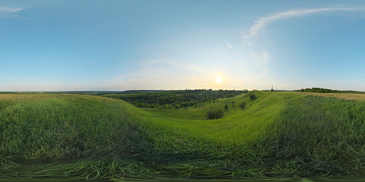
Relief
Relief, or local relief, refers specifically to the quantitative measurement of vertical elevation change in a landscape, the difference between maximum and minimum elevations within a limited area. It can be described qualitatively, such as a “low” or “high” plain or upland.

Quick Facts
- Field
- Physical geography, geomorphology
Facts from the source article.
Lore & Background
Terrain is formed by concurrent processes operating on underlying geological structures over geological time. Geological processes include migration of tectonic plates, faulting and folding, mountain formation, and volcanic eruptions. Erosional processes include glacial, water, wind, chemical, and gravitational actions such as landslides, downhill creep, flows, slumps, and rock falls.
Extraterrestrial processes such as meteorite impacts also shape terrain. Tectonic processes like orogenies and uplifts elevate land, while erosional and weathering processes wear it away. The relationship between erosion and tectonics rarely reaches equilibrium, and their full range of interactions remains a topic of debate.
Reader's Guide
Understanding terrain is critical for many reasons. It largely determines suitability for human settlement, as flatter alluvial plains tend to have better farming soils than steeper, rockier uplands. In environmental quality, agriculture, and hydrology, terrain assists understanding of watershed boundaries, drainage characteristics, groundwater systems, and water quality. Complex relief data are used as input for hydrology transport models to predict river water quality.
Terrain supports soil conservation through practices like contour ploughing. Militarily, terrain determines the ability to take and hold areas and move troops and material; its military usage encompasses landform, land use, land cover, infrastructure, and even human terrain factors. Terrain is important in determining weather patterns, as areas close geographically may differ in precipitation due to elevation or rain shadow effects.
In aviation, precise terrain knowledge is vital for low-flying routes, airport altitudes, and radar performance. Relief refers to quantitative measurement of vertical elevation change, the difference between maximum and minimum elevations within a given area. Relief energy indicates ruggedness or relative height of terrain. Geomorphology studies the long-term formation of terrain, and land surface parameters measure morphometric properties such as slope, aspect, and curvatures, which can derive hydrological and climatic parameters.

Frequently Asked Questions
Who is Terrain?
Terrain is the physical-geography concept describing the dimension and shape of a land surface, expressed through elevation, slope, and the orientation of its features. In everyday terms it is simply the "lay of the land" that geomorphologists map and analyze.
What is Terrain known for?
Terrain dictates how surface water flows and distributes across a landscape, and over broad regions it steers weather and climate patterns. It also underpins practical fields like settlement planning, agriculture, hydrology, military strategy, and aviation.
What's the difference between Terrain, Bathymetry, and Hypsometry?
Terrain is the overarching shape-and-dimension description of land surfaces, while bathymetry applies the same relief concept specifically to underwater terrain. Hypsometry narrows the focus to how terrain stands relative to sea level rather than its absolute form.
More in Physical Geography & Elevation
Sources
Compiled from Wikipedia and the sources listed below. Text from Wikipedia is available under CC BY-SA 4.0; this entry is adapted from it.
- Wikipedia: Terrain (CC BY-SA 4.0).
Spotted an error? Know more?
Reader corrections go straight into our review queue. Suggest an edit · How this site is sourced