Arrowtown
Historic gold rush town in Otago, New Zealand.
Last updated
Where it is
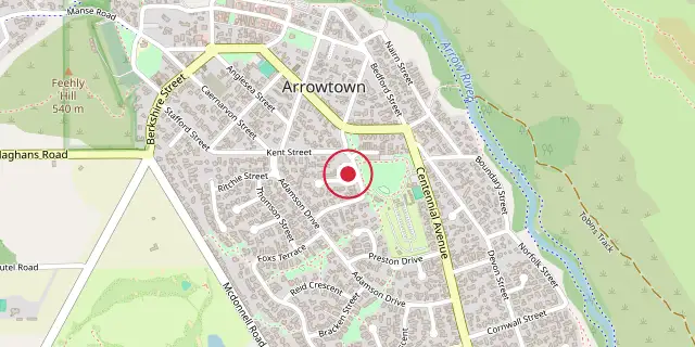
Coordinates: 44°56′35″S 168°50′10″E (-44.9430, 168.8360) · Open in OpenStreetMap
Coordinates and connected clubs: the infobox of Wikipedia: Arrowtown (CC BY-SA 4.0). Map: drawn by Codexery from OpenStreetMap tiles.
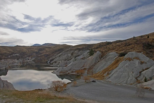
Arrowtown (Kā-muriwai) is a historic gold mining town in the Otago region of New Zealand's South Island, situated on the banks of the Arrow River (Haehaenui) about 19.5 kilometres east of Queenstown. It is notable for its many well-preserved buildings from the European and Chinese immigrant gold mining era.
History
Gold was found in the Arrow River in August 1862 by Jack Tewa, also known as Maori Jack, and a settlement of 800 miners quickly formed. Initially called Fox's after William Fox's claim to have been first, it was soon renamed Arrowtown. Lawlessness troubled the district until a police camp and warden's office were built. Several hotels operated in 1863, including William Fox's Golden Age hotel.
Early buildings were temporary calico structures, but as the population held steady, more permanent buildings were erected. Chinese settlers arrived in the 1870s and were confined to huts along Bush Creek. At the gold rush's peak, Arrowtown's population exceeded 7,000, and it became the centre of a municipality that included Macetown, Skippers Canyon and Bullendale, now ghost towns. Arrowtown was constituted as a borough in 1867, and Samuel Goldston was elected its first mayor in 1874.
A large fire in 1896 destroyed Campbell's bakery, the Morning Star Hotel and part of Pritchard's Store. As late as 1888, the post office called the town Arrow River while the telegraph office used Arrowtown. After the gold rush, Arrowtown served local farms.
Population
Arrowtown covers 3.61 km². In 1951 the population was 200, falling to 186 in 1956 and 171 in 1961 before later increasing. Before the 2023 census, the boundary was 2.36 km², and at the 2018 census the population was 2,814, an increase of 369 (15.1%) since 2013 and 666 (31.0%) since 2006. There were 993 households, with 1,422 males and 1,392 females, giving a sex ratio of 1.02 males per female.
The median age was 38.3 years; 20.9% were under 15, 16.0% aged 15–29, 51.3% aged 30–64, and 11.8% aged 65 or older. Ethnicities were 90.2% European/Pākehā, 6.1% Māori, 1.5% Pasifika, 5.0% Asian, and 3.7% other.
27.9% were born overseas. Religiously, 61.1% had no religion, 31.1% were Christian, 0.3% had Māori religious beliefs, 0.5% were Hindu, 0.1% were Muslim, 0.5% were Buddhist and 1.7% had other religions. Of those aged 15 and over, 27.2% held a bachelor's degree or higher, and 9.7% had no formal qualifications.
Median income was $45,300, with 24.0% earning over $70,000. Employment: 64.0% full-time, 16.7% part-time, 1.2% unemployed.
Notable buildings
The Lodge Arrow Kilwinning No 86 on Berkshire Street, completed in 1888, underwent a six-year restoration finished in 2010 and is a category one historic place. Seven houses along Buckingham Street, built in the 1870s with mostly unaltered exteriors, are listed with Heritage New Zealand as surviving examples of gold miners' cottages. The one-bedroom property at 53 Buckingham Street, built in 1890, served as a chemist shop and later a tailor's shop until 1905; it sold for 350 pounds in the early 1950s and for $1.85 million in 2021.
St John's Church on Berkshire Street, built in 1873 of schist, was the first stone building in Arrowtown, designed by Frederick Burwell in Gothic Revival style, and is a Category II Historic Place. Saint Patrick's on Hertford Street, built between 1873 and 1902, also designed by Burwell in Gothic style with local schist and a Star of David rose window, is a category two historic place. Saint Paul's, built in 1871 of wood in a simplified Gothic revival style at a cost of 350 pounds, is the oldest church in Arrowtown and a category one historic place.
The Arrowtown library on Buckingham Street, built in the 1980s and designed by Michael Wyatt, blends with the town's 19th-century buildings.
Air pollution
In 2015 Arrowtown recorded one of its worst air pollution readings, reaching 168 mcg per cubic metre of PM10 particulates, a level last seen in 2007. Along with Alexandra, Arrowtown had the highest air pollution levels in Otago, attributed to domestic wood burning heaters and local geography causing temperature inversions. The problem persisted in 2019, with Arrowtown labelled as having some of the worst air pollution in Australasia. NIWA deployed 22 sensors in 2019, later increased to 48, and found excellent air quality in early afternoon at all locations; poor quality was linked to cold winter nights with lesser impact the following mornings.
Air quality was better in the north-west and worst in the south-east, consistent with wood heater usage. The Otago Regional Council has worked with homeowners to replace wood burners with heat pumps and improve insulation. In winter 2021 Arrowtown had 23 high pollution nights exceeding national standards; this fell to 10 nights in winter 2022.
Did You Know?
- Arrowtown's main street, Buckingham Street, sits at 410 metres above sea level.
- Queen Elizabeth, the Queen Mother visited the Lakes District Museum in 1966, and Queen Elizabeth II visited in 1990.
More in Otago Gold Rush
Sources
Compiled from Wikipedia and the sources listed below. Text from Wikipedia is available under CC BY-SA 4.0; this entry is adapted from it.
- Wikipedia: Arrowtown (CC BY-SA 4.0).
Spotted an error? Know more?
Reader corrections go straight into our review queue. Suggest an edit · How this site is sourced