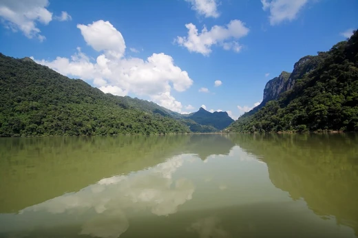
Xuân Thủy National Park
First Ramsar wetland site in Southeast Asia.
Xuân Thủy National Park is a protected area in the Red River Biosphere Reserve, located in Ninh Bình province, Vietnam. Established in 2003 from a former wetland nature reserve, it was the first wetland site in Southeast Asia designated as a Ramsar site. The park is internationally recognized as a critical habitat for migratory birds.
Quick Facts
- Location
- Northern Vietnam
- Nearest city
- Nam Định, Thái Bình
- Established
- 2003
- Governing body
- People's Committee province of Nam Định
Facts from the source article.
Did You Know?
- Three strong storms hit northern Vietnam in 2005, with winds reaching level 12 on 28 September.
- The park is part of the core zone of the Red River Biosphere Reserve, recognized by UNESCO.
Landscape and climate
Xuân Thủy National Park lies 150 km southeast of Hanoi in Giao Thủy District, Nam Định Province. It is the largest coastal wetland ecosystem in northern Vietnam, situated at the southern mouth of the Red River. The Core Zone covers 7,100 hectares, comprising 4,000 hectares of low-tide wetlands and 3,100 hectares of land, including the islets Con Ngan, Con Lu, and Con Xanh. Con Ngan, the largest islet, hosts aquaculture farms and mangrove forest; Con Lu is covered by sandy areas and alluvial flats; Con Xanh, the smallest, is being widened by river alluvium. The Buffer Zone spans 8,000 hectares. The park is a delta and estuary island system at the Ba Lat river-mouth, supporting coastal mangroves and mud flats. The area includes land enclosed by sea dikes with fringing marshes. The human ecological VAC model (vegetable gardens, fish ponds, animal husbandry) and silvofishery models are practiced. The region has a history of wet rice cultivation, dike construction, and land reclamation. Giao Thủy District has a tropical monsoon climate with a hot, rainy season from April to October and a cold, dry season from November to March. August is the wettest month; autumn and winter are driest. The Red River floods from July to October, and storms are most frequent in July and August. Soils are alluvial mud (becoming loam) and sand, forming light, medium, and heavy types.
Biological characteristics
Xuân Thủy National Park serves as a staging and wintering area for shorebirds, gulls, and waterfowl in the coastal Red River Delta. It hosts 250 bird species from 41 families and 13 orders, including 150 migratory and 50 water bird species. Nine species are listed as endangered on the IUCN Red List, such as the spoon-billed sandpiper and Nordmann's greenshank. Between 65 and 75 black-faced spoonbills, the park's symbol, are observed during migration; this represents about 5 percent of the global population of roughly 1,000 individuals. The park also provides habitat for rare animals, including otter species, Chinese white dolphins, finless porpoise, and rorqual whales. There are 30 reptile species and an uncounted number of insects. Vascular plants number 120 species, with 20 thriving in wetland conditions. Mangrove forest stabilizes alluvial soil, provides flood protection, and plays a role in biochemical cycles. One hundred eleven aquatic plant species have been recorded, including seaweed of high economic value. Over 500 species of benthos and zooplankton, such as shrimp, fish, crab, and oysters, have been identified. In the Core Zone, unoccupied land is used for shrimp-rearing ponds and extensive clam rearing areas. Tents and huts for pond management were built without planning. The Buffer Zone includes residential land, agricultural land, aquaculture land, mangroves, flats, and some mangrove areas along river canals. Most areas in Bai Trong and Con Ngan have been divided into ponds for shrimp and crab farming, which expanded rapidly in the 1990s. The culturing season runs from May to January; during the off-season, some locals culture yellow thread seaweed commercially.
Socioeconomic background
As of 2005, 47,123 inhabitants lived in the five Buffer Zone communes of Giao Thien, Giao An, Giao Lac, Giao Xuan, and Giao Hai. Population density ranges from 1,023 to 1,331 people per square kilometer and is rising due to over one percent annual growth. Most income comes from agriculture, primarily rice cultivation, which accounts for 39.3 percent of average income, with a productivity of 632 kg of rice per capita per year. Agricultural land is shrinking due to unfavorable natural changes, limiting further expansion. Fisheries, the second most important sector, contributed 36.1 percent of family income in 2007, with 1,800 hectares of aquaculture ponds in the Buffer Zone. The marine business is growing at 14.9 percent annually and is seen as having higher economic turnover than agriculture. However, clam rearing requires large investments and pressures the environment; some ponds stop being profitable after a few years due to declining water quality. Husbandry provides 10 percent of annual income and produces organic fertilizer, but the veterinarian network cannot handle major diseases, preventing sector growth. Services and trade make up 14.6 percent of income and have high potential. Industry and handicraft are underdeveloped at 5 percent, due to lack of education and poor material base.
Management
Before 2003, the park had poor management with only five staff members of limited capacity, insufficient infrastructure, and unclear institutional arrangements. Monitoring to prevent over-exploitation was not possible. Overlapping responsibilities and conflict between local interest groups dependent on natural resources and the management board hindered effective management. Since 2003, a new office with function rooms and a natural museum has been built, meeting infrastructural and technical needs. Staff numbers increased to 20, recruited from fields such as tourism, forestry, aquaculture, and biology, and they participate in workshops on environmental education, ecotourism, and community development. Institutional challenges remain. A successful co-management project for clam culture involves the park management board, local councils, and clam farmers, with controlled harvesting and clear responsibilities. Strengthening institutional capacity is ongoing, including clarifying land use rights. Many agencies and organizations influence the park, requiring coordination to maintain strict policy and avoid overlapping responsibilities that hinder management plans.
More in National Parks of Vietnam
Spotted an error? Know more?
Reader corrections go straight into our review queue. Suggest an edit · How this site is sourced