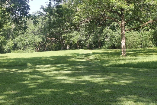
Natchez Trace Parkway
A two-lane road commemorating the historic Natchez Trace.
Last updated

via Wikipedia: Natchez Trace Parkway · see source
Stretching 444 miles from Natchez, Mississippi, to Nashville, Tennessee, the Natchez Trace Parkway is a limited-access national parkway that commemorates the historic Natchez Trace and preserves sections of that original trail. Its central feature is a two-lane road with more than 50 access points in Mississippi, Alabama, and Tennessee.
The southern end is at Liberty Road in Natchez, and the northern end is at Tennessee State Route 100 in Pasquo, Tennessee. Larger cities along the route include Jackson and Tupelo, Mississippi, and Florence, Alabama. Historian Paul Hardin Kapp describes the Parkway as "the most enjoyable and romantic way to arrive in the city" and a "masterpiece in both landscape design and narrative" constructed of "carefully planned vignettes...rolling topography, landscaped with live oaks and hanging Spanish moss," though he notes it is "not the real Natchez Trace."
History
The gentle sloping and curving alignment of the current route closely follows the original foot passage. Its design harkens back to the way the original interweaving trails aligned as an ancient salt lick-to-grazing pasture migratory route of the American bison and other game that moved between grazing the pastures of central and western Mississippi and the salt and other mineral surface deposits of the Cumberland Plateau. The route generally traverses the tops of the low hills and ridges of the watershed divides from northeast to southwest.
Native Americans, following the "traces" of bison and other game, further improved this walking trail for foot-borne commerce between major villages located in central Mississippi and middle Tennessee. By the time of European exploration and settlement, the route had become well known and established as the fastest means of communication between the Cumberland Plateau, the Mississippi River, and the Gulf of Mexico settlements of Pensacola, Mobile, and New Orleans.
In the early post-American Revolutionary War period, the trace was the return route for American flat-boat commerce between the territories of the upper and lower Ohio, Tennessee, and Cumberland River valleys. Americans constructed flat boats, loaded their commerce therein, and drifted upon those rivers, one-way south-southwestward to New Orleans, Louisiana. They would then sell their goods (including the salvageable logs of the flat boats and including enslaved people), and return home via the trace, to as far away as Pittsburgh, Pennsylvania.
Civilian Conservation Corps
Construction of the parkway was begun by the federal government in the 1930s, one of the many projects of the Civilian Conservation Corps during the Great Depression. President Roosevelt signed the legislation to create the parkway on May 18, 1938. Construction on the Parkway began in 1939, and the route was to be overseen by the National Park Service. Its length includes more than 45,000 acres and the towering Natchez Trace Parkway Bridge in Williamson County, Tennessee, completed in 1994 and one of only two post-tensioned, segmental concrete-arch bridges in the world.
Gaps and completion
For many years, two gaps remained, both in Mississippi. One was a several-mile-long bypass of Jackson, between Interstate 55 at Ridgeland and Interstate 20 at Clinton. The other was between Liberty Road in the city of Natchez and U.S. Highway 61 near Washington. These final two segments were finally completed and opened on May 21, 2005.
In 2013, a new law required the National Park Service to convey about 67 acres of property in the Natchez Trace Parkway to the State of Mississippi. It also adjusted the boundaries of the parkway to include 10 additional acres.
Maintenance
The National Park Service maintains this road, which holds an All-American Road designation. Commercial vehicles are banned along its full length, with a 50 mph speed limit that drops to 40 mph north of Leiper's Fork, Tennessee, and Ridgeland, Mississippi.
The parkway covers 51,746.50 acres, of which 65.86 acres are non-federal. Its headquarters are in Tupelo, with nine district offices in Leipers Fork, Meriwether Lewis, Cherokee, Tupelo, Dancy, Kosciusko, Ridgeland, Port Gibson, and Natchez. Two battlefields—Brices Cross Roads National Battlefield Site and Tupelo National Battlefield—are also managed by the parkway.
Historical sites
Numerous historical sites on the Parkway include the Meriwether Lewis Museum, the refurbished Mount Locust stand, Historic French Camp, MS, and the Mississippi Craft Center in Ridgeland, Mississippi, which focuses on promoting Mississippi's native art. Between the Parkway and Old Port Gibson Road is the ghost town of Rocky Springs that thrived in the late 19th century. The old Rocky Springs Methodist Church, the cemetery, and several building sites still exist and are accessible from the parkway.
Cypress Swamp is located at mile post 122. Also, several cascading waterfalls can be viewed; for access, some require a bit of hiking from the parkway. Besides, parts of the original trail are still accessible. The history of the Natchez Trace, including the parkway, is summarized at the Natchez Trace Visitor Center in Tupelo.
Emerald Mound, the second-largest Native American ceremonial mound in the United States, is located just west of the trace and north of Highway 61 near Natchez.
Frequently Asked Questions
Which country is Natchez Trace Parkway in?
Natchez Trace Parkway is in USA.
When was Natchez Trace Parkway founded?
Natchez Trace Parkway was founded on 18 May 1938.
More in Natchez Trace
Sources
Compiled from Wikipedia and the sources listed below. Text from Wikipedia is available under CC BY-SA 4.0; this entry is adapted from it.
- Wikipedia: Natchez Trace Parkway (CC BY-SA 4.0).
Spotted an error? Know more?
Reader corrections go straight into our review queue. Suggest an edit · How this site is sourced