Washington State Route 504
Main highway to Mount St. Helens National Volcanic Monument.
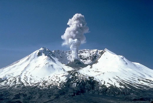
It serves as the primary access route to the Mount St. Helens National Volcanic Monument, running from an interchange with Interstate 5 in Castle Rock to the Johnston Ridge Observatory near Spirit Lake.
Quick Facts
- Route
- 504
- Spur of
- 5
- Section
- 655
- Length (mi)
- 51.76
- Length round
- 2
- Established
- 1964
- Tourist
- Spirit Lake Memorial Highway
- Counties
- Cowlitz, Skamania
Facts from the source article.
Did You Know?
- The spur route along Sediment Dam Road follows a 0.87-mile section of the former highway and terminates at a viewpoint and WSDOT maintenance facility.
- An average of 50 vehicles use the spur route daily, based on 2016 traffic data.
Route description
SR 504 starts where Huntington Avenue meets I-5 just northeast of Castle Rock, with the road continuing southwest into town as SR 411 and I-5 Business. Heading northeast, the highway goes through a small commercial stretch, then climbs into the hills above Salmon Creek, passing farms and wineries. It follows a small stream southeast into the wetlands around Silver Lake, home to the Mount St. Helens visitor center and Seaquest State Park. The route runs along the lake’s north side and goes through Toutle, where the two forks of the Toutle River meet. After crossing the river on the Coal Bank Bridge, it stays on the north side of the North Fork Toutle River, winding through a narrow valley east of Beigle Mountain. Near Riverdale Raceway, it meets the eastern end of SR 505, which links to I-5 and Toledo. Continuing northeast into Kid Valley, the highway follows the south side of an even narrower valley. At a third river crossing, a short spur called Sediment Dam Road leads to a viewpoint of the Toutle River Sediment Dam. The highway then climbs along the northeast side of the earthen dam and its reservoir, cutting through cliffs. Farther southeast, it passes the privately owned Eco Park resort, a youth camp, a heliport, and the Hoffstadt Bluffs Viewpoint. The road crosses Hoffstadt Creek on a 2,340-foot steel truss bridge 370 feet above the valley floor—the longest of 13 bridges on SR 504. This bridge marks the western edge of the blast zone from the 1980 eruption, where young fir, pine, and cottonwood trees were planted by Weyerhaeuser in the 1980s as part of a restoration project. The company also runs the Charles W. Bingham Forest Learning Center, a museum with a rest area overlooking the North Fork Toutle River.
History
The Spirit Lake Highway was completed in 1903 by the Cowlitz County government, connecting Castle Rock to Spirit Lake along the North Fork Toutle River. The 47-mile unpaved highway was rough and narrow, with sections improved or bypassed in the 1910s. It was added to the state highway system in 1937 as Secondary State Highway 1R (SSH 1R), terminating at the western boundary of Columbia National Forest near Spirit Lake. The state paved sections in the late 1930s and early 1940s, with only a short eastern section unpaved by 1944. The federal Bureau of Public Roads improved and paved the remaining section within the national forest in the late 1930s for $1.2 million. Expanded logging and a planned ski resort on Mount St. Helens spurred construction of a modern highway to the timberline in the 1950s, but funding shortfalls delayed the project. The state legislature approved funds for a 5-mile extension of SSH 1R into the national forest, beginning in late 1959. The new timberline highway opened on September 29, 1962. During the 1964 state highway renumbering, SSH 1R became SR 504. A new bridge over the Toutle River at Kid Valley was completed in November 1965, replacing a narrower truss bridge. By the 1970s, the Forest Service and logging companies had established campgrounds, trailheads, and recreation areas along the highway. A major flood in December 1977 washed out eight sections, leaving only one lane passable until repairs the following year.
More in Mount St. Helens
Spotted an error? Know more?
Reader corrections go straight into our review queue. Suggest an edit · How this site is sourced