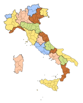
Aosta Valley
Smallest, least populous region of Italy, with Alpine peaks and dual languages.

The Aosta Valley (Valle d'Aosta in Italian, Vallée d'Aoste in French) is an autonomous, mountainous region in northwestern Italy. It borders France’s Auvergne-Rhône-Alpes to the west, Switzerland’s Valais to the north, and Italy’s Piedmont to the south and east. Its capital is Aosta. Covering 3,260.90 square kilometers with a population of 122,554, it is Italy’s smallest region by area, population, and density. The province of Aosta was dissolved in 1945, making this the first Italian region to eliminate provincial subdivisions; the regional government now handles provincial administrative tasks. Italian and French are official languages, and the Valdôtain dialect of Franco-Provençal is also officially recognized. Italian is the mother tongue for 77.29% of residents, Valdôtain for 17.91%, and French for 1.25%; in 2009, about 50.53% of the population could speak all three.
The region’s early inhabitants included Celts and Ligures, whose languages survive in some local place names. Rome conquered the area from the Salassi around 25 BC, founding Augusta Prætoria Salassorum (modern Aosta) to secure strategic mountain passes and building bridges and roads through the Alps. In 1031–1032, Humbert I of Savoy received the title Count of Aosta from Emperor Conrad II and fortified Bard. Saint Anselm of Canterbury was born in Aosta around 1033 or 1034. The region was dotted with castles, and in 1191, Thomas I of Savoy granted communes a Charte des franchises preserving autonomy—rights fiercely defended until revoked in 1770 to tie Aosta closer to Piedmont, then demanded again after Napoleon. In the mid-13th century, Emperor Frederick II made the County of Aosta a duchy, and its lion-rampant arms appeared in Savoy heraldry until Italian unification in 1870. The region remained part of Savoy lands except for French occupations in 1539–1563, 1691, and 1704–1706, and rule by the First French Empire from 1800 to 1814, when it was part of the Aoste arrondissement in the Doire department. As part of the Kingdom of Sardinia, it joined the Kingdom of Italy in 1861. French forces briefly controlled the area at the end of World War II but withdrew under British and American pressure. The region gained special autonomous status after the war, and the province of Aosta ceased to exist in 1945.
Geographically, the Aosta Valley is an Alpine valley that, with its tributary valleys, includes the Italian slopes of Mont Blanc, Monte Rosa, Gran Paradiso, and the Matterhorn. Its highest peak is Mont Blanc at 4,810 meters, making it Italy’s highest region by peak elevation. Valleys above about 1,600 meters have a cold continental climate (Dfc), with snow lasting 8 to 9 months at the highest points. January temperatures range from −7 to −3 °C, and July temperatures from 20 to 35 °C. Areas between 2,000 and 3,500 meters typically have a tundra climate (ET), where every month averages below 10 °C; this can be a cold oceanic type with mild winters or a severe continental type with very low winter averages. At Plateau Rosa, 3,400 meters high, January averages −11.6 °C and July 1.4 °C, making it Italy’s coldest verifiable location. Above 3,500 meters, all months historically averaged below freezing (EF climate), though recent temperatures have risen.
Politically, the valley has long been dominated by autonomist regional parties like the Valdostan Union, representing French-speaking interests. The latest regional election was in September 2025. The current president, Renzo Testolin, was first elected in 2023, leading a coalition of autonomist and progressive lists. The region is divided into 74 municipalities, with no provincial subdivisions.
Demographically, as of 2026, the population is 122,554, 49.2% male and 50.8% female. Minors make up 14.0%, seniors 26.3%. At 37.6 inhabitants per square kilometer, the density is far below the national average of 195.1, with extensive uninhabitable mountain and glacier areas; most people live in the central valley. Negative natural population growth since 1976 has been offset by immigration. The region has one of Italy’s lowest birth rates and a rising average age, partly balanced by younger immigrants working in tourism.
- Capital
- Aosta
- Population
- 122,554 (2026)
- Area
- 3,260.90 km²
- Official Languages
- Italian and French
- Highest Point
- Mont Blanc (4,810 m)
- Region Type
- Autonomous region of Italy
- Abolished Province
- Aosta (1945)
Verified Timeline
Lore & Background
Early inhabitants of the Aosta Valley were Celts and Ligures, whose language heritage remains in some local placenames. Rome conquered the region from the local Salassi around 25 BC and founded Augusta Prætoria Salassorum (modern-day Aosta) to secure the strategic mountain passes, and they went on to build bridges and roads through the mountains. In 1031–1032, Humbert I of Savoy, the founder of the House of Savoy, received the title Count of Aosta from Emperor Conrad II of the Franconian line and built himself a commanding fortification at Bard. Saint Anselm of Canterbury was born in Aosta in 1033 or 1034. The region was divided among strongly fortified castles, and in 1191, Thomas I of Savoy found it necessary to grant to the communes a Charte des franchises ('Charter of Liberties') which preserved autonomy—rights that were fiercely defended until 1770, when they were revoked to tie Aosta more closely to Piedmont, but which were again demanded during post-Napoleonic times. In the mid-13th century, Emperor Frederick II made the County of Aosta a duchy, and its arms charged with a lion rampant were carried in the Savoy arms until the reunification of Italy in 1870. The region remained part of Savoy lands, with the exceptions of French occupations from 1539 to 1563, later in 1691, and then between 1704 and 1706. It was also ruled by the First French Empire between 1800 and 1814. As part of the Kingdom of Sardinia, it joined the new Kingdom of Italy in 1861. French forces briefly controlled the area at the end of World War II, but withdrew under British and American pressure. The region gained special autonomous status after the end of World War II; the province of Aosta ceased to exist in 1945.
Reader's Guide
The Aosta Valley is an Alpine valley which, with its tributary valleys, includes the Italian slopes of Mont Blanc, Monte Rosa, Gran Paradiso and the Matterhorn; its highest peak is Mont Blanc (4,810 m or 15,780 ft). This makes it the highest region in Italy, based on the highest point in each region. The valleys, usually above 1,600 m, annually have a cold continental climate (Dfc), with a snow season lasting as long as 8 to 9 months at the highest points. Temperatures in January are low, between −7 and −3 °C, and in July are between 20 and 35 °C. Areas between 2,000 and 3,500 m usually have a tundra climate (ET). Temperature averages in Plateau Rosa, at 3,400 m high, are −11.6 °C in January and 1.4 °C in July; it is the coldest place in Italy where the climate is verifiable. The region has one of Italy's lowest birth rates, with a rising average age, partly compensated by immigration since most immigrants are younger people working in the tourist industry. Between 1991 and 2011, the population of the Aosta Valley grew by 9.4%, the highest growth among Italian regions, due exclusively to positive net migration. As of 2025, immigrants make up 11.2% of the population; the five largest foreign countries of birth are Morocco, Romania, Albania, France, and Tunisia. The Valdôtain population and their language dialects have been the subject of some sociological research.
Did You Know?
- The Aosta Valley was the first government authority to adopt Modern French as the sole official language in 1536, three years before France itself.
- Italian is spoken as a mother tongue by 77.29% of the population, Valdôtain by 17.91%, and French by 1.25%.
- The region includes the Italian slopes of Mont Blanc, Monte Rosa, Gran Paradiso, and the Matterhorn.
- Plateau Rosa, at 3,400 m, is the coldest place in Italy where the climate is verifiable, with a January average of −11.6 °C.
- The population of Gressoney-Saint-Jean, Gressoney-La-Trinité, and Issime speak two dialects of Walser German, Titsch and Töitschu.
Frequently Asked Questions
What is Aosta Valley?
Aosta Valley is the smallest and least populous autonomous region in Italy, nestled in the northwestern Alps where it meets France, Switzerland, and Piedmont. Its capital and namesake city is Aosta.
Why is Aosta Valley considered special among Italian regions?
It is Italy's smallest region by both area and population, and it was the first to eliminate provincial subdivisions back in 1945. The regional government directly handles all provincial-level administrative duties.
What languages are official in Aosta Valley?
Both Italian and French hold official status, reflecting the valley's position in the Alpine borderlands between Italy, France, and Switzerland. This bilingual framework is a defining feature of the region's identity.
How big is Aosta Valley and how many people live there?
The region spans roughly 3,261 square kilometers and is home to about 122,554 residents, making it the least densely populated region in all of Italy. Despite its compact size, it contains some of the tallest peaks in the Alps.
What is the highest point in Aosta Valley?
Mont Blanc, at 4,810 meters, stands as the region's highest point and one of the tallest summits in the entire European Alps. It sits along the French-Italian border and remains a major draw for alpinists.
More in Italian Regions 1-17
Spotted an error? Know more?
This is a living reference — every entry is fact-audited, and reader corrections feed straight into our audit queue. Suggest an edit · See this site's audit record