Sumba
Indonesian island with living megalithic traditions and unique biodiversity.

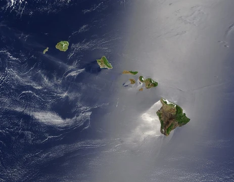
Sumba, also known natively as Humba, Hubba, Suba, or Zuba, is an Indonesian island within the Lesser Sunda Archipelago, administratively part of the East Nusa Tenggara province. Its land area is comparable to that of Jamaica or the island of Hawaii. The population has grown from over 686,000 in 2010 to more than 779,000 in 2020, with an official estimate of over 852,000 by mid-2025. The island is bordered by Sumbawa to the northwest, Flores across the Sumba Strait to the northeast, Timor across the Savu Sea to the east, and Australia across the Indian Ocean to the south. The name "Sumba" derives from the native Sumbanese word *humba* or *hubba*. According to Sumbanese oral traditions, Flores and Sumba were once linked by an ancient stone bridge called the Kataka Lindiwatu, built by the native peoples. Civilization is thought to have arisen around this connection, which corresponds to northern and parts of eastern Sumba. Archaeological ruins date back to the BC era, including megalithic burials in central Sumba that are thousands of years old. These stone burial traditions remain a living practice, observable today. Notable finds include quadrangular adzes in the Anakalang area and an urn burial site in Melolo, dated to around 2,870 BC. Around the 12th century, the island came under the dominion of the Majapahit empire, and the name "Sumba" first appeared in Javanese manuscripts from that period. European contact began with the Portuguese in 1522, followed by the Dutch VOC in the 1600s. Sandalwood became the main export, leading to the island’s colloquial name, Sandalwood Island. Governance transferred to the Dutch East Indies in 1866, and a Jesuit missionary program began in 1886. The largest town is Waingapu, the main port. The landscape features low limestone hills, with a dry season from May to November and a rainy season from December to April. The western side is more fertile and densely populated. Sumba lies within the Wallacea region, hosting a mix of Asian and Australasian flora and fauna, and is classified as the Sumba deciduous forests ecoregion. It is particularly rich in bird life, with nearly 200 species, including seven endemics.
- largest_town
- Waingapu
- major_export_historically
- sandalwood
- ecoregion
- Sumba deciduous forests
- endemic_bird_species
- 7
Lore & Background
According to Sumbanese oral tradition, Flores and Sumba were once connected by the Kataka Lindiwatu, an ancient stone bridge built by the native inhabitants of both islands, around which civilization is thought to have arisen. The island was part of the Majapahit empire, and the name 'Sumba' first appeared in Javanese manuscripts from that period, likely as a substitution for the native names Humba or Hubba. Sandalwood was the main export, leading to the island being called Sandalwood Island. The landscape is low, with limestone hills rather than steep volcanoes, and has a distinct dry season from May to November. The western side is more fertile and densely populated than the east. Originally covered in deciduous monsoon forest and evergreen rainforest on moist south-facing slopes, the northern part has suffered soil depletion from deforestation and erosion. Sumba lies in the Wallacea region, with a mix of Asian and Australasian flora and fauna, and is categorized by the World Wildlife Fund as the Sumba deciduous forests ecoregion. The island is particularly rich in bird life, with nearly 200 species, including seven endemic species.
Reader's Guide
Sumba holds significance as one of the last places on Earth where societies still build megalithic monuments for collective burials, with about 100 new megalithic tombs constructed annually. The island's cultural systems vary: western Sumba has segmentary societies, while northern and eastern Sumba have stratified caste-based societies. Ecologically, Sumba is part of the Wallacea region, with a mix of Asian and Australasian flora and fauna. It hosts seven endemic bird species, including the threatened Sumba hornbill. The island's landscape features limestone hills rather than volcanoes, with a dry season from May to November. Recent research suggests Sumba may have detached from the Southeast Asia margin rather than being part of Gondwana.
Did You Know?
- Sumba has a land area about the same size as Jamaica or the island of Hawaii.
- The name 'Sumba' is derived from the native Sumbanese word 'humba' or 'hubba'.
- Saltwater crocodiles can still be found in some areas of Sumba.
- The Sumba hornbill has an estimated population of less than 4,000 individuals.
Frequently Asked Questions
What are Sumba's living megalithic traditions?
Sumba is one of the few places on Earth where megalithic burial customs—massive stone tombs and ritual practices—have been maintained continuously for thousands of years without interruption. These traditions are still actively practised by local communities rather than existing only as archaeological ruins.
Why did European colonial powers target Sumba?
The island's dense forests yielded high-quality sandalwood, making it a prized source of that fragrant timber during the colonial era. Sandalwood became Sumba's defining historical export, drawing trade routes and foreign interest to the region.
What is the largest settlement on Sumba?
Waingapu serves as the island's biggest town and its primary urban centre. It functions as the main hub for commerce, administration, and transport across the island.
What makes Sumba's biodiversity distinctive?
The island falls within the Sumba deciduous forests ecoregion, a habitat type found on very few landmasses worldwide. Seven bird species are found nowhere else on the planet, all restricted to Sumba's forests and grasslands.
More in Islands 1-24
Spotted an error? Know more?
This is a living reference — every entry is fact-audited, and reader corrections feed straight into our audit queue. Suggest an edit · See this site's audit record