
Greenland ice sheet
Second-largest ice sheet, key driver of global sea level rise.

derivative work: Algkalv ( talk ) Greenland_stub.svg : PavelD · Public domain
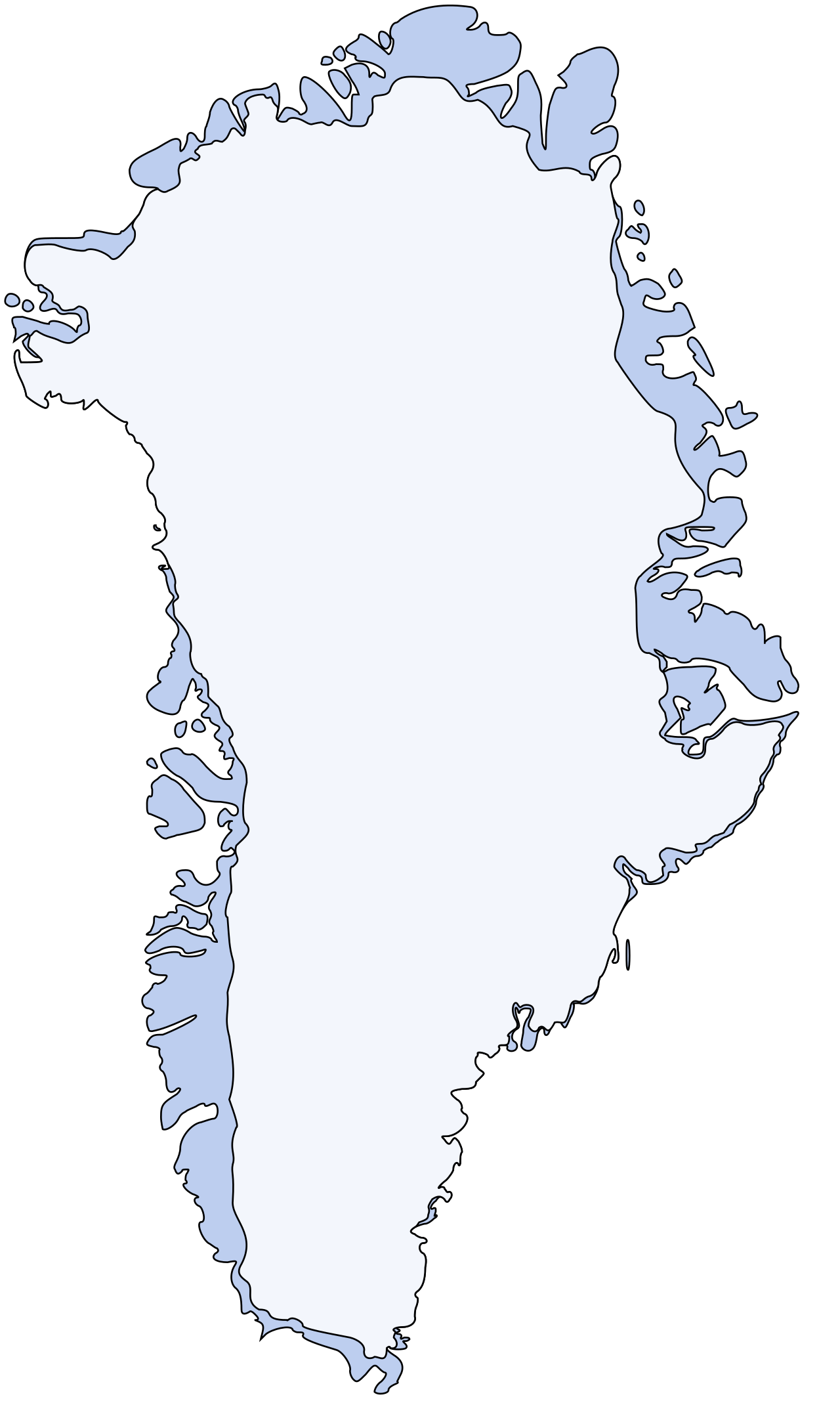
The Greenland ice sheet is the second-largest body of ice on Earth, covering roughly 80% of Greenland’s land area. It stretches nearly the entire length of the island in a north–south direction, reaching its maximum width near 77°N latitude. The ice averages several thousand meters in thickness, with its deepest point exceeding that average. This massive ice body formed through the gradual accumulation and compression of snow over centuries, a process known as glaciation. While Greenland has hosted major glaciers for at least 18 million years, a single, coherent ice sheet first covered most of the island around 2.6 million years ago. Since then, it has expanded and contracted multiple times; there have been 11 periods when it extended beyond its current boundaries, the last such advance occurring about 1 million years ago. The oldest ice preserved on Greenland today is roughly 1 million years old.
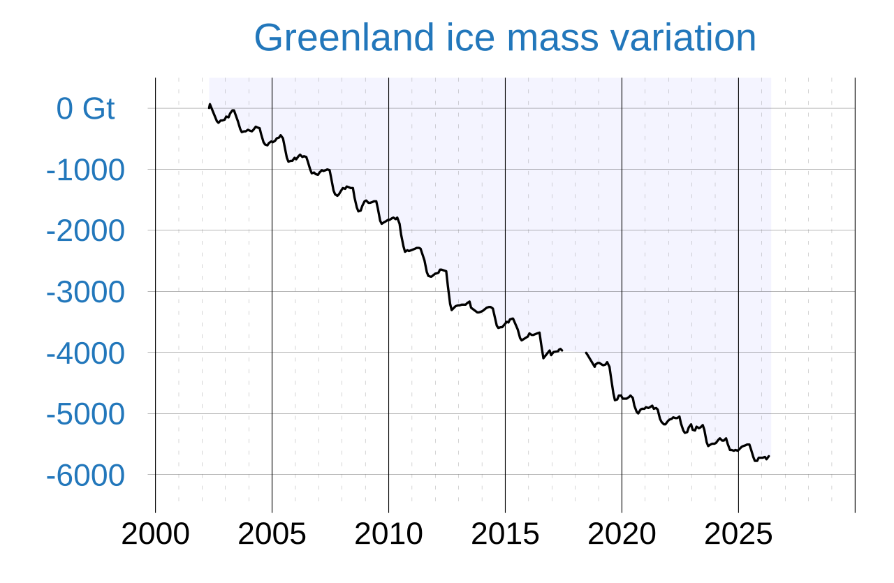
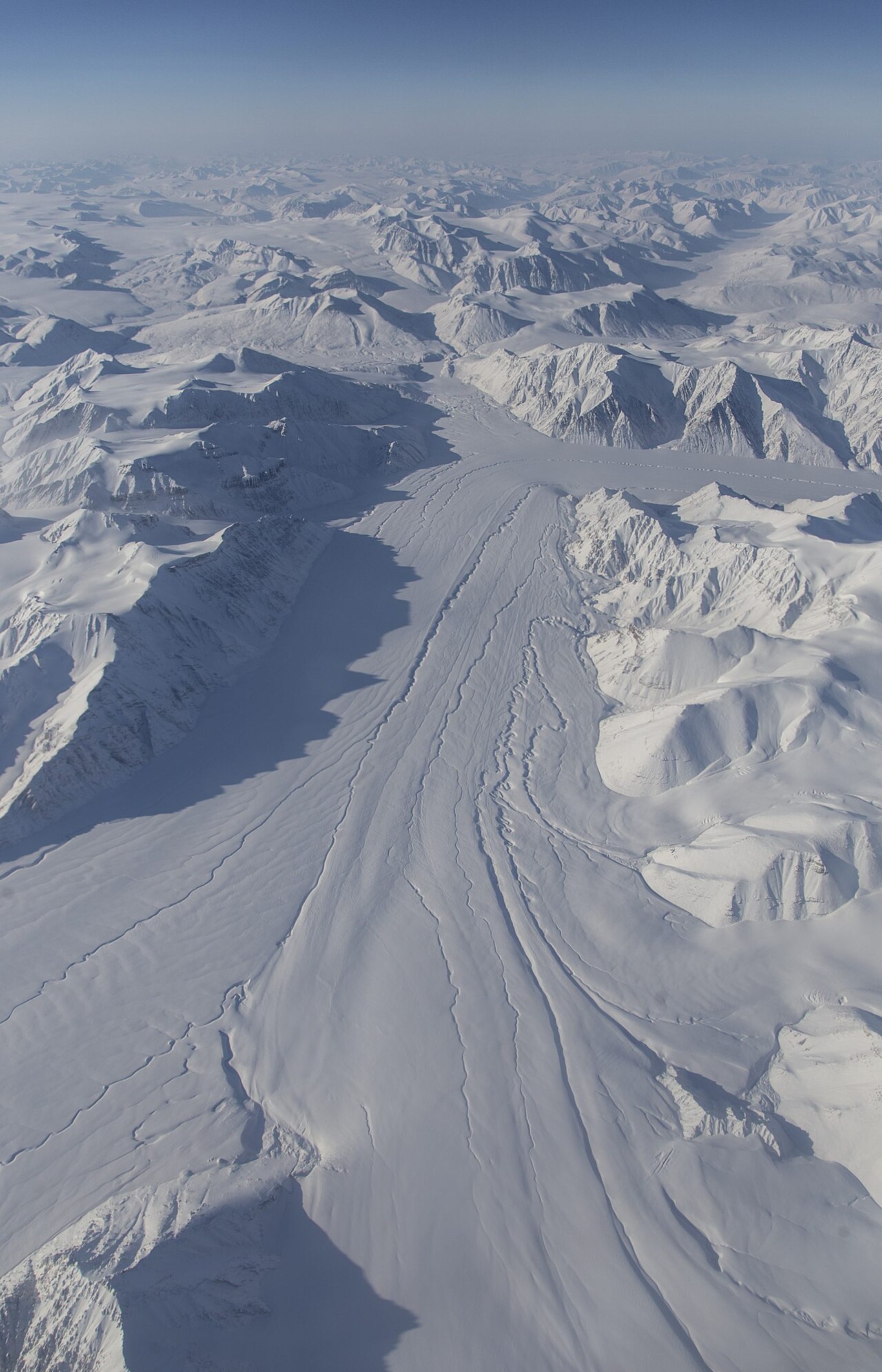
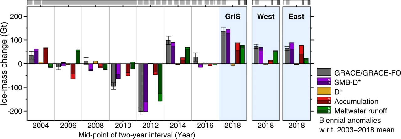
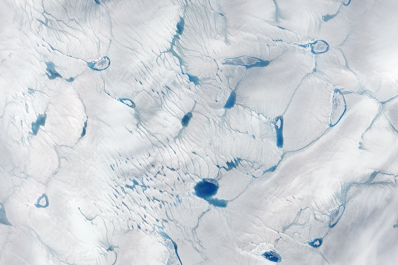
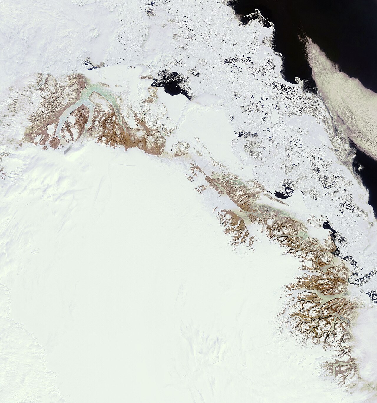
The ice sheet is not static; its immense weight causes it to flow slowly outward. Coastal mountains typically block this flow, but in the northwest and southeast, gaps allow outlet glaciers to reach the ocean, where they calve icebergs. Beneath the ice lie mountains and lake basins. Geothermal activity can warm the base of the sheet, sometimes creating liquid water that erodes the bedrock. In other areas, near the summit, the ice has frozen solid to ancient soil, preserving it for millions of years. Currently, due to anthropogenic greenhouse gas emissions, the ice sheet is at its warmest in the past millennium and is losing ice faster than at any point in the last 12,000 years. Summer melting and calving now far outpace winter snowfall replenishment, a trend that has been accelerating since 1996.
- sea level equivalent if melted
- ~7.4 m (24 ft)
Lore & Background
The Greenland ice sheet is the second-largest body of ice on Earth, covering roughly 80% of Greenland’s surface. It extends almost the entire length of the island in a north–south direction, with a maximum width near its northern edge at 77°N latitude. The ice averages a substantial thickness, with even greater depths at its maximum. Beneath this immense mass lie mountains and lake basins. The sheet formed through the gradual accumulation and compression of snow into firn and then solid glacier ice over centuries. While large glaciers existed in Greenland for at least 18 million years, a single, coherent ice sheet first covered most of the island around 2.6 million years ago, when atmospheric carbon dioxide levels dropped sufficiently. Since then, the sheet has expanded and contracted significantly; on eleven occasions it extended beyond its current boundaries, the last time about 1 million years ago. The oldest ice recovered from the sheet is approximately 1 million years old. Today, the ice sheet is at its warmest in the past millennium due to anthropogenic emissions, and it is losing ice faster than at any point in the last 12,000 years. Each summer, surface melting and iceberg calving occur, particularly where outlet glaciers flow through gaps in coastal mountains into the ocean.
Reader's Guide
The Greenland ice sheet's significance lies in its role as a major contributor to global sea level rise. Even if the Paris Agreement goal of staying below 2°C is met, melting would still add about 6 cm. If the entire ice sheet melted, global sea levels would rise by about 7.4 m. Geological evidence shows that during past warm periods, less than 10% of the current ice sheet volume remained when temperatures were less than 2.5°C warmer than preindustrial conditions. Ice cores from the summit provide records of rapid climate changes and human impacts, such as lead production from ancient Greece and Rome.
Did You Know?
- The Greenland ice sheet covers about 12% of the area of the Antarctic ice sheet.
- The oldest known ice on Greenland is about 1 million years old.
Physical Scale and Continental Dominance
In scientific literature, researchers commonly abbreviate it as GIS or GrIS. For perspective, its area represents roughly 12 percent of the Antarctic ice sheet, making it a truly continental-scale feature. Beneath this vast frozen expanse lie mountains and lake basins, a reminder that the ice sheet is not a uniform slab but a complex landscape shaped by the terrain it covers.
Deep-Time Formation and Tectonic Uplift
Greenland's relationship with ice stretches back at least 18 million years, though for much of that period the ice existed as scattered glaciers and ice caps rather than a unified sheet. These elevations intensified orographic precipitation and cooled surface temperatures, creating conditions favorable for persistent ice accumulation. As recently as 3 million years ago, during a Pliocene warm interval, ice was confined to the highest eastern and southern peaks.
Accelerated Melting and Sea-Level Stakes
The consequences for global sea levels are measurable and escalating. Without emissions reductions, that figure climbs to roughly 13 centimetres, with a worst-case scenario reaching 33 centimetres. The stakes are not merely incremental; they represent a fundamental shift in the planet's hydrological balance.
Ice Flow, Calving, and the Ancient Record
The immense weight of the ice sheet drives a slow gravitational flow outward, but coastal mountains in most directions act as barriers, channeling the ice into specific gaps where outlet glaciers carry it to the sea. The northwest and southeast margins are the principal routes for this discharge, where ice cliffs regularly calve into the ocean. Sediment liberated from calved and melting ice settles on the seafloor, and cores recovered from locations like the Fram Strait preserve long records of Greenland's glacial history. Beneath the summit, conditions are particularly remarkable: geothermal warmth at the base can melt ice into pressurized liquid water that erodes the bedrock, yet in some areas the basal ice has frozen solid to the ground, trapping ancient soil. The oldest such preserved soil has been buried under ice for approximately 2.7 million years, while a 3-kilometre-deep core has yielded ice roughly 1 million years old. These archives offer an unbroken window into climate conditions spanning most of the current ice age.
Gallery
Frequently Asked Questions
Why does the Greenland ice sheet matter for global sea level?
Because it stores such an enormous volume of freshwater, even a few percent of loss translates into measurable ocean-level rise worldwide. Its accelerating melt in recent decades has become one of the leading contributors to the current global sea-level increase.
What is driving the Greenland ice sheet to shrink?
Warming air temperatures caused by human-emitted greenhouse gases are the principal force speeding up both surface melting and basal loss. In many sectors the sheet is now losing mass faster than seasonal snowfall can replace it.
How does the Greenland ice sheet compare to Antarctica's ice sheet?
Antarctica's sheet is larger in both area and volume, but Greenland's roughly 1.71 million square kilometers of ice still make it a colossal feature in its own right. Together the two sheets hold the overwhelming majority of Earth's land-based ice.
More in Islands And Archipelagos 1-24
Spotted an error? Know more?
This is a living reference — every entry is fact-audited, and reader corrections feed straight into our audit queue. Suggest an edit · See this site's audit record