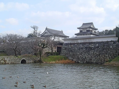
Tōbarusan Castle
A 7th-century Korean-style fortress guarding the Yamakuni River mouth.
Last updated
Where it is
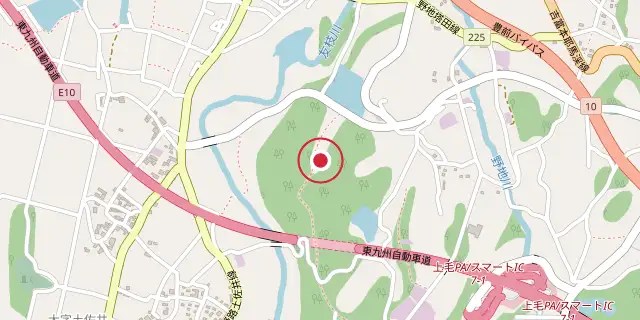
Coordinates: 33°33′58″N 131°09′40″E (33.5660, 131.1610) · Open in OpenStreetMap
Coordinates and connected clubs: the infobox of Wikipedia: Tōbarusan Castle (CC BY-SA 4.0). Map: drawn by Codexery from OpenStreetMap tiles.
Tōbarusan Castle is an ancient castle, also known as a Korean-style fortress in Japan, located in the town of Kōge, Chikujō District, Fukuoka Prefecture. Its ruins have been protected as a National Historic Site since 2005.
History
After the combined forces of Baekje and Yamato Japan lost to the Silla and Tang China alliance at the Battle of Hakusukinoe in 663, the Yamato court grew worried about a possible invasion from either Tang or Silla. To defend against this threat, they built a large network of coastal fortifications throughout the rest of the 600s, often with help from Baekje engineers, generals, and artisans. Not knowing that the Silla-Tang War had broken out between 670 and 676, the Japanese kept constructing these defenses until 701, even after they learned that Silla and Tang were no longer allies.
Tōbarusan Castle sits near the mouth of the Yamakuni River, which flows into the Gulf of Suo on the Seto Inland Sea and marks the border between present-day Fukuoka and Ōita Prefectures. The fortifications stand on a separate hill about 0.8 kilometers from north to south, 0.6 kilometers from east to west, and roughly 70 meters above sea level. The surrounding coastline has many similar remains of ancient mountain castles. During an archaeological dig in 1998, workers found rows of cut granite stones and earthworks with an L-shaped cut at the top, a typical feature of these old mountain castles.
These stone rows appeared on the hill, and from the northwestern part eastward and southward, they confirmed four spots where rows of cut stones, sometimes three stones linked together, were present. Where no stone rows existed, researchers detected terrace-like flat surfaces three to four meters wide at spots matching the expected lines of the stone rows. Local people had known about the stone rows on the hill long before scholars became aware of them.
Records from the Edo Period show that many stone blocks were taken from this site to build Nakatsu Castle, located about five kilometers away. When the stone walls were whole, their total length is estimated at roughly 1.7 kilometers, and the fortification encloses three valleys, each with a water gate. No artifacts were found that directly show when the fortification was built, but based on its structure and similarities to other examples, it is thought to date from the latter half of the 7th century. The ruins are about a 20-minute drive from Nakatsu Station on the JR Kyushu Nippo Main Line.
More in Castles in Fukuoka Prefecture
Sources
Compiled from Wikipedia and the sources listed below. Text from Wikipedia is available under CC BY-SA 4.0; this entry is adapted from it.
- Wikipedia: Tōbarusan Castle (CC BY-SA 4.0).
Spotted an error? Know more?
Reader corrections go straight into our review queue. Suggest an edit · How this site is sourced