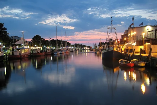
Chesapeake & Delaware Canal
Ship canal connecting Delaware River and Chesapeake Bay.
Last updated
Where it is
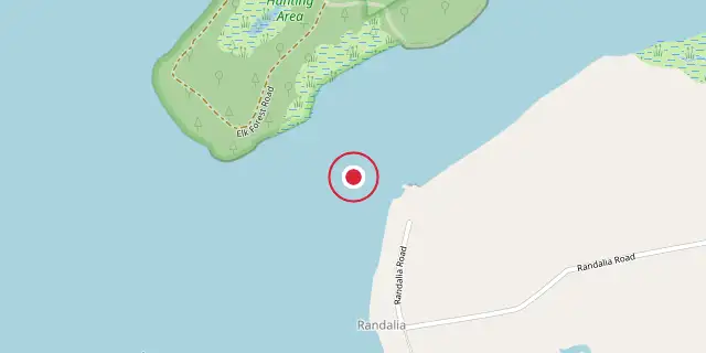
Coordinates: 39°31′26″N 75°52′23″W (39.5240, -75.8730) · Open in OpenStreetMap
Coordinates and connected clubs: the infobox of Wikipedia: Chesapeake & Delaware Canal (CC BY-SA 4.0). Map: drawn by Codexery from OpenStreetMap tiles.
The Chesapeake & Delaware Canal is a deep-draft, sea-level navigable passage crossing Delaware and Maryland, joining the Delaware River at Reedy Point, DE with the Upper Chesapeake Bay near Chesapeake City, MD.[1] It saves mariners a trip down the Delaware Bay, coastwise to the Virginia Capes, and back up the Chesapeake Bay to Baltimore.[1] Over 25,000 vessels use it annually, making it one of the busiest canals in the world.[1]
Key facts and history
Construction began in 1804 under Benjamin Latrobe but halted two years later for lack of funds.[2] Workers continuously battled slides along the soft slopes of the swampy marshlands.[3] In 1825, the company fired chief engineer John Randel Jr., who later won a breach-of-contract award of $226,885.84, which almost bankrupted the company.[4] The Ericsson Line of steamboats began operations in 1844, named after its first ship which was named for John Ericsson, who developed the screw propeller installed on the vessel.[5]
The canal's project controlling depth is now 35 ft over a project width of 400 ft.[1] In April 1824, construction on the canal started again; within a few years, around 2,600 men were excavating and moving earth from the ditch, earning an average of 75 cents per day.[3] The C&D Canal Company finally declared the waterway "open for business" in 1829, and the $3.5 million spent on its construction ranked it among the priciest canal projects of that era.[3] For 75 years, the Ericsson Line ran from Baltimore's No. 1 Light Street Pier, using thirty registered steamers to carry both passengers and freight along the canal.[5]
During the mid-1920s, the waterway was changed to a sea-level operation with a depth of 12 ft and a width of 90 ft, and all locks except the one at Delaware City were taken out.[6]
What the cited sources add
The BlueSeas navigation guide notes that the canal's length is reported as 17 miles by the Army Corps of Engineers, but the distance from the mouth of Back Creek to the end of the breakwaters is 15.3 nautical miles.[1] The canal has five fixed bridges, one lift bridge, five overhead power lines, and one overhead pipeline spanning it.[1] Traffic lights at Reedy Point and Old Town Point Wharf apply to all vessels, with a flashing red signal indicating the canal is closed.[1] Maximum tidal current velocities range from 1.9 knots to 2.6 knots depending on location within the canal.[1]
Vessels of 300 gross tons or more must establish radio communications with the Canal Dispatcher two hours prior to entering.[1]
References
- "Chesapeake and Delaware Canal: Navigating the Chesapeake and Delaware Canal", BlueSeas, 2015. facts only, no text reused. offshoreblue.com
- Wikipedia, "Chesapeake & Delaware Canal" (CC BY-SA 4.0), which cites: Matson, Candy and Wendy Woloson, "Guide to Manuscripts and Print Resources for Research", Economic History In the Philadelphia Region, 2005; Matson, Candy and Wendy Woloson, "Guide to Manuscripts and Print Resources for Research", Economic History In the Philadelphia Region, 2005 (original not read by us) en.wikipedia.org
- Wikipedia, "Chesapeake & Delaware Canal" (CC BY-SA 4.0), which cites: "Appletons' annual cyclopaedia and register of important events of the year: 1862", D. Appleton & Company, 1863, p. 378 (original not read by us) en.wikipedia.org
- Wikipedia, "Chesapeake & Delaware Canal" (CC BY-SA 4.0), which cites: ; (original not read by us) en.wikipedia.org
- Wikipedia, "Chesapeake & Delaware Canal" (CC BY-SA 4.0), which cites: Blum, Isidor. The Jews of Baltimore. 1910.; Dayton, Fred Irving. Steamboat Days. New York: Frederick A. Stokes Company, 1925.; "The Chesapeake and Delaware Canal – The Ericsson Line". Baltimore Municipal Journal 22 (November 1919): 1–2. (original not read by us) en.wikipedia.org
- Wikipedia, "Chesapeake & Delaware Canal" (CC BY-SA 4.0), which cites: Edward F. Heite, "National Register of Historic Places Inventory/Nomination: Eastern Lock of the Chesapeake and Delaware Canal", National Park Service, February 1975; (original not read by us) en.wikipedia.org
Each numbered sentence above was checked against the source it cites before publication. Sentences citing Wikipedia adapt text from the English Wikipedia article Chesapeake & Delaware Canal (contributors), used under CC BY-SA 4.0; this entry is available under the same licence. Other sources were used for facts only; no text or images are copied from them.
More in Canals And Artificial Waterways
Sources
Compiled from Wikipedia and the sources listed below. Text from Wikipedia is available under CC BY-SA 4.0; this entry is adapted from it.
- Wikipedia: Chesapeake & Delaware Canal (CC BY-SA 4.0).
Spotted an error? Know more?
Reader corrections go straight into our review queue. Suggest an edit · How this site is sourced