
Bishkek

xiquinhosilva · CC BY 4.0
Bishkek, the capital and largest city of Kyrgyzstan, also serves as the capital of the Chüy Region and lies near the border with Kazakhstan. Its population is around 1,200,000 as of 2024. The city originated as a caravan rest stop on a branch of the Silk Road, possibly founded by the Sogdians, and was fortified in 1825 by the Khanate of Kokand with a mud fort. In 1860, Russian forces under Colonel Apollon Zimmermann destroyed this fortress, and a Russian settlement was established on the site in 1868 under the original name Pishpek. The settlement became the capital of the Kara-Kirghiz Autonomous Oblast in 1925. In 1926, the Communist Party renamed it Frunze after Bolshevik military leader Mikhail Frunze, who was born there. It became the capital of the Kirghiz Soviet Socialist Republic in 1936. The Kyrgyz parliament changed the name to Bishkek in 1991, a modified version of the original name. The etymology is linked to a paddle used to churn fermenting milk; local legend tells of a hero’s wife who lost such a paddle, gave birth to a boy named Bishkek, who became a noble figure buried near the Alamüdün River. The city sits at the northern fringe of the Kyrgyz Ala-Too Range, an extension of the Tian Shan, with a fertile steppe extending north into Kazakhstan. The Chüy River drains the area, and a spur line connects Bishkek to the Turkestan–Siberia Railway. The city features wide boulevards, marble-faced public buildings, Soviet-era apartment blocks, and many smaller private houses. Streets follow a grid pattern and are lined with irrigation channels that water shade trees. Bishkek is Kyrgyzstan’s financial centre, housing all of the country’s commercial banks. The Dordoy Bazaar is a major employment hub, selling Chinese goods to CIS countries. Before independence, the majority of the population were ethnic Russians; by 2004, Russians made up about 20% of the city’s inhabitants.
- Country
- Kyrgyzstan
- Region
- Chüy Region
Lore & Background
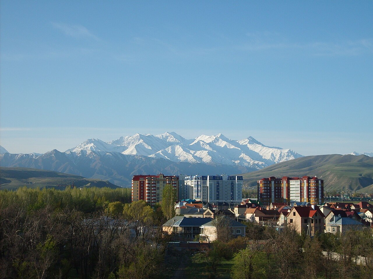
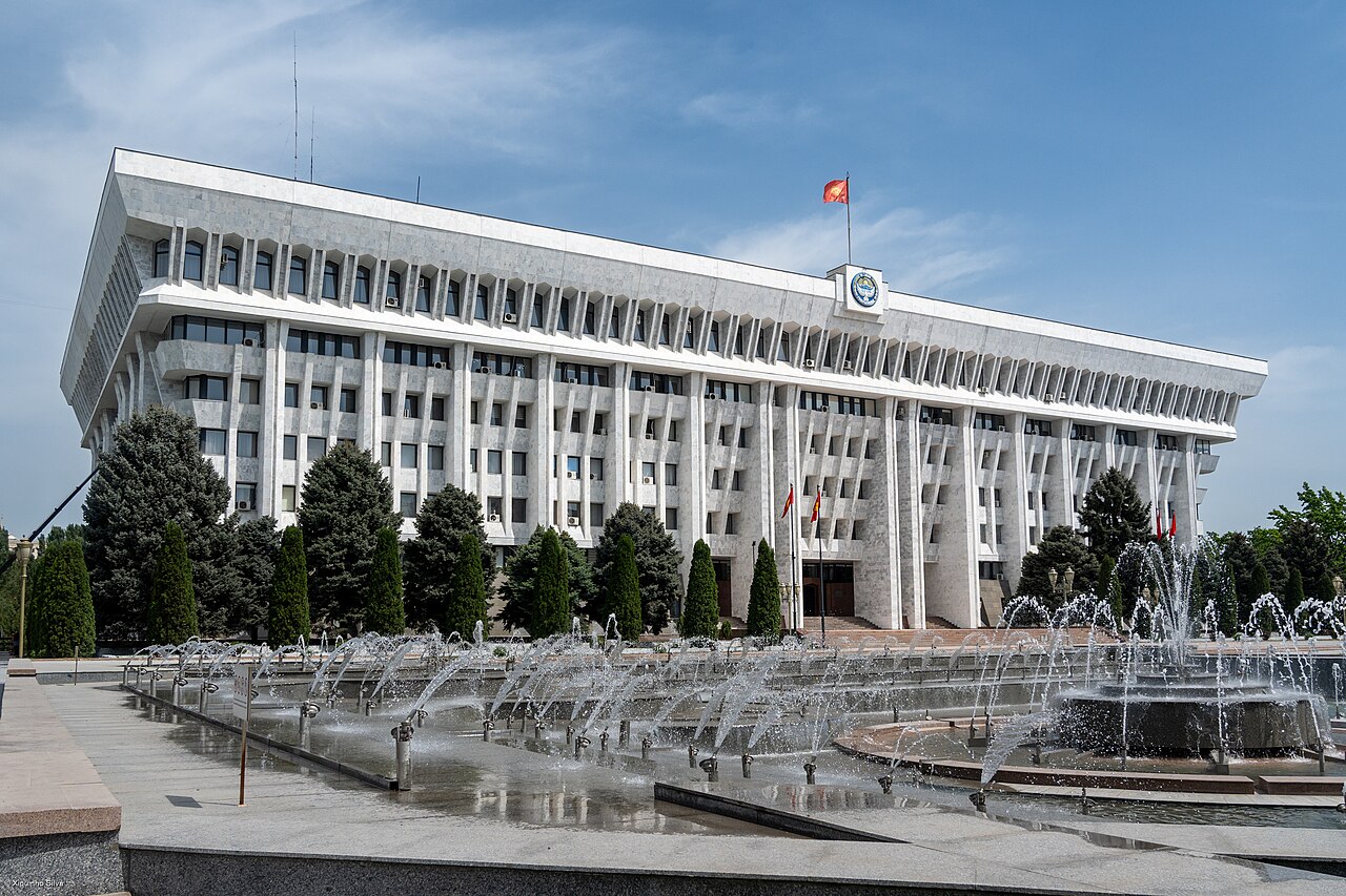
Bishkek is a large city set at the northern edge of the Kyrgyz Ala-Too Range, part of the Tian Shan mountains, which rise to a significant height nearby. To the north, a fertile, gently rolling steppe extends far into Kazakhstan. The city’s layout follows a grid pattern of wide boulevards, with many streets lined by narrow irrigation channels that water trees, providing shade in the hot summers. The urban landscape is a mix of marble-faced public buildings, numerous Soviet-era apartment blocks arranged around interior courtyards, and thousands of smaller, privately built houses, most located outside the city center. The ruins of the original 1825 Kokand fortress, destroyed by Russian forces in 1860, lie just north of Jibek Jolu Street, near the main mosque. Historically, the area is considered a possible origin point for the Black Death of the 14th century, based on DNA evidence. The city’s name is derived from a paddle used to churn fermenting milk; local legend tells of a pregnant woman who lost such a paddle, gave birth to a son named Bishkek, who became a noble figure and was buried on a mound near the Alamüdün River. Bishkek serves as Kyrgyzstan’s financial hub, housing all of the country’s 21 commercial banks, and the Dordoy Bazaar is a major employment center, trading Chinese goods across CIS countries.
Reader's Guide
Bishkek, the capital and largest city of Kyrgyzstan, serves as the nation’s financial hub, housing all 21 of the country’s commercial banks. Its economy relies heavily on the Dordoy Bazaar, a major open market where Chinese goods are traded to other CIS nations. The city’s layout features a rectangular grid pattern, with the main east-west artery being Chüy Avenue, formerly Lenin Avenue, lined with government buildings and universities. Wide boulevards and marble-faced public buildings are common, alongside numerous Soviet-era apartment blocks arranged around interior courtyards, while thousands of smaller, privately built houses are found outside the city center. Narrow irrigation channels flank most streets, providing water for trees that offer shade in the hot summers. The city lies at an altitude just north of the Kyrgyz Ala-Too Range, an extension of the Tian Shan mountains, with fertile steppe extending north into Kazakhstan. Historically, the site began as a caravan rest stop on a Silk Road branch, fortified by the Khanate of Kokand in 1825. Russian forces destroyed that fortress in 1860, and a Russian settlement was established there in 1868. Under Soviet rule, the city was renamed Frunze in 1926 and became the capital of the Kirghiz SSR in 1936. It was renamed Bishkek in 1991 upon Kyrgyzstan’s independence. The name is traditionally linked to a paddle used to churn kumis, with a local legend about a hero’s wife who lost such a paddle and gave birth to a son named Bishkek, who later became a noble figure buried near the Alamüdün River.
Did You Know?
- Bishkek is supposedly named after the paddle used to churn fermenting milk.
Origins & the Fortress Era
The site that would become Bishkek has deep roots as a caravan waypoint along one of the Silk Road branches threading through the Tian Shan mountains, possibly established by Sogdian traders.
The Naming Saga
Few cities in Central Asia have cycled through so many official names in so short a span. The name Frunze endured for sixty-five years. The city's official website traces the name to a paddle used in churning kumis, lost by the pregnant wife of a hero who, while searching for it, gave birth to a son she named Bishkek.
Geography & Urban Fabric
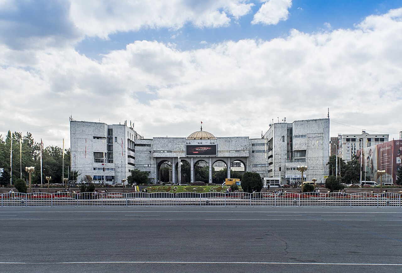
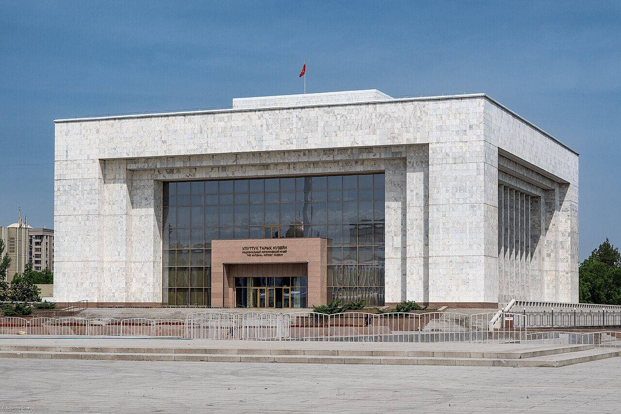
To the north, the terrain flattens into a broad, gently rolling steppe that stretches all the way into Kazakhstan, drained largely by the Chüy River. The city's core is laid out on a strict rectangular grid, a legacy of its planned Russian founding. Wide boulevards and marble-clad public buildings coexist with dense clusters of Soviet-era apartment blocks arranged around interior courtyards, while thousands of smaller privately built houses fill the periphery. A distinctive feature of the streetscape is the pair of narrow irrigation channels running along both sides of most roads, feeding the rows of trees that cast welcome shade through the hot summers. The east-west Chüy Avenue, once called Lenin Avenue, anchors the governmental and academic heart of the city, while Sovietskaya Street (now officially Yusup Abdrakhmanov Street) serves as the main north-south artery, linking the railway station to the Dordoy Bazaar in the north.
Post-Soviet Transformation
The decades following independence reshaped Bishkek's economic and demographic character. During the Soviet period the city hosted a substantial base of industrial plants, yet most of those facilities have since closed or been drastically scaled back. Today the city functions as Kyrgyzstan's financial hub, housing the headquarters of all twenty-one of the country's commercial banks. One of the largest single employers is the Dordoy Bazaar, a sprawling open market where vast quantities of Chinese goods destined for CIS markets are traded.
Gallery
Frequently Asked Questions
What role does Bishkek play in the country?
As the national capital it houses the government, parliament, and major cultural institutions, anchoring Kyrgyzstan's political and economic life. Its position in the fertile Chüy Valley also makes it a critical hub for regional trade and transport.
More in Asian Cities 1-24
Spotted an error? Know more?
This is a living reference — every entry is fact-audited, and reader corrections feed straight into our audit queue. Suggest an edit · See this site's audit record