Department of Aerospace Science and Technology
Brazil's military aerospace research and coordination center.
Last updated
Where it is
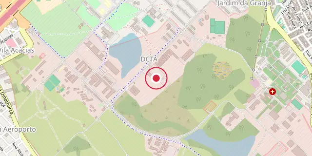
Coordinates: 23°12′36″S 45°52′16″W (-23.2100, -45.8710) · Open in OpenStreetMap
Coordinates and connected clubs: the infobox of Wikipedia: Department of Aerospace Science and Technology (CC BY-SA 4.0). Map: drawn by Codexery from OpenStreetMap tiles.
The Brazilian Department of Science and Aerospace Technology, known as DCTA, is a military research center for aviation and space, under the Brazilian Air Force. It oversees technical and scientific work in aerospace for the Ministry of Defense. Founded in 1953, it employs thousands of civilian and military staff.
Institutes
The DCTA campus houses four institutes. The Institute for Advanced Studies works in pure and applied sciences including photonics, nuclear energy, applied physics, remote sensor systems and decision support systems; in 2006 it inaugurated the T3 Hypersonic wind tunnel, the largest in Latin America.
More in Aerospace
Sources
Compiled from Wikipedia and the sources listed below. Text from Wikipedia is available under CC BY-SA 4.0; this entry is adapted from it.
- Wikipedia: Department of Aerospace Science and Technology (CC BY-SA 4.0).
Spotted an error? Know more?
Reader corrections go straight into our review queue. Suggest an edit · How this site is sourced