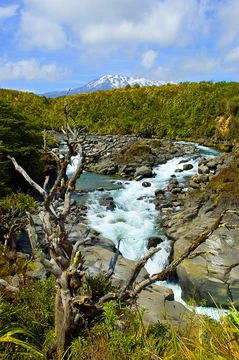
Whakapapa River
River on Mount Ruapehu, diverted for power and prized for trout.
Last updated

via Wikipedia: Whakapapa River · see source
Where it is
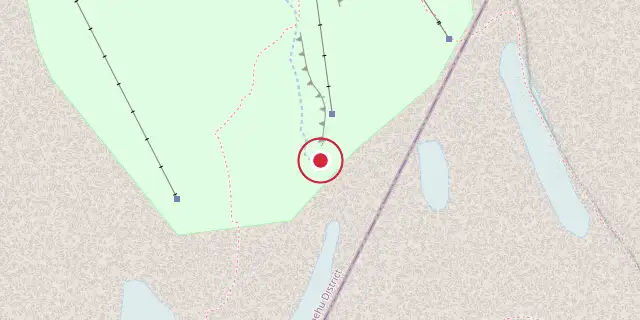
Coordinates: 39°15′40″S 175°33′50″E (-39.2610, 175.5640) · Open in OpenStreetMap
Coordinates and connected clubs: the infobox of Wikipedia: Whakapapa River (CC BY-SA 4.0). Map: drawn by Codexery from OpenStreetMap tiles.
The Whakapapa River begins where the Whakapapaiti and Whakapapanui Streams meet, in a 100-metre-deep gorge on Mount Ruapehu’s western slopes. It flows about 40 kilometres, passing Ōwhango, and joins the Whanganui River east of Kakahi. Before the North Island Main Trunk Railway was built around 1904, the valley was thick with podocarp forest. The last large stand of bush on the west bank was logged near Oio in 1914.
Lore
Peter McIntyre had a home near Kakahi overlooking the confluence of the Whanganui and Whakapapa rivers, and painted several oil landscapes of the Whakapapa River. After his death, the Whakapapa River undermined the white pumice cliffs where his house was built and claimed the house as its own.
Tributaries
The river starts where the Whakapapaiti and Whakapapanui streams meet. They both run from Ruapehu and are joined by several other streams. These include the Waikare and Tawhai streams that join the Whakapapaiti stream before its confluence to form the river.
The 13 m tall Tawhai Falls are on the Whakapapanui stream, rather than the Tawhai stream and are accessible by a walking track from the Bruce Road. The upper stream catchment has had several lahars run down them in the last 10,000 years, including 1969 and 1975. There was a major sector collapse without eruption of Ruapehu about 9500 years ago that impacted on the upper catchment.
Guide
Occasionally people kayak a 7.5 km stretch of the river from near Ōwhango to near Kakahi. When the river was high enough, kayaks went 23 km from the Whakapapa Intake to Ōwhango bridge. However, Intake Road was closed when a Landcorp farm passed to Te Kotahitanga a Ngāti Tūwharetoa on 1 July 2019. Herenga ā Nuku and Fish and Game have since been negotiating for public access.
Eels and Crans bullies live in the river. Trout were put in the river around 1911 and Fish & Game now describe it as very clear and having one of the finest trout fisheries, with rainbow and brown trout. However, the upper reaches were diverted from the Whakapapa Intake, via tunnels (about 11 km and 5.5 km long and over 3 m in diameter), Te Whaiau Stream and Lake Otamangakau reservoir to Lake Rotoaira, as part of the Tongariro Power Scheme, built between 1964 and 1971.
Since then the water has been warmer, as about 80% of the river's headwaters now flow into the Waikato catchment. It has also increased the proportion of water coming from developed land. The river is among the worst 25% of rivers for dissolved reactive phosphorus pollution. The Intake was also repaired in 2009.
More in Tongariro National Park
Sources
Compiled from Wikipedia and the sources listed below. Text from Wikipedia is available under CC BY-SA 4.0; this entry is adapted from it.
- Wikipedia: Whakapapa River (CC BY-SA 4.0).
- Word definitions: the Codexery glossary, each quoted from its Wikipedia article.
Spotted an error? Know more?
Reader corrections go straight into our review queue. Suggest an edit · How this site is sourced