Cajon Pass
Mountain pass linking Southern California to the Mojave Desert.
Last updated

via Wikipedia: Cajon Pass · see source
Where it is
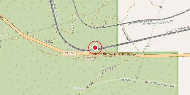
Coordinates: 34°19′34″N 117°25′41″W (34.3260, -117.4280) · Open in OpenStreetMap
Coordinates and connected clubs: the infobox of Wikipedia: Cajon Pass (CC BY-SA 4.0). Map: drawn by Codexery from OpenStreetMap tiles.
Cajon Pass, a mountain pass in Southern California, sits at 3,777 ft elevation between the San Bernardino Mountains and the San Gabriel Mountains. Formed by movements of the San Andreas Fault, it lies within the Mojave Desert and serves as a vital transportation corridor from the Greater San Bernardino Area to the Victor Valley and onward to Las Vegas. The Pacific Crest Trail also runs through the area.
Aviation
Flying through Cajon Pass is risky due to high winds, turbulence, and fog. Conditions can change from foggy, low-visibility days to clear afternoons with Santa Ana gusts exceeding 80 mph. The usual wind direction is from the west, but Santa Ana events or other weather may bring winds from the north or southeast. Air spilling over the San Gabriel Mountains creates violent up- and downdrafts.
On a normal westerly wind day, turbulence begins a few miles west of Rialto and continues eastward, intensifying above mountain altitude and especially near the HITOP intersection. During Santa Ana conditions, violent up- and downdrafts occur northeast of Ontario Airport, and turbulence can extend east to the Banning Pass, itself known for rough air. An aircraft's mass and wing loading affect its sensitivity to turbulence; what feels violent in a Cessna 172 may seem mild to moderate in a Boeing 747. In 2006, the Mercy Air 2 air ambulance helicopter collided with mountainous terrain near the pass in foggy weather.
Rail transport
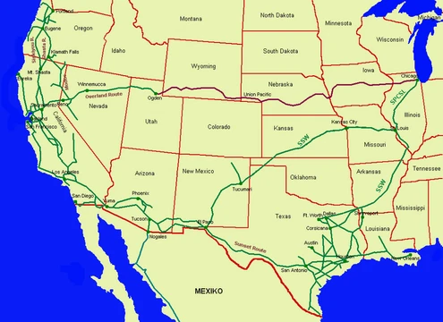
The California Southern Railroad, a subsidiary of the Atchison, Topeka and Santa Fe Railway, built the first railroad through Cajon Pass in the early 1880s, linking present-day Barstow and San Diego. Today, Union Pacific Railroad and BNSF Railway (the Santa Fe's successor) use the pass as part of the Southern Transcon to reach Los Angeles and San Bernardino. The pass is a popular spot for railfans due to heavy train traffic, scenic views, and easy access.
Union Pacific and BNSF share track rights through the pass, negotiated under the original Los Angeles and Salt Lake Railroad. BNSF owns three tracks, built in the 1880s, 1913, and 2008. The south track's 3.0% grade is challenging for long trains, making westbound descent dangerous. The 1913 track is 2 mi longer with a lower 2.2% grade and originally had two tunnels, later removed for open cuts.
Trains typically ascend at 14 to 22 mph and descend at 20 to 30 mph, reaching 60 or 70 mph on straighter sections away from the pass. On April 6, 1974, a Union Pacific freight train led by DDA40X units 6903 and 6924 ran into the rear of a standing Santa Fe train, killing the UP brakeman and injuring the UP conductor and Santa Fe crew. The steep downhill grade south of the pass contributed to the May 12, 1989, San Bernardino train disaster.
Road transport
The Mojave Freeway (I-15) was built in 1969 over Cajon Summit, west of Cajon Pass, and is a major route from Los Angeles and the Inland Empire to Las Vegas. The freeway runs above and parallel to an original stretch of U.S. Route 66 and U.S. Route 395, now called Cajon Boulevard, which was rerouted and widened in the early 1950s. Only the southbound/westbound lanes remain in use; the northbound/eastbound lanes and their bridges are closed to through traffic.
This stretch, accessible via the Kenwood Avenue or Cleghorn Road exits, offers some of the best trainspotting areas. The Cajon Pass segment of I-15 has been named the deadliest road in California. The historic Summit Inn, a Route 66 diner at the summit off the Oak Hills exit, operated from 1952 until it was destroyed by the Blue Cut fire in 2016. Some maps show Cajon Pass as a feature on SR 138, which crosses I-15 south of the summit between West Cajon Valley and Summit Valley.
Natural hazards
The following winter, rains on burnt vegetation caused landslides that further closed the freeway. Cajon Pass is notorious for high winds, especially during Santa Ana season, with gusts up to 60 mph that can cause semi-trucks to tip over.
Caltrans uses changeable message signs to warn motorists during wind advisories. Snow occasionally falls but rarely causes closures; when total closure occurs, California Highway Patrol often provides escorts. The San Andreas Fault passes through Cajon Pass, crossing I-15 on the south side of the summit, and instrumentation tracks earthquakes there.
Did You Know?
- The name 'Cajon' comes from the Spanish word for box or drawer, first used in English on an 1852 map.
- Early Latter-day Saint documents referred to the pass as 'Cahoon Pass,' possibly named after Mormon pioneer Andrew Cahoon.
- The Blue Cut Fire on August 16, 2016, destroyed the historic Summit Inn, which had operated since 1952.
More in Southern Pacific Railroad
Sources
Compiled from Wikipedia and the sources listed below. Text from Wikipedia is available under CC BY-SA 4.0; this entry is adapted from it.
- Wikipedia: Cajon Pass (CC BY-SA 4.0).
Spotted an error? Know more?
Reader corrections go straight into our review queue. Suggest an edit · How this site is sourced