Antofagasta
Last updated
Where it is
Coordinates: 23°39′00″S 70°24′00″W (-23.6500, -70.4000) · Open in OpenStreetMap
Coordinates and connected clubs: the infobox of Wikipedia: Antofagasta (CC BY-SA 4.0). Map: drawn by Codexery from OpenStreetMap tiles.
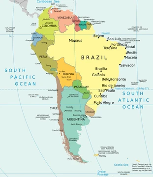
Located in northern Chile, the port city of Antofagasta lies roughly 1100 km to the north of Santiago and functions as the administrative center for both Antofagasta Province and Antofagasta Region.[1]
Geography and history
In the 18th century, the territory was included in maps of the Captaincy General of Chile, depending from Copiapó.[2] Bolivia later enforced a tax of 10 cents, which it suspended and then reactivated, eventually cancelling the company.[3] In 1912, the British community erected a clock tower replicating Big Ben in Plaza Colón to celebrate the republic's centenary.[4] The city was hit by a 7.3 magnitude earthquake on 30 July 1995.[5]
The Humboldt Current and the morning fog called "Camanchaca" are the factors that control the region's aridity.[6] A mudslide on 18 June 1991 caused widespread destruction across much of the city, resulting in 92 fatalities and leaving approximately 20,000 residents without homes.[5]
What the cited sources add
Caballo's 2022 paper in Andean Geology reports that lithium-rich brine is transported to processing plants near Antofagasta, at Salar del Carmen and La Negra.[7] The 2024 census data shows that immigrants make up 19.1% of Antofagasta's population, with 18.8% from South America.[1][8]
References
- Wikipedia, "Antofagasta" (CC BY-SA 4.0), which cites: "Resultados – Censo 2024", INE (we also read that source) en.wikipedia.org
- Wikipedia, "Antofagasta" (CC BY-SA 4.0), which cites: Jaime Eyzaguirre (1967). BREVE HISTORIA DE LAS FRONTERAS DE CHILE. (original not read by us) en.wikipedia.org
- Wikipedia, "Antofagasta" (CC BY-SA 4.0), which cites: Bolivian maritime claim, "Documentos Anexos", 2005 (original not read by us) en.wikipedia.org
- Wikipedia, "Antofagasta" (CC BY-SA 4.0), which cites: Edmundson, "A History of the British Presence in Chile: From Bloody Mary to Charles Darwin and the Decline of British Influence", Palgrave MacMillan, 2009, p. 128-129 (we also read that source) en.wikipedia.org
- Wikipedia, "Antofagasta" (CC BY-SA 4.0), which cites: "Mudslide in Chile Inundates Slums in Desert Area, Killing at Least 64", The New York Times, 19 June 1991 (original not read by us) en.wikipedia.org
- Wikipedia, "Antofagasta" (CC BY-SA 4.0), which cites: "Humboldt Current Index (HCI)", August 2012; Montecino, "The Humboldt Current System: Ecosystem components and processes, fisheries, and sediment studies", Progress in Oceanography, 2009, p. 65–79 doi:10.1016/j.pocean.2009.07.041; Schemenauer, "A Neglected Water Resource: The Camanchaca of South America", Bulletin of the American Meteorological Society, February 1988, p. 138–147; van der Spek, "The Humboldt Current and why Chilean beaches are the coldest", Chile Today, 18 January 2019 (original not read by us) en.wikipedia.org
- Caballo, "Reserves, resources and lithium exploration in the salt flats of northern Chile", Andean Geology, 2022, p. 297–306. facts only, no text reused. andeangeology.cl
- "Resultados – Censo 2024", INE. facts only, no text reused. censo2024.ine.gob.cl
Each numbered sentence above was checked against the source it cites before publication. Sentences citing Wikipedia adapt text from the English Wikipedia article Antofagasta (contributors), used under CC BY-SA 4.0; this entry is available under the same licence. Other sources were used for facts only; no text or images are copied from them.
More in South American Cities
Sources
Compiled from Wikipedia and the sources listed below. Text from Wikipedia is available under CC BY-SA 4.0; this entry is adapted from it.
- Wikipedia: Antofagasta (CC BY-SA 4.0).
Spotted an error? Know more?
Reader corrections go straight into our review queue. Suggest an edit · How this site is sourced