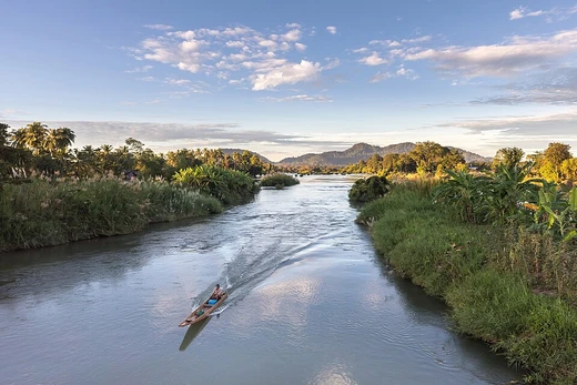
Vistula
Poland's longest river and a national symbol of cultural identity.

The Vistula (Polish: Wisła) is Poland’s longest river and the longest one that flows into the Baltic Sea, stretching 1,047 kilometers (651 miles). Its drainage basin spans 193,960 square kilometers (74,890 square miles), with 168,868 square kilometers (65,200 square miles) lying within Poland. The river originates at Barania Góra in southern Poland, 1,220 meters (4,000 feet) above sea level in the Silesian Beskids, part of the western Carpathian Mountains. It begins as two headstreams: the White Little Vistula (Biała Wisełka) and the Black Little Vistula (Czarna Wisełka). The Vistula passes through major Polish cities such as Kraków, Sandomierz, Warsaw, Płock, Włocławek, Toruń, Bydgoszcz, Świecie, Grudziądz, Tczew, and Gdańsk. It reaches the Baltic Sea via the Vistula Lagoon (Zalew Wiślany) or directly into Gdańsk Bay, forming a delta with six main branches: Leniwka, Przekop, Śmiała Wisła, Martwa Wisła, Nogat, and Szkarpawa.
- source
- Barania Góra, Silesian Beskids, Poland
- mouth
- Vistula Lagoon or Gdańsk Bay, Baltic Sea
- major_cities
- Kraków, Warsaw, Gdańsk, Toruń, Płock
- glaciation
- Weichselian glaciation (100,000–10,000 BC)
Verified Timeline
Lore & Background
The Vistula has many associations with Polish culture, history and national identity. It is Poland's most important waterway and natural symbol, flowing through its two main cities (Kraków and Warsaw), and the phrase 'Land on the Vistula' (Polish: kraj nad Wisłą) can be synonymous with Poland. Historically, the river was also important for the Baltic and German (Prussian) peoples. The name Vistula first appears in the written record of Pomponius Mela (3.33) in AD 40. Pliny in AD 77 in his Natural History names the river Vistla (4.81, 4.97, 4.100). The root of the name Vistula is often thought to come from Proto-Indo-European *weys-: 'to ooze, flow slowly'. The actual name of Vistula is Vėstulė in Lithuanian language meaning the 'cooling' or 'cool' river in diminutive. In writing about the river and its peoples, Ptolemy uses Greek spelling: Ouistoula. Other ancient sources spell the name Istula. Ammianus Marcellinus referred to the Bisula (Book 22) in the 380s. In the sixth century Jordanes (Getica 5 & 17) used Viscla. The Anglo-Saxon poem Widsith refers to the Wistla. The 12th-century Polish chronicler Wincenty Kadłubek Latinised the river's name as Vandalus. Jan Długosz (1415–1480) in his Annales seu cronicae incliti regni Poloniae contextually points to the river, stating 'of the eastern nations, of the Polish east, from the brightness of the water the White Water...so named' (Alba aqua), perhaps referring to the White Little Vistula (Biała Wisełka). In the course of history the river has borne similar names in different languages: German: Weichsel; Low German: Wießel; Dutch: Wijsel [ˈʋɛisəl]; Yiddish: ווײַסל, romanized: Vaysl; and Russian: Висла, romanized: Visla.
Reader's Guide
The Vistula can be divided into three parts: upper, from its sources to Sandomierz; central, from Sandomierz to the confluences with the Narew river and the Bug river; and bottom, from the confluence with Narew to the sea. The river forms a wide delta called Żuławy Wiślane, or the 'Vistula Fens' in English. The delta currently starts around Biała Góra near Sztum, about 50 km (31 mi) from the mouth, where the river Nogat splits off. Various causes (rain, snow melt, ice jams) have caused many severe floods of the Vistula over the centuries. Land in the area was sometimes depopulated by severe flooding, and later had to be resettled. Near the sea, the Vistula was diverted sideways by coastal sand as a result of longshore drift. Until the 14th century, the Elbing Vistula was the bigger. In 1371, the Danzig Vistula became bigger than the Elbing Vistula. In 1540 and 1543, huge floods depopulated the delta area, and afterwards the land was resettled by Mennonite Germans. In 1553, a channel was dug between the Vistula and the Nogat at Weissenberg (now Biała Góra). In 1840, a flood caused by an ice-jam formed a shortcut from the Danzig Vistula to the sea, now called the Śmiała Wisła or Wisła Śmiała ('Bold Vistula'). From 1889 to 1895, the Prussian government constructed an artificial channel about 12 kilometres (7.5 miles) east of Danzig (now named Gdańsk), known as the Vistula Cut (German: Weichseldurchstich; Polish: Przekop Wisły), diverting much of the Vistula's flow. The Vistula has given its name to the last glacial period that occurred in northern Europe, approximately between 100,000 and 10,000 BC, the Weichselian glaciation.
Did You Know?
- The Vistula is 1,047 kilometres (651 miles) long, making it the longest river in Poland and the longest river draining into the Baltic Sea.
- The river's name first appears in the written record of Pomponius Mela in AD 40, and Pliny named it Vistla in AD 77.
- The Vistula delta has six main branches: Leniwka, Przekop, Śmiała Wisła, Martwa Wisła, Nogat and Szkarpawa.
- The Weichselian glaciation, the last glacial period in northern Europe (approximately 100,000–10,000 BC), is named after the Vistula.
- In 1840, an ice-jam flood created a new shortcut to the sea called the Śmiała Wisła ('Bold Vistula'), leaving the old channel known as the Dead Vistula (Martwa Wisła).
Frequently Asked Questions
Where does the Vistula begin and end?
The river's source sits on Barania Góra in the Silesian Beskids of southern Poland, and it ultimately empties into the Baltic Sea through a delta near Gdańsk Bay or the Vistula Lagoon.
Why is the Vistula a symbol of Poland?
For centuries the river has served as a shorthand for Polish national identity, with the country itself often called 'the land on the Vistula.' It threads through iconic cities like Kraków, Warsaw, and Gdańsk, tying together the nation's history and culture.
How did glaciers shape the Vistula's landscape?
The Weichselian glaciation, spanning roughly 100,000 to 10,000 years ago, carved and reshaped the river's valley and course, leaving the distinctive glacial terrain the Vistula flows through today.
More in Rivers 1-16
Spotted an error? Know more?
This is a living reference — every entry is fact-audited, and reader corrections feed straight into our audit queue. Suggest an edit · See this site's audit record