Smith River (California)
Undammed river flowing through redwood parks to the Pacific.
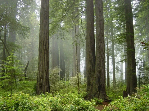
The Smith River (Tolowa: xaa-wvn’-taa-ghii~-li~’, nii~-li~’) flows from the Klamath Mountains to the Pacific Ocean in Del Norte County, California. It is about 25.1 miles long and passes through Jedediah Smith Redwoods State Park. The river is notable as the only major California river never to have been dammed.
Quick Facts
- Length
- 25.1 mi / 40.4 km
- Source location
- Gasquet, Klamath Mountains
- Six Rivers National Forest
- Del Norte County
- Source elevation
- 315 ft / 96 m
- Mouth
- Pacific Ocean
- Mouth location
- near community of Smith River, Del Norte County
- Mouth elevation
- 0 ft / 0 mm
- Basin size
- 719 sq mi / 1,862 km²
- Tributaries left
- Middle Fork Smith River, South Fork Smith River
Facts from the source article.
Did You Know?
- The Smith River and surrounding forests were used as filming locations for most of the Endor scenes in the 1983 movie Return of the Jedi.
- The river is considered one of the crown jewels of the National Wild and Scenic River program.
Course
The Smith River begins at the confluence of its Middle Fork and North Fork near Gasquet. The Middle Fork, 27.8 miles long, rises in Del Norte County and flows west. The North Fork, 28.1 miles long, originates in Oregon on Chetco Peak. The South Fork, 43.3 miles long, joins near Hiouchi. From there the river flows northwest, entering the Pacific Ocean near the community of Smith River, about 10 miles north of Crescent City. Its estuary is recognized for protection by the California Bays and Estuaries Policy.
Crossings
The Smith River Bridge, built in 1929 and also known as the Hiouchi Bridge, was an uncommon cantilever highway truss bridge in California. It carried U.S. Highway 199 over the Smith River. Virginia Bridge & Iron Co. in Roanoke fabricated its steel, which traveled through the Panama Canal to San Francisco, then by coastal vessel to Crescent City. Its suspended center span was a Parker truss. This was the first cantilever truss design from the California Division of Highways Bridge Department, created in 1928 and influenced by the 1927 Carquinez Bridge. Replacement studies started in 1987 because the bridge was functionally obsolete and had suffered damage from heavy truck traffic, raising collapse concerns. Since it was deemed eligible for the National Register of Historic Places, it was recorded to Historic American Engineering Record standards before its 1989 demolition.
More in Redwood National and State Parks
Spotted an error? Know more?
Reader corrections go straight into our review queue. Suggest an edit · How this site is sourced