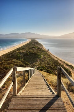
Isthmus of Corinth
Narrow land bridge separating Peloponnese from mainland Greece.

The Isthmus of Corinth, a narrow strip of land near the city of Corinth, links the Peloponnese peninsula to the Greek mainland. At just 6.3 kilometers (3.9 miles) wide, it served in antiquity as the boundary between the Peloponnese and the rest of Greece. In the first century AD, the geographer Strabo recorded a stone marker on the isthmus bearing two inscriptions: one facing east toward Megara read, “Here is not Peloponnesus, but Ionia,” while the one facing west toward the Peloponnese read, “Here is Peloponnesus, not Ionia.” Plutarch attributed this stele to the Athenian hero Theseus, who supposedly set it up on his journey to Athens. To the west lies the Gulf of Corinth, and to the east the Saronic Gulf. Since 1893, the Corinth Canal has cut through the isthmus, effectively turning the Peloponnese into an island. Today, two road bridges, two railway bridges, and two submersible bridges at each end of the canal connect the mainland side to the Peloponnese, with a military emergency bridge also located at the canal’s western end.
The idea of a canal to spare ships the long voyage around the Peloponnese was considered by the ancient Greeks. The tyrant Periander first attempted to build one in the 7th century BC but abandoned it due to technical challenges, instead constructing a simpler stone portage road called the Diolkos, whose remnants still exist near the modern canal. Under Roman rule, various solutions were tried. Julius Caesar saw the value of a link for his new colony, Colonia Laus Iulia Corinthiensis. During the reign of Tiberius, engineers tried digging a canal but were thwarted by a lack of modern equipment; they then adopted an ancient Egyptian method, rolling ships across the isthmus on logs, a practice in use by AD 32. In AD 67, the philhellene emperor Nero ordered 6,000 slaves—whom historian Flavius Josephus identified as Jewish pirates captured by Vespasian—to dig a canal with spades. According to Pliny the Elder, the work advanced about four stadia (roughly 0.8 kilometers). Nero died the following year, and his successor Galba halted the project as too costly. In modern times, the idea was seriously proposed in 1830, shortly after Greek independence from the Ottoman Empire, and was completed in 1893 after eleven years of work.
Near the canal runs the ancient stone trackway known as the Diolkos, once used for dragging ships overland. There is significant concern over its preservation, with Greek campaigners urging the government to do more to protect this archaeological site. Also located close to the canal is the Hexamilion wall, a Roman defensive barrier built across the isthmus to guard the only land route into the Peloponnese; it is the largest single archaeological structure in Greece.
- width
- 6.3 km (3.9 mi)
- location
- Near Corinth, Greece
- bodies_of_water
- Gulf of Corinth to the west, Saronic Gulf to the east
- notable_ancient_feature
- Diolkos stone ramp
- defensive_structure
- Hexamilion wall
Lore & Background
In the first century AD, the geographer Strabo noted a stele on the Isthmus bearing two inscriptions: one facing east reading 'Here is not Peloponnesus, but Ionia' and one facing west reading 'Here is Peloponnesus, not Ionia.' Plutarch ascribed the stele's erection to the Attic hero Theseus. The isthmus was known in the ancient world as the landmark separating the Peloponnese from mainland Greece. The idea for a canal to bypass the Peloponnese was long considered by ancient Greeks. The tyrant Periander attempted to build a canal in the 7th century BC but abandoned it due to technical difficulties, instead constructing a simpler stone ramp called the Diolkos. Under Roman rule, Julius Caesar foresaw advantages, and engineers under Tiberius tried to dig a canal but lacked modern equipment, resorting to rolling boats across on logs. Today, two road bridges, two railway bridges, two submersible bridges, and a military emergency bridge cross the canal. The ancient Diolkos trackway still exists nearby, and the Hexamilion wall, a Roman defensive wall, is located close to the canal.
Reader's Guide
The Isthmus of Corinth holds enduring significance as both a geographical boundary and a testament to human engineering ambition across millennia. Its narrow width made it a natural dividing line between the Peloponnese and mainland Greece, as commemorated by the ancient stele. The surviving Diolkos, a stone portage ramp, offers rare archaeological evidence of ancient overland ship transport. The Hexamilion wall further underscores the isthmus's strategic importance as the only land route into the Peloponnese. Today, the Corinth Canal makes the Peloponnese an island, while preservation concerns for the Diolkos highlight ongoing tensions between modern infrastructure and heritage protection. The isthmus thus encapsulates layers of Greek, Roman, and modern history in a single narrow strip of land.
Did You Know?
- The Isthmus is 6.3 km (3.9 mi) wide.
- A stele on the isthmus bore inscriptions marking the boundary between Peloponnesus and Ionia.
- The first canal attempt was by the tyrant Periander in the 7th century BC, who instead built the Diolkos stone ramp.
Frequently Asked Questions
What is the Isthmus of Corinth?
It is a narrow strip of land roughly 6.3 kilometers wide that links the Peloponnese peninsula to the rest of mainland Greece, situated just outside the city of Corinth. The Gulf of Corinth lies to its west and the Saronic Gulf to its east.
What role does the Isthmus of Corinth play geographically?
It serves as the sole natural land connection between the Peloponnese and the Greek mainland, making it a persistent chokepoint that has shaped trade routes, military campaigns, and regional identity for thousands of years.
Why is the Isthmus of Corinth historically significant?
Its strategic position made it a repeated target for canal-building projects and a natural defensive line, as evidenced by both the ancient Diolkos stone ramp and the later Hexamilion wall that guarded the crossing.
What ancient feature is associated with the Isthmus of Corinth?
The Diolkos, a paved stone ramp stretching across the isthmus, allowed vessels to be hauled overland between the two gulf sides, predating any canal by roughly two millennia.
More in Peninsulas And Isthmuses 1-24
Spotted an error? Know more?
This is a living reference — every entry is fact-audited, and reader corrections feed straight into our audit queue. Suggest an edit · See this site's audit record