Ngorongoro Conservation Area
A UNESCO World Heritage Site in Tanzania, home to Ngorongoro Crater, Olduvai Gorge, and the Great Migration.
Last updated

via Wikipedia: Serengeti National Park · see source
Where it is
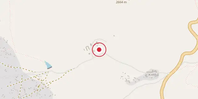
Coordinates: 3°12′36″S 35°27′36″E (-3.2100, 35.4600) · Open in OpenStreetMap
Coordinates and connected clubs: the infobox of Wikipedia: Ngorongoro Conservation Area (CC BY-SA 4.0). Map: drawn by Codexery from OpenStreetMap tiles.
Ngorongoro Conservation Area is a protected region and UNESCO World Heritage Site in northeastern Tanzania, located in the Ngorongoro District within the Crater Highlands, about 180 kilometers west of Arusha City. It takes its name from the Ngorongoro Crater, a large volcanic caldera found there. The area is managed by the Ngorongoro Conservation Area Authority (NCAA), a branch of the Tanzanian government, and its borders match those of the Ngorongoro District in the Arusha Region. To the west, it borders Serengeti National Park.
Together, the NCA, Serengeti National Park, and Kenya’s Maasai Mara game reserve host the Great Migration—an annual movement of millions of wildebeest, zebras, gazelles, and other animals. The NCA also includes Olduvai Gorge, a globally significant site for paleoanthropology. In 2023, it drew 752,232 visitors, making it one of Tanzania’s top attractions.
History
The crater’s name is onomatopoeic, inspired by the sound of a cowbell (ngoro ngoro) as heard by Maasai pastoralists. Hominid fossils, including OH 7 from Olduvai Gorge, show that various early human species have lived here for at least 1.75 million years. Hunter-gatherers gave way to pastoralists a few thousand years ago. The Iraqw people arrived around 2,000 years ago, followed by the Datooga around 1700, but both groups were pushed out by the Maasai in the 1800s.
The first European known to visit the Ngorongoro Crater was Oscar Baumann in 1892. Later, two German brothers, Adolph and Friedrich Siedentopf, farmed inside the crater after leasing the land from the German East African administration, continuing until World War I. They hosted shooting parties for German friends and tried to drive wildebeest out of the crater. The Germans established early game reserves that allowed hunting.
After World War I, under British rule, hunting restrictions began in 1921, and by 1930 the Ngorongoro Crater was included. The Land Ordinance of 1923 gave the Governor authority over indigenous land rights, though those rights were maintained through the 1950s. Tensions between conservation and indigenous rights grew.
The Serengeti National Park was created by the National Park Ordinance of 1948, implemented in 1951. To protect land rights for Maasai pastoralists, the Ngorongoro Conservation Area Ordinance of 1959 separated the NCA from the park. Maasai living in Serengeti National Park were systematically moved to the NCA, increasing the Maasai population there and fueling disputes with the Tanzanian government. The NCAA was established at the same time to manage the NCA as a multi-use protected area, with a mission to support Maasai pastoral traditions, preserve natural and cultural values, and regulate tourism.
The NCA became a UNESCO World Heritage Site in 1979 for its natural significance, particularly the crater and wildlife. In 2010, it gained Mixed Heritage Status due to the cultural importance of Olduvai Gorge.
This cultural recognition, however, has not included the Maasai community, contributing to ongoing conflict over land use and management. The Wildlife Conservation Act of 2009 further restricted human activity in the crater and created a legal basis to disenfranchise and forcibly displace traditional pastoralists. The International Union for Conservation of Nature is working to reduce conflict and improve collaborative conservation with local people.
Starting in 2021, citing concerns over preserving natural value, the Tanzanian government designed and began implementing a plan to relocate all Maasai from the NCA to Msomera, a village 600 kilometers away. The government calls this voluntary, but Human Rights Watch reports coercive actions that violate the principle of free, prior, and informed consent.
Geography
Geographically, the NCA lies in the southeast of the Serengeti ecosystem, adjoining Serengeti National Park to the northwest and sharing its southern Serengeti plains. These plains extend north into the unprotected Loliondo division, kept open to wildlife by Maasai transhumance pastoralism. To the south and east are volcanic highlands, including the Ngorongoro Crater and the smaller Empakaai Crater. The southern and eastern edges of the Serengeti ecosystem are roughly defined by the East African Rift wall, which also blocks animal migration in those directions.
Frequently Asked Questions
What is the Ngorongoro Conservation Area?
It is a protected region in northeastern Tanzania built around the world's largest intact, unfilled volcanic caldera. Beyond the crater itself, the area encompasses Olduvai Gorge and supports one of Africa's most dramatic seasonal wildlife movements.
What is Ngorongoro Conservation Area most famous for?
Fans typically cite three headline features: the Great Migration of wildebeest, zebra, and gazelle; the paleoanthropological excavations at Olduvai Gorge; and the ongoing Maasai pastoral traditions that continue within the boundaries.
More in Other Geographic Features
Sources
Compiled from Wikipedia and the sources listed below. Text from Wikipedia is available under CC BY-SA 4.0; this entry is adapted from it.
- Wikipedia: Ngorongoro Conservation Area (CC BY-SA 4.0).
- Word definitions: the , each quoted from its Wikipedia article.
Spotted an error? Know more?
Reader corrections go straight into our review queue. Suggest an edit · How this site is sourced