Denali
Highest peak in North America, third most prominent on Earth.

Denali (pronounced də-NAH-lee; in Koyukon, Deenaalee) is the highest peak in North America, rising 20,310 feet (6,190 meters) above sea level. Its vertical rise from the surrounding plateaus is about 18,000 feet (5,500 meters), one of the greatest on Earth. With a topographic prominence of 20,156 feet (6,144 meters) and an isolation of 4,621.1 miles (7,436.9 kilometers), it ranks as the third most prominent and third most isolated mountain globally, after Mount Everest and Aconcagua. The mountain sits in the Alaska Range within interior Alaska and forms the centerpiece of Denali National Park and Preserve. The Koyukon people have called it Denali for centuries. In 1896, a gold prospector renamed it Mount McKinley to support presidential candidate William McKinley, who later became the 25th president. The federal government recognized that name from 1917 until 2015. On August 29, 2015—40 years after Alaska had already officially renamed the mountain Denali—the U.S. Department of the Interior under the Obama administration changed the federal name to Denali. In January 2025, the Department of the Interior under the Trump administration reverted the federal name to Mount McKinley. The first recorded climbing attempt was in 1903 by James Wickersham, which failed. Frederick Cook claimed a first ascent in 1906, but that claim remains unverified and disputed. The first confirmed summit was reached on June 7, 1913, by Hudson Stuck, Harry Karstens, Walter Harper, and Robert Tatum via the South Summit. In 1951, Bradford Washburn pioneered the West Buttress route, now considered the safest and easiest, and thus the most popular. On September 2, 2015, the U.S. Geological Survey measured the mountain at 20,310 feet (6,190 meters), 10 feet lower than the 20,320 feet (6,194 meters) recorded in 1952 using photogrammetry. Geologically, Denali is a granitic pluton, mostly pink quartz monzonite, pushed upward by tectonic pressure from the Pacific plate subducting beneath the North American plate, while erosion stripped away overlying sedimentary material. These forces also generate many deep earthquakes in Alaska and the Aleutian Islands. The Pacific Plate remains seismically active beneath Denali in a region called the "McKinley cluster."
The mountain’s high topography stems from complex structural relationships involving the right-lateral Denali Fault and the Denali Fault Bend. The fault is driven by stresses from the low-angle subduction of the Yakutat microplate under Alaska. The Denali Fault Bend is a gentle restraining bend about 75 kilometers long. This curvature creates a "space problem": as right-lateral movement continues, high compressional forces at the bend push the crust upward vertically. The longer the crust stays within the bend, the higher the topography becomes. Several active normal faults north of the bend have been mapped with slip rates of roughly 2–6 millimeters per year, helping accommodate the unusual curvature. Denali’s summit elevation of 20,310 feet (6,190 meters) makes it North America’s highest peak and the northernmost mountain above 19,685 feet (6,000 meters) worldwide. From base to peak, it rises about 18,000 feet (5,500 meters), among the largest mountains entirely above sea level. It ascends from a sloping plain at 1,000 to 3,000 feet (300 to 910 meters), giving a base-to-peak height of 17,000 to 19,000 feet (5,000 to 6,000 meters). By comparison, Mount Everest starts from the Tibetan Plateau at a much higher base elevation—13,800 feet (4,200 meters) on the south side to 17,100 feet (5,200 meters) on the plateau—yielding a base-to-peak range of 12,000 to 15,300 feet (3,700 to 4,700 meters). Denali’s base-to-peak height is little more than half that of Mauna Kea’s 33,500 feet (10,200 meters), most of which lies underwater. The mountain has two main summits: the South Summit is higher, while the North Summit stands at 19,470 feet (5,934 meters) with a prominence of about 1,270 feet (387 meters). The North Summit is sometimes considered a separate peak but is rarely climbed except on northern routes. Five large glaciers flow from Denali’s slopes: the Peters Glacier on the northwest, the Muldrow Glacier on the northeast, the Traleika Glacier just east of the Muldrow and abutting the eastern side, the Ruth Glacier to the southeast, and the Kahiltna Glacier leading to the southwest. At 44 miles (71 kilometers), the Kahiltna is the longest glacier in the Alaska Range. The Koyukon Athabaskans have called the peak Dinale or Denali for centuries, a name based on a Koyukon word meaning "high" or "tall." During Russian ownership of Alaska, it was commonly called Bolshaya Gora (Russian for "big mountain"), a translation of Denali.
- Location
- Alaska Range, interior Alaska, United States
- Type
- Granitic pluton (pink quartz monzonite)
Quick Facts
- Native Name
- koy · Deenaalee
- Other Name
- Mount McKinley
- Elevation
- 20,310 ft
- Elevation System
- NAVD88
- Prominence Ft
- 20,156
- Parent Peak
- Aconcagua
- Isolation Mi
- 4,621.1
- Mapframe
- yes
- Mapframe-Zoom
- 8
- Mapframe-Caption
- Interactive map of Denali
- Location
- Denali National Park and Preserve, Alaska, US
- Range
- Alaska Range
Facts from the source article.
Lore & Background
Denali, the highest peak in North America, rises to 20,310 feet above sea level, with a vertical relief of about 18,000 feet from the surrounding plateaus, making its base-to-peak height among the greatest on Earth. Its topographic prominence of 20,156 feet and isolation of 4,621.1 miles rank it as the third most prominent and third-most isolated peak globally, after Mount Everest and Aconcagua. The mountain has two significant summits; the South Summit is the higher, while the North Summit reaches 19,470 feet with about 1,270 feet of prominence. Five large glaciers flow from its slopes: the Peters Glacier to the northwest, the Muldrow Glacier to the northeast, the Traleika Glacier to the east, the Ruth Glacier to the southeast, and the Kahiltna Glacier to the southwest, the latter being the longest glacier in the Alaska Range at 44 miles. Geologically, Denali is a granitic pluton composed mostly of pink quartz monzonite, formed by tectonic pressure from the subduction of the Pacific plate beneath the North American plate, with sedimentary material eroded away. Its high topography results from compressional forces at the Denali Fault Bend, a gentle restraining bend about 75 kilometers long, where right-lateral movement pushes the crust upward; several active normal faults north of this bend slip at rates of 2–6 mm per year. The Koyukon people have called the peak Denali for centuries, a name based on a word meaning "high" or "tall." It was federally designated as Mount McKinley from 1917 until 2015, when the official name was changed to Denali, though this was reverted to Mount McKinley in January 2025. The first verifiable ascent was on June 7, 1913, via the South Summit, and the West Buttress route, pioneered in 1951, is the safest and most popular.
Reader's Guide
Denali’s significance extends beyond its status as North America’s highest peak, rooted in its extreme topographic prominence and isolation—third globally in both measures after Everest and Aconcagua. Geologically, it is a granitic pluton, primarily pink quartz monzonite, uplifted by tectonic pressure from the Pacific plate subducting beneath the North American plate, while overlying sedimentary rock was eroded away. This process also generates deep earthquakes in Alaska and the Aleutians, particularly within the seismically active “McKinley cluster.” The mountain’s high topography results from the right-lateral Denali Fault and its gentle restraining bend, a 75-kilometer curvature that creates compressional forces, pushing crust vertically; the longer crust remains in this bend, the higher the topography. Active normal faults north of the bend, with slip rates of 2–6 mm/year, accommodate this curvature. Denali rises from a sloping plain with a base-to-peak height of roughly 18,000 feet, compared to Everest’s much higher base elevation. Its two main summits include the higher South Summit and the rarely climbed North Summit. Five large glaciers flow from its slopes: Peters, Muldrow, Traleika, Ruth, and the 44-mile-long Kahiltna, the longest in the Alaska Range. The Koyukon people have called it Denali for centuries, meaning “high” or “tall.” First climbed verifiably in 1913 via the South Summit, the West Buttress route, pioneered in 1951, is now the safest and most popular.
Did You Know?
- The Kahiltna Glacier, at 44 miles (71 km) long, is the longest glacier in the Alaska Range.
Denali's Standing Among the World's Most Prominent Peaks
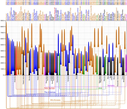
Denali is identified in topographic literature as a typical very high-prominence peak, placing it squarely within the elite tier of Earth's most independently rising summits. It appears in the ranking of the 125 most topographically prominent peaks on the planet, a list that represents the absolute pinnacle of what prominence measurement can capture. The United States claims twelve entries in this top-125 table, and Denali is among them, standing as one of the nation's most significant contributors to the global prominence landscape. This is not merely a matter of raw elevation above sea level; rather, it is about the sheer vertical independence of the summit from any higher neighbor. The prominence metric strips away the context of a mountain range and asks a more fundamental question: how much ground must you climb from the lowest saddle separating you from the next higher peak? For Denali, that answer is enormous, which is precisely why it earns its place in this exclusive grouping alongside the world's other great independent summits.
The Topographic Independence of Denali
What sets Denali apart in prominence terminology is the extraordinary distance between the summit and both of its parent peaks. In the framework of topographic analysis, every peak except the highest on a landmass has a prominence parent and an encirclement parent. For a peak with a very low key col, these parents can be surprisingly close or produce counterintuitive results. Denali, however, is cited as the archetype of a peak for which both definitions place the parent far, far away. This spatial separation is not a flaw in the measurement system; it is the very signature of topographic independence. The prominence parent is determined by tracing runoff territories from the key col of every more-prominent peak, and the encirclement parent is found by following the contour below that col to the highest mountain in the resulting region. For Denali, both methods yield a parent that is geographically remote, underscoring that the mountain rises from a broad, low-lying base rather than from the shoulder of a nearby giant.
Denali as a Touchstone in Prominence Theory
In discussions of topographic prominence, Denali serves as a go-to example when explaining how parent relationships work for peaks of exceptional independence. The terminology distinguishes between two ways of identifying a peak's parent: the prominence parent, found by dividing the region into territories based on runoff from the key cols of all more-prominent summits, and the encirclement parent, found by tracing the contour line below the key col and selecting the highest mountain within that enclosed area. For most peaks, these two methods agree, and a single parent is listed. Denali is presented as a case where both definitions converge on the same conclusion—that the parent lies at a great distance—making it a clean, intuitive illustration of the concept. This stands in contrast to peaks with very low cols, such as Jabal Shams at rank 110, where the encirclement method can produce results that feel unintuitive to the observer. Denali's clarity makes it a natural reference point for anyone learning the mechanics of prominence ranking.
Denali in the Global Prominence Landscape
Denali occupies a position within a broader global context of topographic prominence that spans every continent. The 125-peak table from which it draws its standing is dominated by a handful of nations: Indonesia leads with thirteen entries, while China and the United States each claim twelve. Denali is one of America's twelve representatives in this elite list, a testament to the country's diverse and dramatic topography. Beyond the top 125, the prominence world extends much further. Any peak with a prominence exceeding 1,500 metres qualifies as an Ultra, and the current count of such summits worldwide stands at approximately 1,524. Denali, with its very high prominence, sits comfortably well above that threshold. The prominence framework also makes specific allowances: human-made features like the Suez and Panama canals are excluded from col calculations, as are towers or monuments atop summits. These conventions ensure that Denali's prominence figure reflects purely natural topography, unaltered by engineering or human construction.
Frequently Asked Questions
What is Denali made of?
The peak is a granitic pluton composed of pink quartz monzonite, a rock type that gives the mountain its distinctive hue.
More in Notable Mountains And Peaks 1-23
Spotted an error? Know more?
This is a living reference — every entry is fact-audited, and reader corrections feed straight into our audit queue. Suggest an edit · See this site's audit record