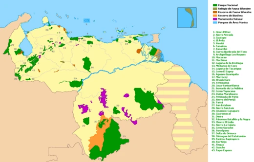
Sierra Nevada National Park (Venezuela)
Venezuelan national park protecting the Sierra Nevada de Mérida.
Sierra Nevada National Park is a protected area in western Venezuela, spanning the states of Mérida and Barinas. Established on May 2, 1952, by decree of President Germán Suárez Flamerich, it was created to safeguard the Sierra Nevada de Mérida in the Andes. The park contains many of Venezuela's tallest mountains, including Pico Bolívar, the nation's highest peak at 4978 m.
Quick Facts
- Location
- Venezuelan Andes
- Nearest city
- Mérida
- Area
- 276,446 ha / 1,067 sq mi
- Established
- 2 May 1952
- Governing body
- Instituto Nacional de Parques(INPARQUES); National Park Institute
Facts from the source article.
History
The concept for the park originated in 1948 at the Escuela de Ingeniería Forestal. The University of the Andes formed a commission that prepared a preliminary study, later presented to national authorities to justify the park's creation. The Governing Board, chaired by Germán Suárez Flamerich, signed the decree on May 2, 1952. Initially covering 190,000 hectares, the park was expanded on August 14, 1985, by President Jaime Lusinchi, adding 86,446 hectares to reach a total of 276,446 hectares.
Geography
The park covers 276,446 hectares across six municipalities in Mérida and three in Barinas, with 67.2% in Mérida and 32.8% in Barinas. It includes the Sierra Nevada de Mérida and Sierra de Santo Domingo, part of the Cordillera de Mérida in the central Venezuelan Andes. The rugged terrain features the country's main peaks: Pico Bolívar (4,978 m), Pico Humboldt (4,942 m), Pico La Concha (4,922 m), Pico Bonpland (4,883 m), and Pico Espejo (4,609 m). The Sierra Nevada is separated from the Sierra La Culata by the Chama River valley to the northwest and by the Santo Domingo River valley, Kettle Mucubají, and José Antonio Páez dam to the northeast. The southwestern boundary follows the valley of the Nuestra Señora river. The park's two major mountain ranges are characterized by high peaks, glacial valleys, and river valleys. Main rivers include the Chama, Albarregas, and Mucujún flowing into Lake Maracaibo, and the Caparo, Santo Domingo, and Cajurí flowing into the Orinoco basin. Thirteen watersheds and ten glacial lakes, such as Mucubají, La Negra, La Verde, and Los Anteojos, are present. Vegetation includes Andean cloud forests with trees, undergrowth, epiphytes, and endemic species; above 3,000 m, moorland with Espeletia species; xerophytic scrub in drier areas; and forest with trees up to 25 m in Barinas.
Fauna
The park's diverse climate supports a wide range of animal species. It is home to the spectacled bear, the only Ursidae species in the Andes and classified as endangered. Other wildlife includes white-tailed deer, helmeted curassow, puma, Andean coati, jaguar, paca, and moor rabbit, as well as feral cattle and horses. Avian species include the Andean guan, white-tailed quetzal, masked trogon, magpies, black-chested buzzard-eagle, and the Andean condor, which faces extinction and is subject to restocking programs in Colombia.
Access
The park is accessible via several routes. The Mérida cable car is the most popular entry method. Road access is available through the village of Tabay, via the La Mucuy area, leading past lagoons such as Coromoto, La Verde, and El Suero. This route passes the periphery of Pico Humboldt and La Concha, continues south to Pico Bolívar, and extends southeast to Pico Espejo.
More in National Parks of Venezuela
Spotted an error? Know more?
Reader corrections go straight into our review queue. Suggest an edit · How this site is sourced