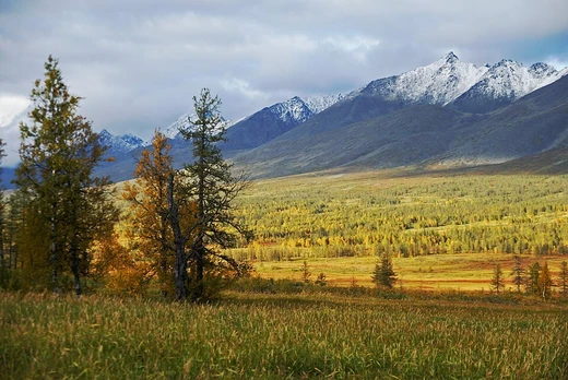
Anyuysky National Park
Ecological corridor from Amur floodplain to Sikhote-Alin mountains.
Anyuysky National Park sits on the western side of the Central Sikhote-Alin range in Russia's Far East, following the Anyuy River basin. The river flows west into the Amur, which then runs northeast to the Sea of Okhotsk. The park links the low Amur floodplain with the high, forested mountains, serving as a vital ecological corridor. Located in Khabarovsk Krai's Nanaysky District, it lies about 50 miles northeast of Khabarovsk city.
Quick Facts
- Location
- Khabarovsk Krai
- Nearest city
- Khabarovsk
- Area
- 429,370 ha / 1,658 sq mi
- Established
- 15 May 1999
- Governing body
- FGBI "Anyuiskiy"
Facts from the source article.
Did You Know?
- Vulnerable species in the park include the near-threatened mountain weasel, the vulnerable Asian black bear, and the data-deficient long-tailed birch mouse.
- The local indigenous people are the Nanai, representing about a quarter of the nearby settlements.
Topography
The park is shaped like a horseshoe, its borders tracing the ridges that separate the Anyuy and Pihtsy river basins. Both rivers flow west to join the Amur. The eastern side is mountainous, while the lower western part is mostly floodplain. This western half sits on a low eastern edge of the Sredneamurskaya plain, a flat, swampy lowland between the Sikhote-Alin ridge and the Lesser Khingan mountains, with elevations dropping to 40 meters. The southeastern wing, the Pihtsy river valley, is fairly flat. The northeastern wing, the Anyuy river valley and its tributaries, features steeper, deeper canyons and averages 600 meters in height. The park’s southern boundary follows the northern line of the Three Sisters dividing range.
Climate and ecoregion
Anyuysky National Park experiences a humid continental climate with warm summers, marked by four distinct seasons. Winters are cold and dry, receiving less than a tenth of the summer rainfall, while summers are warm and wet. The park sits within the Ussuri broadleaf and mixed forests ecoregion, known for temperate forests and autumn foliage. Its freshwater environment is the Lower Amur River Basin. The Amur River hosts more freshwater species than any other Russian river, totaling 120, and is famous for salmon migrating up the river and its mountain tributaries.
Plants
The park integrates continuous habitat from river floodplains through valley-mountain sub-taiga of Mongolian oak and Korean pine to mountain ridges. The Korean cedar pine, described by the World Wildlife Fund as the heart of the ecosystem, has seen its numbers reduced by two-thirds in the past 50 years and is increasingly targeted by illegal logging in areas surrounding Anyuysky.
History and current status
The Nanai were the traditional inhabitants of local rural settlements. The village of Arsenyevo, on the interior border of the park, was a place of exile during 1930s collectivization and later served as a Japanese POW camp in the 1940s. In 2011, the Sakhalin–Khabarovsk–Vladivostok pipeline was completed along the west border of the park, with the operator stating that construction was carried out within existing communication lines and that disturbed lands were remediated. As of 2012, the park had opened a visitors center and employed 50 people. In 2015, an Amur tiger named Uporny was released in the region and after six weeks chose a territory inside the park.
More in National Parks of Russia
Spotted an error? Know more?
Reader corrections go straight into our review queue. Suggest an edit · How this site is sourced