
Hakusan National Park
National park in Chūbu, Japan, centered on Mount Haku.
Last updated
Where it is
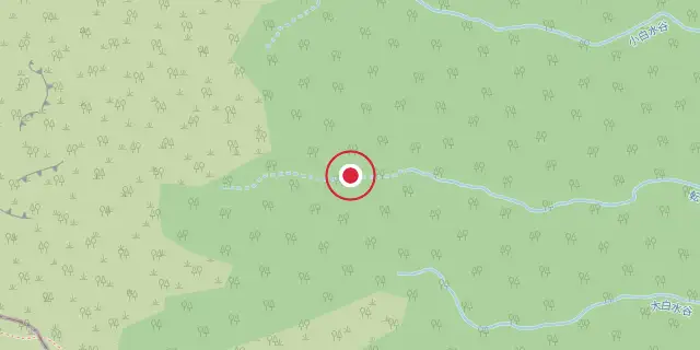
Coordinates: 36°09′18″N 136°47′17″E (36.1550, 136.7880) · Open in OpenStreetMap
Coordinates and connected clubs: the infobox of Wikipedia: Hakusan National Park (CC BY-SA 4.0). Map: drawn by Codexery from OpenStreetMap tiles.
Hakusan National Park is a national park in the Chūbu region of Honshū, Japan, established in 1962. It spans the borders of Fukui, Gifu, Ishikawa, and Toyama prefectures, with Mount Haku as its main geographical feature. In 1980, an area of 480 km² corresponding to the park was designated a UNESCO Man and the Biosphere Reserve.
Background
Hakusan National Park was originally designated Hakusan Quasi-National Park in 1955, before receiving full national park status in 1962. Its main geographical feature is Mount Haku, and the park spans the borders of four prefectures: Fukui, Gifu, Ishikawa, and Toyama. The vegetation of the park ranges from warm temperate to alpine zones. The base of the mountains is covered by coniferous forests dominated by firs, pines, and Japanese cedar, while deciduous forests and woodlands dominated by Mongolian oak and Japanese beech are present at higher elevations, where open landscapes occur.
The park is home to golden eagle, mountain hawk-eagle, Japanese macaque, Asiatic black bear, Japanese serow, and Sika deer. Sites of interest include Mount Akausagi, Mount Haku, Heisen-ji Hakusan Jinja, Hyakuyojō falls, Kyō Mountains, and Shiramizu falls. Neighboring municipalities include Ōno and Katsuyama in Fukui; Gujō, Takayama, Shirakawa, and Gifu in Gifu; Hakusan in Ishikawa; and Nanto in Toyama.
From Quasi-National to UNESCO Recognition
Hakusan's path to full protection was not immediate. In 1955, the area around Mount Haku received a preliminary designation as a quasi-national park, a status that offered some conservation measures but fell short of the comprehensive framework that full national park standing would provide. Seven years later, in 1962, the Japanese government elevated the region to complete national park status, cementing its place among the country's most important protected landscapes in the Chūbu region of Honshū.
The park's story did not end there. In 1980, an area of 480 square kilometers within the park's boundaries was recognized by UNESCO as a Man and the Biosphere Reserve, a designation that acknowledged the intertwined relationship between human communities and the natural environment surrounding Mount Haku. This layered progression—from quasi-national protection, to full national park status, to international biosphere recognition—reflects a growing appreciation for the ecological and cultural value of the Hakusan region across more than two decades of the twentieth century.
A Four-Prefecture Landscape
What makes Hakusan National Park geographically distinctive is that it does not belong to a single administrative region. The park stretches across the borders of four prefectures—Fukui, Gifu, Ishikawa, and Toyama—placing it firmly in the heart of Honshū's Chūbu region. This multi-prefecture footprint means that the park's conservation and management involve coordination among several local governments. The neighboring municipalities that touch the park's edges include Ōno and Katsuyama in Fukui; Gujō, Takayama, Shirakawa, and Gifu in Gifu; Hakusan in Ishikawa; and Nanto in Toyama.
At the center of this sprawling landscape stands Mount Haku, the park's defining geographical feature and the source of its name. The mountain anchors a region where the boundaries of human settlement and wild terrain blur, with communities in all four prefectures looking up toward the same peak. This shared geography has made Hakusan a natural focal point for the Chūbu region's identity, tying together diverse local cultures under a single protected landscape.
Living Ecosystems from Forest Floor to Alpine Sky
The biological richness of Hakusan National Park is shaped by its dramatic elevation range, which supports vegetation zones stretching from warm temperate lowlands all the way up to open alpine landscapes at the highest points. At the mountain bases, dense coniferous forests dominate, with firs, pines, and Japanese cedar forming thick canopies. Interspersed among these are deciduous woodlands where Mongolian oak and Japanese beech set the tone for the understory.
As the terrain climbs, the forest thins and eventually gives way to exposed, open alpine terrain. This vertical diversity creates habitat for a remarkable assemblage of wildlife. The skies above the park are patrolled by the golden eagle and the mountain hawk-eagle, both powerful raptors. On the ground, the park shelters several larger mammal species characteristic of the Japanese islands, including the Japanese macaque, the Asiatic black bear, the Japanese serow, and the Sika deer.
Together, these species paint a picture of a mountain ecosystem where every elevation band supports its own community of life, from the shaded conifer floors to the windswept peaks.
Landmarks and Sacred Grounds
Beyond its ecological significance, Hakusan National Park is dotted with landmarks that blend natural drama with deep cultural and spiritual resonance. Mount Haku itself, the park's namesake and central peak, towers over the landscape as a symbol of the region. Nearby, Mount Akausagi and the Kyō Mountains add further peaks to the skyline, each offering its own character and vantage points. Water features play a prominent role in the park's scenery: Hyakuyojō falls, whose name encodes its considerable height, and Shiramizu falls, meaning white water falls, cascade through the terrain, their names preserving the Japanese tradition of embedding landscape qualities into place names.
Perhaps most culturally significant is Heisen-ji Hakusan Jinja, a shrine that ties the mountain to centuries of Japanese spiritual practice, where Mount Haku has long been venerated as a sacred entity. These sites—peaks, waterfalls, and shrine—form a constellation of places that draw visitors seeking both the raw beauty of the Chūbu highlands and the quiet weight of a landscape shaped by human reverence over generations.
Ranked in
More in National parks of Japan
Sources
Compiled from Wikipedia and the sources listed below. Text from Wikipedia is available under CC BY-SA 4.0; this entry is adapted from it.
- Wikipedia: Hakusan National Park (CC BY-SA 4.0).
Spotted an error? Know more?
Reader corrections go straight into our review queue. Suggest an edit · How this site is sourced