St. Francis Dam
A 1928 dam collapse that killed at least 431 people.
Last updated

via Wikipedia: St. Francis Dam · see source
Where it is
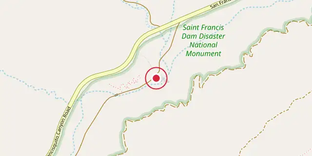
Coordinates: 34°32′49″N 118°30′47″W (34.5470, -118.5130) · Open in OpenStreetMap
Coordinates and connected clubs: the infobox of Wikipedia: St. Francis Dam (CC BY-SA 4.0). Map: drawn by Codexery from OpenStreetMap tiles.
The St. Francis Dam was a concrete gravity-arch dam built in San Francisquito Canyon in northern Los Angeles County, California, between 1924 and 1926. It was built to serve the growing water needs of the city of Los Angeles, creating a large regulating and storage reservoir that was an integral part of the Los Angeles Aqueduct. The dam failed catastrophically in 1928, killing at least 431 people in the subsequent flood, in what is considered to have been one of the worst American civil engineering disasters of the 20th century and the third-greatest loss of life in California history. Its failure ended the career of William Mulholland, the general manager and chief engineer of the Bureau of Water Works and Supply.
Construction and modification
Surveying for the dam began in December 1922, and construction started without public ceremony to avoid drawing attention from Owens Valley saboteurs who had damaged the Los Angeles Aqueduct. The St. Francis Dam was only the second concrete dam designed by the Bureau of Water Works and Supply, following the nearly identical Mulholland Dam.
Its design adapted plans and stress calculations from the Mulholland Dam, with modifications for the site. Although the dam was curved, the arch effect was not well understood at the time, so the structure was treated as a gravity dam without accounting for arch action, making its profile conservative. Preliminary studies and topographical surveys were completed by June 1923, calling for a dam at elevation 1825 feet above sea level, 175 feet above the stream bed, creating a reservoir of about 30,000 acre-feet capacity.
Dam instability
The reservoir began filling on March 12, 1926. Temperature and contraction cracks appeared, and minor seepage emerged from under the abutments. No contraction joints were included, following the protocol used for the Mulholland Dam.
Two vertical cracks ran down from the top, one about 58 feet west of the outlet gates and another a similar distance east. Mulholland and his assistant Harvey Van Norman inspected these and considered them normal. In April 1926, water reached the inactive San Francisquito Fault line in the western abutment, causing seepage that workers could not fully seal.
A 2-inch pipe collected this seepage and carried it to the dam keeper's home. By April 1927 the reservoir was within 10 feet of the spillway, and in May it was within 3 feet. The seepage pipe flowed about one-third full, which Mulholland described as exceptionally dry for a dam of that size.
Collapse and flood wave
The dam failed catastrophically at 11:57:30 p.m. on March 12, 1928. No eyewitnesses survived, but Ace Hopewell, a carpenter, rode past about ten minutes before midnight and heard a rumbling like rocks rolling on a hill, which he attributed to a landslide. At the moment of failure, a voltage drop occurred at two receiving stations in Los Angeles and at Powerhouse No. 1, while a transformer at a Southern California Edison substation exploded due to shorted wires on the hillside above the dam.
Only the center section and a wing wall remained standing. The main dam broke into large and small pieces, with the largest piece, weighing about 10,000 tons, found three-quarters of a mile downstream. The flood released 12.4 billion gallons of water down San Francisquito Canyon.
Investigation
At least a dozen investigations were launched, with eight beginning by the weekend after the collapse. Notable panels included one sponsored by Governor C. C. Young, headed by dam engineer A. J. Wiley; a Los Angeles City Council panel chaired by Reclamation Service chief Elwood Mead; and inquiries by the county coroner Frank Nance and district attorney Asa Keyes. Other groups were convened by the Water and Power Commissioners, the Los Angeles County Board of Supervisors (which hired J. B. Lippincott), and the Santa Clara River Protective Association (which employed geologist Bailey Willis and engineer Carl E. Grunsky).
Most commissions reached conclusions quickly, though not unanimously. The governor's commission submitted a 79-page report on March 24, only 11 days after the collapse, before the coroner's inquest had begun. The urgency stemmed from the Swing–Johnson Bill, then before Congress, which would fund Hoover Dam; supporters feared the disaster might jeopardize the bill, which was signed into law on December 21, 1928.
More in National Memorials of the United States
Sources
Compiled from Wikipedia and the sources listed below. Text from Wikipedia is available under CC BY-SA 4.0; this entry is adapted from it.
- Wikipedia: St. Francis Dam (CC BY-SA 4.0).
Spotted an error? Know more?
Reader corrections go straight into our review queue. Suggest an edit · How this site is sourced