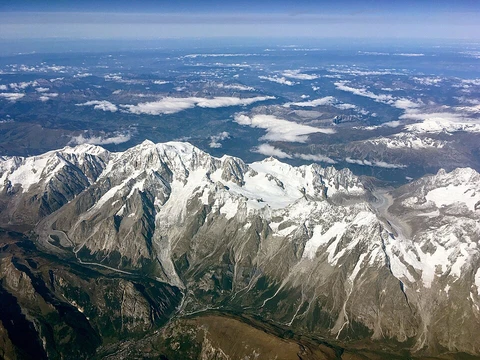
Ural Mountains
Mountain range listed in the Alpine-Himalayan orogenic belt.
Last updated
Where it is
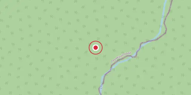
Coordinates: 60°00′00″N 59°00′00″E (60.0000, 59.0000) · Open in OpenStreetMap
Coordinates and connected clubs: the infobox of Wikipedia: Ural Mountains (CC BY-SA 4.0). Map: drawn by Codexery from OpenStreetMap tiles.
The Ural Mountains, a mountain range in Eurasia, run north-south primarily through Russia, extending from the Arctic Ocean coast to the Ural River and northwestern Kazakhstan near the Caspian Sea. This range forms a conventional boundary between Europe and Asia, separating European Russia from Siberia. Its northern continuation includes Vaygach Island and the Novaya Zemlya archipelago.
The average altitude is modest, with the highest peak, Mount Narodnaya, reaching a notable height. The mountains lie within the Ural geographical region, overlapping with the Ural Federal District and economic region. Their mineral wealth includes metal ores, coal, and precious and semi-precious stones, contributing significantly to Russia’s mineral sector since the 18th century, making the area a major center for metallurgy and heavy industry.
Historically, medieval Middle Eastern geographers knew of the range from trade with Bashkirs and others as far north as Great Perm by the 10th century. The first Russian mention appears in the Primary Chronicle, describing a Novgorodian expedition to the upper Pechora in 1096. Novgorodians later traded furs and collected tribute from Yugra and Great Perm, expanding southward. In 1472, Moscow’s Ivan III captured Perm, Pechora, and Yugra from Novgorod, and excursions across the Urals in 1483 and 1499–1500 fully subjugated Yugra.
By the early 16th century, Polish geographer Maciej of Miechów denied any mountains in Eastern Europe, but Sigismund von Herberstein’s 1549 report, citing Russian sources, confirmed the range’s existence, identifying it with ancient Riphean and Hyperborean mountains. After Moscow defeated the Khanate of Kazan in the 1550s, Russians reached the southern Urals, founding Ufa in 1574. The Stroganovs received lands in the Middle Urals, enabling Yermak’s crossing around 1581. Babinov’s road was built in 1597, and Verkhoturye was founded in 1598, with customs established shortly after.
Lore & Background
Stretching north-south through Russia from the Arctic Ocean coast to the Ural River and northwestern Kazakhstan near the Caspian Sea, the Ural Mountains form the conventional boundary between Europe and Asia, separating European Russia from Siberia. The chain continues northward into the Arctic Ocean through Vaygach Island and the Novaya Zemlya islands. The range’s average altitudes are modest, with its highest point at Mount Narodnaya.
The mountains lie within the Ural geographical region, overlapping with the Ural Federal District and Ural economic region. Their defining characteristics include rich deposits of metal ores, coal, and precious and semi-precious stones, which have made them a cornerstone of Russian metallurgy and heavy industry since the 18th century. Indigenous peoples have long named the range variously: the Komi and Northern Khanty call it “stone” or “rock,” the Tundra Nenets refer to it as “big rock,” and the Mansi name means “mountain.” The modern Russian name “Ural” emerged during the 16th–17th centuries, possibly from Turkic words for “stone belt” or from Ob-Ugric languages, and was initially applied to the southern parts before spreading to the entire range in the 18th century.
Reader's Guide
The Ural Mountains run north–south from the Arctic Ocean coast to the Ural River and northwestern Kazakhstan, forming the conventional boundary between Europe and Asia. Vaygach Island and Novaya Zemlya extend the chain into the Arctic. The highest point is Mount Narodnaya.
The range lies within the Ural geographical region, overlapping the Ural Federal District and Ural economic region. Its resources include metal ores, coal, and precious and semi-precious stones, contributing significantly to Russia’s mineral sector since the 18th century. The region remains a major center of metallurgy and heavy industry.
The name “Ural” first appeared in the 16th–17th centuries during the Russian conquest of Siberia, initially applied to southern parts and later the entire range. It may derive from Turkic “stone belt,” Bashkir “elevation,” Mansi “mountain peak,” or Evenk “mountain.” Indigenous peoples call it “stone” or “rock” in Komi, Khanty, and Nenets, and “mountain” in Mansi. Medieval Middle Eastern geographers knew the full range by the 10th century. The first Russian mention came in 1096 via a Novgorodian expedition.
Novgorodians later traded furs and collected tribute, expanding southward. By the 16th century, after the Tsardom of Russia defeated the Khanate of Kazan, Russians reached the southern Urals, founding Ufa in 1574. Yermak crossed the range around 1581, and Babinov’s road was built in 1597, leading to Verkhoturye in 1598.
More in Mountain Ranges And Massifs
Related in Mountain Ranges And Massifs
Links follow this subject's own source article.
Sources
Compiled from Wikipedia and the sources listed below. Text from Wikipedia is available under CC BY-SA 4.0; this entry is adapted from it.
- Wikipedia: Ural Mountains (CC BY-SA 4.0).
Spotted an error? Know more?
Reader corrections go straight into our review queue. Suggest an edit · How this site is sourced