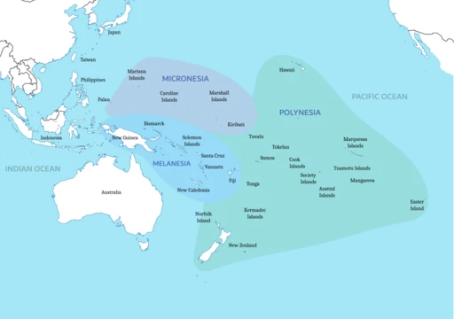
Campbell Island, New Zealand
Uninhabited subantarctic island, nature reserve, and part of a UNESCO World Heritage Site.

Vallee · CC BY-SA 4.0
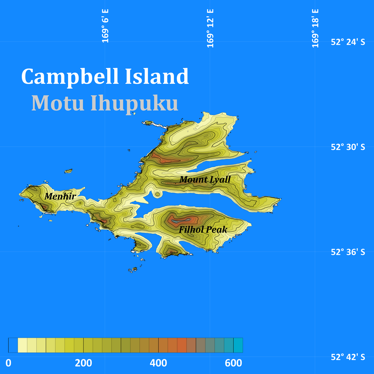
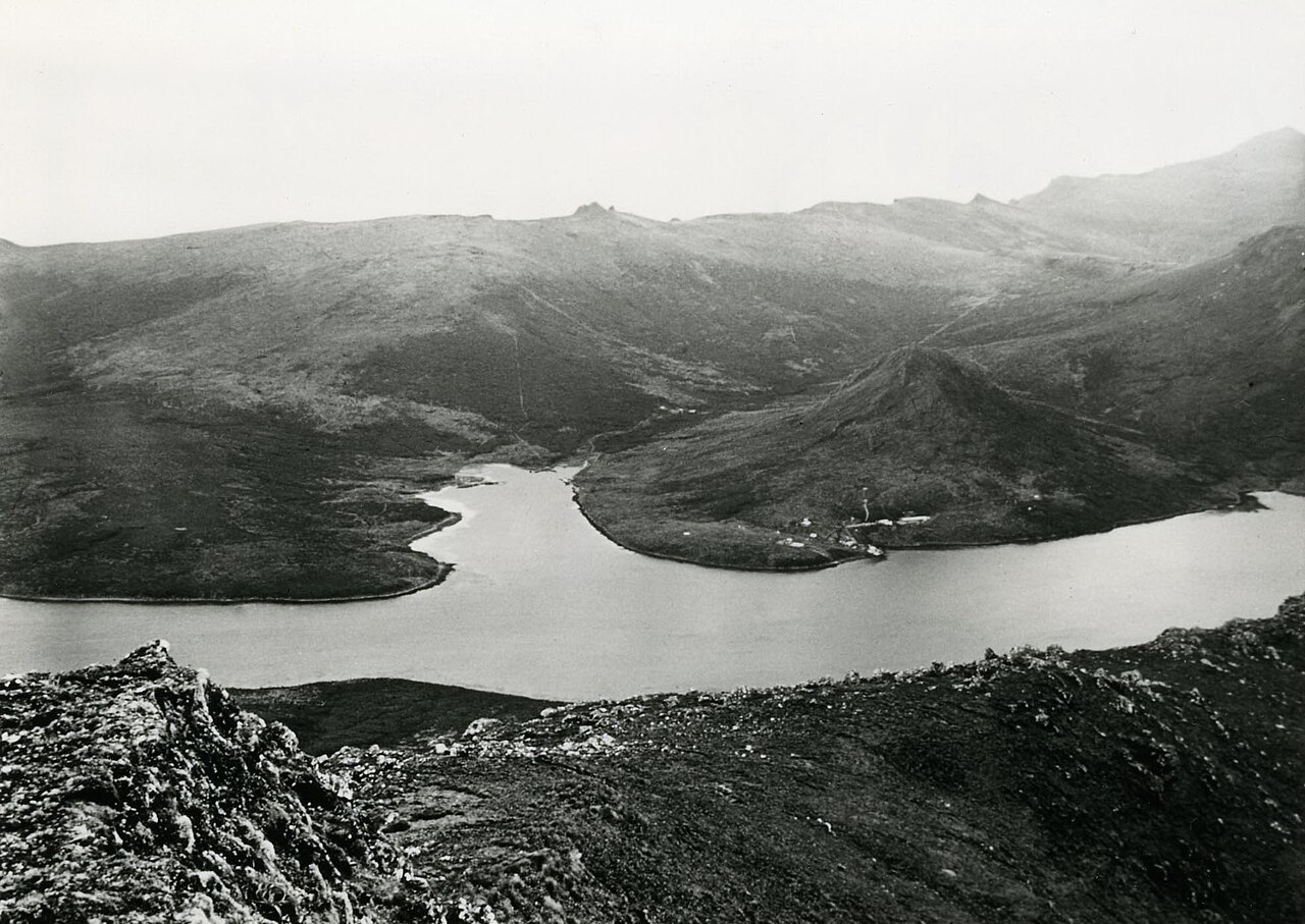
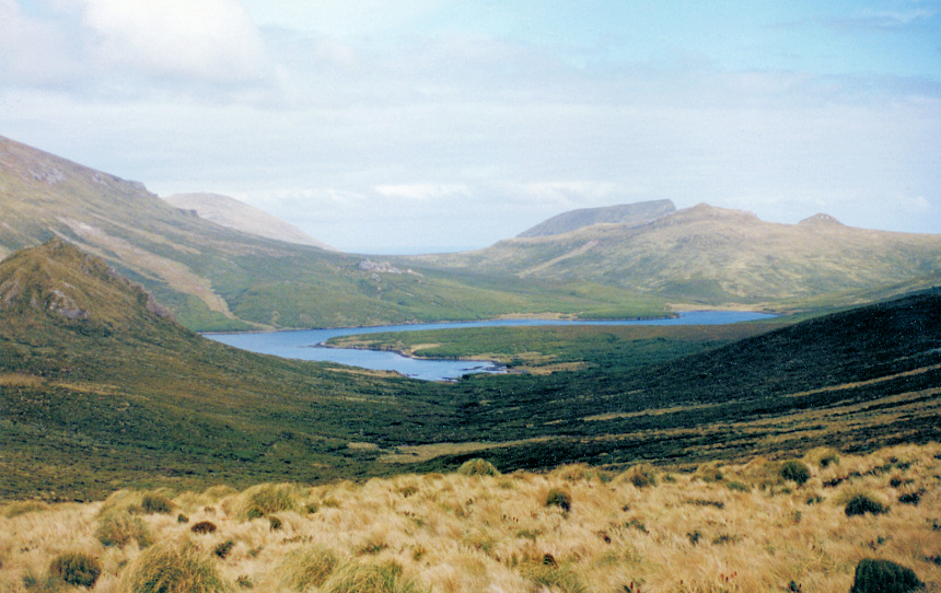
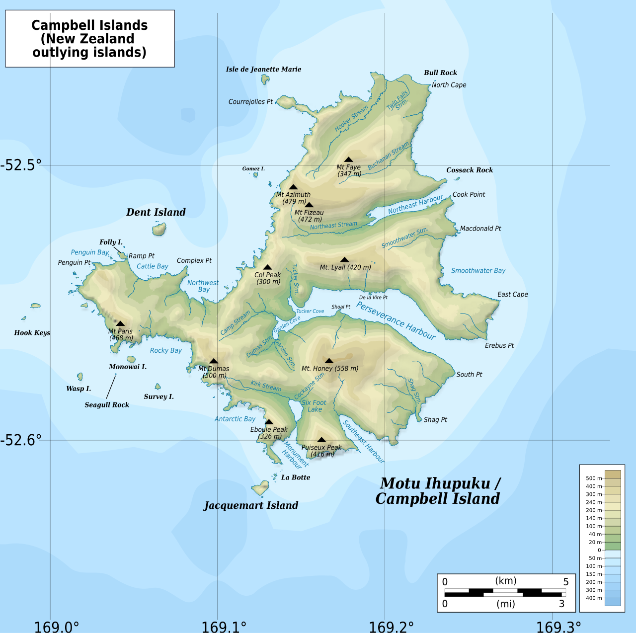
Campbell Island / Motu Ihupuku is a remote, uninhabited subantarctic island belonging to New Zealand. It is the largest island in the Campbell Island group, covering 112.68 square kilometres of the group’s total 113.31 square kilometres. The island sits about 660 kilometres south of New Zealand’s South Island. Its terrain is mountainous, with heights exceeding 500 metres in the southern part. A long fiord called Perseverance Harbour nearly cuts the island in two, opening to the sea on the east coast. Surrounding the main island are numerous stacks, rocks, and smaller islands, including Dent Island, Folly Island (or Folly Islands), Isle de Jeanette-Marie, and Jacquemart Island—the southernmost point of New Zealand.
Administratively, Campbell Island is listed with the New Zealand Outlying Islands. It is part of New Zealand but does not belong to any region or district; instead, it is an Area Outside Territorial Authority, like all other outlying islands except the Solander Islands. The island was declared a nature reserve in 1954 and became a UNESCO World Heritage Site in 1998 as part of the New Zealand Subantarctic Islands designation.
The island was first discovered in 1810 by Captain Frederick Hasselborough, commanding the sealing brig *Perseverance*, owned by Robert Campbell’s Sydney-based company Campbell & Co.—hence the island’s name. Captain Hasselborough drowned on 4 November 1810 in Perseverance Harbour, along with a young woman and a boy. The island soon became a seal hunting base, and the seal population was nearly wiped out. The first sealing boom ended by the mid-1810s; a brief revival occurred in the 1820s. The sealing era lasted from 1810 to 1912, with 49 recorded vessels visiting for sealing, one of which was lost off the coast. Whaling expanded here in the 1830s and 1840s. In 1874, a French scientific expedition visited to observe the transit of Venus, and much of the island’s topography is named after aspects of or people connected with that expedition. In December 1840, Campbell Island was the last landfall before the Ross expedition explored Antarctica.
In 1883, the American whaling schooner *Sarah W. Hunt* was near the island. Twelve men in two whaleboats headed for the island in bad weather to hunt seals. One boat vanished; the other, with six men, made it ashore. The captain, Sanford Miner, assumed all were lost and sailed to Lyttelton, New Zealand. The stranded whalers were rescued when the seal protection boat *Kekeno* happened to arrive. The captain’s actions caused an international scandal. In the late 19th century, the island became a pastoral lease. Sheep farming ran from 1896 until the lease, along with the sheep and a small herd of cattle, was abandoned in 1931 due to the Great Depression. In 1907, a group of scientists spent eight days on the island group surveying, conducting a magnetic survey and collecting botanical, zoological, and geological specimens. During World War II, a coastwatching station operated at Tucker Cove on the north shore of Perseverance Harbour as part of the Cape Expedition programme.
In 1992, a Campbell Island scene appeared on the reverse of the New Zealand five-dollar note in the fifth series. The scene includes a yellow-eyed penguin, a subantarctic lily, a daisy, and bull kelp. Following the Ngāi Tahu Claims Settlement Act 1998, the island’s name was officially changed to Campbell Island / Motu Ihupuku. In November–December 2012, an amateur radio DXpedition organised by the Hellenic Amateur Radio Association of Australia visited the island. The team of ten operators from around the world, a Department of Conservation officer, and a crew of six aboard the sailing vessel *Evohe* made 42,922 on-air contacts over eight days.
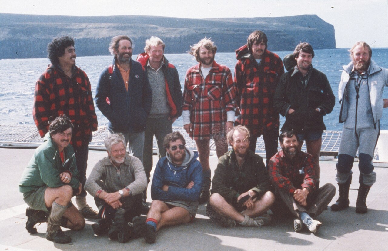
After World War II, the coastwatching station at Tucker Cove was converted into a meteorological station, used until the summer of 1958. A new base was then established at Beeman Cove, a few hundred metres east, offering better exposure for weather instruments—especially wind recordings—and more modern accommodation for up to 12 full-time staff. This station (WMO ID 93944) was run by the New Zealand Meteorological Service with ten full-time staff. Each team undertook 12-month expeditions, sending three-hourly weather reports and twice-daily radiosonde flights using hydrogen-filled balloons. Reports were radioed to ZLW Wellington Radio via HF. Besides meteorology, staff operated a seismic monitoring station, measured Earth’s magnetic field, the ionosphere, and aurora australis, and conducted albatross banding and whale counts—mainly of Southern Right Whales—for the New Zealand Wildlife Service. In April 1992, while snorkelling at Northwest Bay, staff member Mike Fraser was attacked by a great white shark about 30 metres offshore at Middle Bay. With help from teammate Jacinda Amey, Fraser reached shore despite severe lacerations to both arms. The team kept him alive at the bay, some four kilometres from the main base, while a rescue helicopter from Taupō made an emergency flight to the island.
- discoverer
- Captain Frederick Hasselburgh (also spelled Hasselborough)
Lore & Background
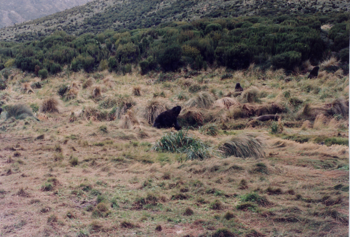
The island became a seal hunting base, and the seal population was almost totally eradicated. The sealing era on Campbell Island is generally considered to have ended by the 1830s, with only sporadic visits later. Whaling boomed in the 1830s and 1840s. Hunt lost twelve men in two whaleboats near the island; six were rescued by the seal protection boat Kekeno. During World War II, a coastwatching station operated at Tucker Cove.
Reader's Guide
Campbell Island is significant as a remote subantarctic outpost of New Zealand, serving as a seal hunting and whaling base in the 19th century, and later as a pastoral lease and meteorological station. Today, the island is visited by conservation staff, meteorological service personnel, and occasional eco-tourism cruises.
Discovery and the Era of Exploitation
Campbell Island entered the historical record in 1810 when Captain Frederick Hasselborough, commanding the sealing brig Perseverance, made the first recorded sighting. The vessel was owned by Robert Campbell's Sydney-based company, Campbell & Co., which gave the island its English name. The discovery was marred by tragedy: on 4 November 1810, Hasselborough drowned in Perseverance Harbour along with a young woman and a boy. The island swiftly became a seal-hunting ground, and the seal population was nearly eradicated. The first sealing boom collapsed by the mid-1810s, with only a brief revival in the 1820s. Across the entire sealing era, from 1810 to 1912, 49 vessels are documented as having called at the island, one of which was lost off the coast. Whaling then took hold, peaking in the 1830s and 1840s. In December 1840, Campbell Island served as the last landfall before the Ross expedition ventured into Antarctic waters.
The Sarah W. Hunt Disaster and the 1883 Scandal
In 1883, the American whaling schooner Sarah W. Hunt was operating near Campbell Island. In terrible weather, twelve men set out in two small whaleboats to hunt seals. One boat vanished without a trace. The other, carrying six men, limped ashore. Captain Sanford Miner of the Sarah W. Hunt, assuming all twelve were dead, sailed away for Lyttelton in New Zealand, leaving the six survivors stranded. Their rescue came by sheer luck: a seal protection vessel, the Kekeno, happened to arrive at the island and picked up the castaways. Miner's decision to abandon the survivors without proper search or notification sparked an international scandal that drew widespread condemnation. The incident remains one of the most notorious maritime controversies connected to the island, a stark reminder of the lawlessness that could prevail in the remote waters of the subantarctic.
Science, Weather, and Strategic Service
From the 1870s, Campbell Island drew the attention of scientists and governments alike. A French expedition visited in 1874 to observe the transit of Venus, and much of the island's topography carries names tied to that venture. In 1907, a Sub-Antarctic Islands Scientific Expedition spent eight days on the group, conducting a magnetic survey and collecting botanical, zoological, and geological specimens. During World War II, a coastwatching station operated at Tucker Cove on the north shore of Perseverance Harbour as part of the Cape Expedition programme. After the war, that station was converted into a meteorological outpost. By the summer of 1958, operations shifted to Beeman Cove, where a new base housed up to 12 full-time staff. The New Zealand Meteorological Service team issued three-hourly weather reports and launched twice-daily radiosonde flights using hydrogen-filled balloons, radioing data via HF to Wellington. Staff also monitored seismic activity, measured the Earth's magnetic field and ionosphere, tracked aurora australis, banded albatross, and counted Southern Right Whales for the Wildlife Service. In 1995, the manual programme was replaced by an automated station.
Conservation, Heritage, and the 1992 Rescue
The island's path from exploited resource to protected sanctuary is central to its identity. Sheep farming ran under a pastoral lease from 1896 until 1931, when the Great Depression forced the abandonment of the lease, the flock, and a small cattle herd. In 1954, Campbell Island was gazetted as a nature reserve, and in 1998 it gained UNESCO World Heritage status as part of the New Zealand Subantarctic Islands designation. Legally, the island is an immediate part of New Zealand yet falls outside any region or district, classified as an Area Outside Territorial Authority. In 1992, a Campbell Island scene featuring a yellow-eyed penguin, subantarctic lily, daisy, and bull kelp appeared on the reverse of the New Zealand five-dollar note. That same April, weather station staff member Mike Fraser was attacked by a great white shark roughly 30 metres offshore at Middle Bay. Colleague Jacinda Amey helped haul him to shore, and the team kept him alive four kilometres from the base until a helicopter from Taupō made what became the world's longest single-engine helicopter rescue. Amey received the New Zealand Cross; pilot John Funnell, the New Zealand Bravery Medal. Following the Ngāi Tahu Claims Settlement Act of 1998, the island's official name became Campbell Island / Motu Ihupuku.
Gallery
Frequently Asked Questions
What are the key geographical features of Campbell Island, New Zealand?
The island is nearly split in two by Perseverance Harbour, a large natural inlet that dominates its coastline. Beyond the harbour, the landscape is predominantly mountainous, with the highest peaks concentrated in the southern portion of the island.
Why is Campbell Island, New Zealand important to the Pacific Islands canon?
As entry 1-19 in the Islands of the Pacific series, Campbell Island highlights New Zealand's subantarctic territory and its transition from commercial exploitation to full conservation. Its designation as both a national nature reserve and a UNESCO World Heritage Site underscores its ecological significance within the broader Pacific region.
More in Islands Of The Pacific 1-19
Spotted an error? Know more?
This is a living reference — every entry is fact-audited, and reader corrections feed straight into our audit queue. Suggest an edit · See this site's audit record