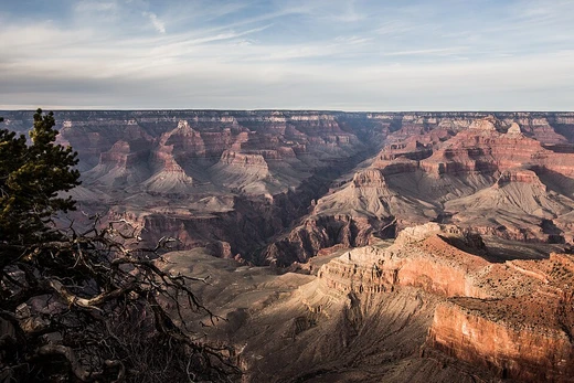
Karst
Karst is a topography formed from dissolving carbonate rocks.

Karst is a type of landscape created when water dissolves soluble carbonate rocks, mainly limestone and dolomite. Above ground, it often features large closed depressions called poljes; below ground, it is known for sinkholes, caves, and underground drainage networks. Under the right conditions, karst may also develop in more resistant rocks like quartzite. Because much of the drainage happens underground, surface water—such as rivers and lakes—is often scarce. In some cases, the dissolved rock is covered by debris or buried beneath non-soluble rock layers, so the characteristic karst features exist only underground and are completely absent at the surface.
The study of buried karst, known as paleokarst, is significant in petroleum geology. An estimated 50% of the world’s hydrocarbon reserves are held in carbonate rock, and a large portion of that is located within porous karst systems.
The word "karst" entered English from German in the late 19th century. German had used it much earlier to describe geological and hydrological features in the Dinaric Alps, a region stretching from northeastern Italy near Trieste, across southwestern Slovenia, and along the eastern Adriatic coast through the Balkan Peninsula to Kosovo and North Macedonia, where the Šar Mountains begin. The original karst zone is a plateau at the northwestern end of this range, between Italy and Slovenia. In local South Slavic languages, all forms of the word come from a Romanized Illyrian base (giving Latin *carsus* and Dalmatian *carsus*). This was later metathesized in Slavic from the reconstructed *korsъ* into forms like Slovene *kras* and Serbo-Croatian *krš* or *kras*, first recorded in the 18th century, with the adjective *kraški* appearing in the 16th century. As a proper noun, the Slovene form *Grast* appears in a document from 1177. Modern languages that kept the non-metathesized form (with -ar-) include Italian *Carso*, German *Karst*, and Albanian *karsti*. The word ultimately has a Mediterranean origin; it may come from the Proto-Indo-European root *karra-* meaning 'rock'. It might also be linked to the oronym *Kar(u)sádios oros* mentioned by Ptolemy, and perhaps to the Latin *Carusardius*.
Early studies of karst were pioneered by Johann Weikhard von Valvasor, who introduced the term to European scholars in 1689 in his description of the underground flows of rivers at Lake Cerknica. Jovan Cvijić, later called the "father of karst geomorphology," greatly advanced the field. His 1893 publication *Das Karstphänomen* described landforms such as karren, dolines, and poljes, and in 1918 he proposed a cyclical model for karst landscape development. Karst hydrology became a recognized discipline in the late 1950s and early 1960s in France. Before that, the work of cave explorers (speleologists) was often seen as a sport rather than a science, so underground karst caves and their water systems were poorly studied.
Karst develops most strongly in dense, thinly bedded, and highly fractured carbonate rock like limestone. It does not typically form well in chalk, because chalk is highly porous rather than dense, so groundwater flow is not concentrated along fractures. Karst is also most pronounced where the water table is low—such as in uplands with entrenched valleys—and where rainfall is moderate to heavy. These conditions promote rapid downward movement of groundwater, which dissolves the bedrock; standing groundwater, by contrast, becomes saturated with carbonate minerals and stops dissolving the rock.
The dissolution process begins when rain picks up carbon dioxide from the atmosphere, forming a weak carbonic acid solution. Additional carbon dioxide from soil respiration may be added as the water passes through the ground. This carbonic acid dissolves calcium carbonate in a sequence: water and carbon dioxide form carbonic acid, which then reacts with calcium carbonate to produce calcium ions and bicarbonate ions. In rare cases, oxidation plays a role. It was a major factor in forming ancient Lechuguilla Cave in New Mexico and is still active in the Frasassi Caves of Italy. The oxidation of sulfides can also contribute to karst formation. Oxygen-rich surface water seeping into deep, oxygen-poor karst systems reacts with sulfides (such as pyrite or hydrogen sulfide) to produce sulfuric acid. This acid then reacts with calcium carbonate, increasing erosion. The chain of reactions produces gypsum.
Karstification creates a range of surface and subsurface features. On exposed surfaces, small features include solution flutes (rillenkarren), runnels, limestone pavement (clints and grikes), and kamenitzas—collectively called karren or lapiez. Medium-sized surface features include sinkholes and cenotes (closed basins).
- field
- Geology, Geomorphology
- known_for
- Topography formed by dissolution of carbonate rocks, featuring sinkholes, caves, and subterranean drainage
- key_contributor_2
- Jovan Cvijić (known as the 'father of karst geomorphology')
Lore & Background
The English word karst was borrowed from German Karst in the late 19th century, which entered German usage much earlier to describe features in the Dinaric Alps. The karst zone is at the northwesternmost section, described as a plateau between Italy and Slovenia. In local South Slavic languages, all variations derive from a Romanized Illyrian base, later metathesized into forms such as Slovene kras and Serbo-Croatian krš. The word is ultimately of Mediterranean origin, possibly from the Proto-Indo-European root *karra- 'rock'.
Reader's Guide
Karst is most strongly developed in dense carbonate rock such as limestone that is thinly bedded and highly fractured. It is not typically well developed in chalk because chalk is highly porous. Karst is also most strongly developed where the water table is relatively low and where rainfall is moderate to heavy. The carbonic acid that causes karst features is formed as rain passes through Earth's atmosphere picking up carbon dioxide, which reacts with water to form a weak carbonic acid solution that dissolves calcium carbonate. In rare conditions, oxidation of sulfides leading to sulfuric acid can also be a corrosion factor. Karstification may result in a variety of large- or small-scale features both on the surface and beneath, including solution flutes, sinkholes, cenotes, disappearing streams, caves, and speleothems. Interstratal karst develops beneath a cover of insoluble rocks. Paleokarst is a fossil karst preserved within the rock sequence and is important in petroleum geology.
Did You Know?
- Widely-cited estimates suggest that 20% to 40% of the world's hydrocarbon reserves are hosted in carbonate rock, much of it found in porous karst systems.
- Karst hydrology emerged as a discipline in the late 1950s and early 1960s in France.
The Chemistry of Dissolution
Karst landscapes are born from a deceptively simple chemical process: water laced with dissolved carbon dioxide slowly eats away at carbonate bedrock. As rain falls through the atmosphere it absorbs CO₂, and once it reaches the ground, soil respiration contributes additional gas. Together these create a weak carbonic acid that attacks calcium carbonate, releasing calcium ions and bicarbonate into solution. This is the engine behind every sinkhole, cave, and underground river in a karst terrain. The process works best in dense, thinly bedded, highly fractured limestone, where water is channeled along cracks rather than spreading diffusely. Chalk, by contrast, is so porous that groundwater flows too evenly to carve dramatic features. A relatively low water table and moderate-to-heavy rainfall accelerate dissolution, because moving water remains undersaturated and hungry for more rock. In rare cases oxidation takes the lead. Ancient Lechuguilla Cave in New Mexico and the Frasassi Caves in Italy owe much of their form to this pathway, where oxygen-rich water meets sulfide minerals such as pyrite, generating sulfuric acid that dissolves limestone far more aggressively and ultimately precipitates gypsum.
A Landscape in Layers
A mature karst terrain is a catalog of forms spanning every scale. At the smallest level, rainwater carves delicate solution flutes and runnels into exposed bedrock, while broader areas develop into limestone pavements of flat clints separated by deep grikes—collectively called karren or lapiez. Step up in size and you encounter closed-basin sinkholes or cenotes, vertical shafts, inverted-funnel foibe, streams that vanish into the ground, and springs that re-emerge miles away. The grandest expressions include vast poljes, karst valleys, and, in landscapes where more rock has been removed than remains, striking karst towers or the so-called haystack and eggbox topographies. Beneath all of this sits an intricate plumbing network: karst aquifers, branching underground rivers, and sprawling cave and cavern systems. Because so much water is routed below, the surface often looks deceptively arid, with few or no rivers and lakes in sight. In some settings the soluble bedrock is buried under debris or capped by non-soluble strata, so every karst feature is locked at depth and the ground above shows no hint of what lies below.
Naming a Phenomenon
The word karst traveled a long road before entering English in the late nineteenth century. It passed first into German as Karst, describing the distinctive geology of the Dinaric Alps—a band stretching from above Trieste in northeastern Italy, across southwestern Slovenia, down the eastern Adriatic coast through the Balkans to the Šar Mountains in Kosovo and North Macedonia. In local South Slavic tongues the term descends from a Romanized Illyrian base, later metathesized from a reconstructed *korsъ into Slovene kras and Serbo-Croatian krš. Some scholars trace the root to Proto-Indo-European *karra- meaning rock, and Ptolemy's oronym Kar(u)sádios oros may preserve an even older echo. Karst hydrology only crystallized as a formal field in France during the late 1950s and early 1960s, after speleologists' fieldwork was finally taken seriously as science rather than sport.
Hidden Reservoirs and Practical Reach
Beyond its scenic drama, karst geology carries enormous practical weight. Because subterranean drainage diverts water below the surface, karst regions often lack the rivers and lakes one might expect, and the water that does exist is stored in complex aquifer systems. Where soluble bedrock is overlain by non-soluble strata or buried under debris, all karst features are confined to depth, making them invisible to surface observation. The most consequential application lies in petroleum geology. Paleokarst—karst features preserved within the stratigraphic column—matters because roughly half of the world's known hydrocarbon reserves are hosted in carbonate rock, and a significant share of those accumulations sit in porous karst systems. Understanding how ancient dissolution created those reservoirs is therefore central to exploration. Karst is not limited to classic carbonate settings either. Under the right conditions, even more weathering-resistant rocks such as quartzite can develop karst-like features, broadening the range of terrains where these processes must be considered.
Frequently Asked Questions
What exactly is Karst in geology?
Karst refers to a distinctive landscape that develops when water gradually dissolves soluble carbonate rocks such as limestone and dolomite over long periods. The resulting terrain is marked by both surface depressions and complex underground water pathways.
What surface and underground features are typical of a Karst landscape?
Above ground you commonly see poljes (large flat-floored depressions) and sinkholes, while below the surface the network of caves and subterranean streams channels the region's drainage.
Who is regarded as the father of karst geomorphology?
The Croatian geographer Jovan Cvijić is widely credited as the father of karst geomorphology for his systematic early-20th-century studies of the Dinaric Alps and the processes that shape these landscapes.
Why does Karst matter to petroleum geology?
Widely cited estimates place 20% to 40% of the world's hydrocarbon reserves in carbonate rock, and a large share of that oil and gas sits within the porous, fractured karst systems that form as those rocks dissolve.
Which scientific fields study Karst terrain?
Karst falls primarily under geology and geomorphology, with hydrology and petroleum geology also drawing on karst research because of its influence on groundwater flow and reservoir quality.
More in Geology & Earth Science 1-16
Spotted an error? Know more?
This is a living reference — every entry is fact-audited, and reader corrections feed straight into our audit queue. Suggest an edit · See this site's audit record