Bedrock river
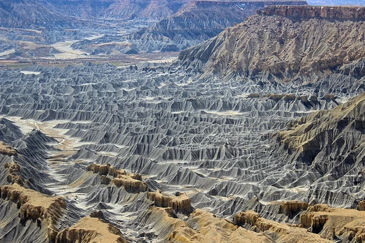
River flowing over bedrock with minimal sediment cover.
Last updated
A bedrock river is defined by its channel, which has little to no alluvium—loose sediment—covering the underlying bedrock. Most such rivers are not purely bedrock channels; they exhibit a mix of bedrock and alluvial characteristics, and the primary distinction from an alluvial river lies in the degree of sediment coverage. This coverage depends on the balance between the sediment supplied to the channel and the channel’s capacity to transport that sediment. Bedrock rivers are predominantly found in upland or mountainous regions, and they provide a unique natural laboratory for studying bedrock incision processes that are not associated with glacial activity.
The formation and erosion of bedrock rivers involve several key processes. Tectonic plate movement can force a river to incise into its bedrock as the land is uplifted, maintaining its flow path. The type of bedrock can change along a river’s course, influencing which erosional mechanisms dominate.
The main erosional processes are stream power, abrasion, quarrying, wedging, and dissolution. Stream power represents the conversion of gravitational potential energy into kinetic energy as water flows down a slope, calculated from water density, gravitational constant, discharge, and channel slope. Abrasion occurs when transported sediments—particularly suspended load (fine clays and silts) and saltating bedload (gravels and pebbles)—strike the bedrock, wearing away grains or flakes and forming features like potholes or troughs.
Quarrying, or plucking, involves the removal of bedrock blocks, often facilitated by pre-existing joints or fractures, which are then pushed along the riverbed by shear stress exceeding frictional forces. Wedging further contributes to block removal through processes such as hydraulic wedging or frost-cracking. These rivers typically employ a combination of these processes, with the dominant mechanism varying according to the specific river and its bedrock type.
Quick Facts
- Field
- Fluvial geomorphology
- Known for
- Bedrock incision and erosional processes
- Key processes
- Stream power
- abrasion
- quarrying
- wedging
- dissolution
- cavitation
Facts from the source article.
Lore & Background
Bedrock rivers form through incision caused by tectonic plate movement; as land is uplifted, the river incises into bedrock to keep flowing. The main erosional processes include stream power, abrasion, quarrying, wedging, and dissolution.
Stream power is the conversion of gravitational potential energy into kinetic energy as water steepens in slope, calculated by the equation Ω = ρgQS, where Ω is stream power, ρ is water density, g is the gravitational constant, Q is hydraulic discharge, and S is slope. Abrasion occurs when transported sediments erode the bedrock, with suspended load (fine grains like clays and silts) having high kinetic energy and causing damage upon contact with obstructions. Bedload erosion from saltating grains also wears away the surface, forming micro-cracks.
Reader's Guide
Bedrock rivers are significant because they provide a primary means of studying bedrock incision independent of glacial processes. Their formation and erosion are driven by tectonic uplift and a combination of erosional mechanisms, each dependent on the river's specific bedrock type. Stream power is considered the single most important factor in bedrock incision, as it converts water's potential energy into kinetic energy that beats on the bedrock.
Abrasion, quarrying, wedging, dissolution, and cavitation each contribute uniquely: abrasion by sediment transport, quarrying by removing bedrock blocks, wedging by enlarging cracks, dissolution by chemical weathering of soluble rocks, and cavitation by bubble collapse causing shock waves. These processes are not mutually exclusive; a bedrock river is a combination of all, varying by individual river and bedrock. Understanding these rivers helps explain landscape evolution in upland regions and the long-term response of rivers to tectonic and climatic changes.
Did You Know?
- Bedrock rivers are one of the only ways to study incision into bedrock that is not related to glaciers.
- Cavitation eroded a maximum depth of 18 inches of concrete in a dam spillway in 23 hours.
More in Coastal And Fluvial Geomorphology
Sources
Compiled from Wikipedia and the sources listed below. Text from Wikipedia is available under CC BY-SA 4.0; this entry is adapted from it.
- Wikipedia: Bedrock river (CC BY-SA 4.0).
Spotted an error? Know more?
Reader corrections go straight into our review queue. Suggest an edit · How this site is sourced