El Torcal de Antequera
A Jurassic limestone karst landscape in southern Spain.
Last updated
Where it is
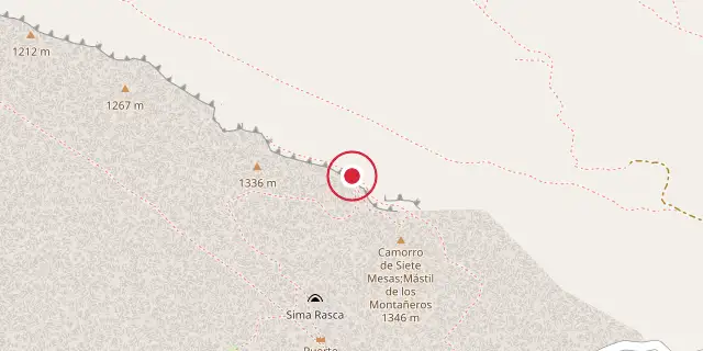
Coordinates: 36°57′50″N 4°32′46″W (36.9640, -4.5460) · Open in OpenStreetMap
Coordinates and connected clubs: the infobox of Wikipedia: El Torcal de Antequera (CC BY-SA 4.0). Map: drawn by Codexery from OpenStreetMap tiles.
El Torcal de Antequera is a protected natural area in the Sierra del Torcal range, just south of Antequera in Málaga province, Andalusia, Spain. It sits off the A45 road and is famous for its bizarre rock formations, widely considered one of Europe’s finest karst landscapes. The site was declared a Natural Site of National Interest in July 1929, and a Natural Park Reserve covering about 17 square kilometres was established in October 1978.
Geology
The Sierra del Torcal is a small mountain chain that separates Antequera from Málaga, made up of four geological sections: Sierra Pelada, Torcal Alto, Torcal Bajo, and Tajos and Laderas. Its highest point, Camorro de las Siete Mesas (1,336 m), lies in Torcal Alto. The limestone here is Jurassic in age, roughly 150 million years old, originally deposited in a marine corridor stretching from the Gulf of Cádiz to Alicante, linking the Atlantic and Mediterranean.
During the Tertiary period, these seabeds were uplifted over 1,300 metres, creating a low mountain range of flat-lying limestone—an unusual feature in Andalusia. Later, fractures, cracks, and faults at right angles (mostly NW-SE and NE-SW) were widened by erosion, forming the alleys between large limestone blocks seen today. The blocks themselves were shaped by water dissolving the rock (karstification) and freeze-thaw splitting, working on the horizontal beds to produce forms that resemble everyday objects—the Sphinx, the Jug, the Camel, the Screw, and others.
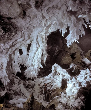
Flat surfaces were karstified into rugged, rocky terrain that is difficult to walk across. Like many massive limestones, El Torcal contains caves and underground features, some historically significant, such as the Cueva del Toro (Cave of the Bull), which holds Neolithic artifacts. These cavities also formed from rainwater dissolving the underground limestone.
Biology
The reserve hosts a rich variety of wildflowers, including rock-dwelling species like Linaria anticaria, Saxifraga biternata, Linaria oblongifolia, Viola demetria, Saxifraga reuterana, and Polypodium australe, along with lilies, red peonies, wild rose trees, and thirty types of orchid. Reptiles include the Montpellier snake and ocellated lizard. Other wildlife includes griffon vultures, Spanish ibex (the Andalusian mountain goat), and nocturnal mammals such as badgers, weasels, and rodents.
Visitor facilities
Visitors can reach El Torcal by paved road from the village of Villanueva de la Concepción. A small gift shop and interpretive centre near the parking area serve as the starting point for a short walk to a notable viewpoint and three colour-coded hiking trails—1.5 km, 2.5 km, and 4.5 km long—offering many scenic overlooks. Due to temperature extremes, most people visit in spring and autumn.
Quick Facts
- Location
- Sierra del Torcal, south of Antequera, Málaga, Andalusia, Spain
- Area
- about 17 square kilometres
Facts from the source article.
Also in the Codexery
More in Caves And Karst Formations
Sources
Compiled from Wikipedia and the sources listed below. Text from Wikipedia is available under CC BY-SA 4.0; this entry is adapted from it.
- Wikipedia: El Torcal de Antequera (CC BY-SA 4.0).
- Word definitions: the Codexery glossary, each quoted from its Wikipedia article.
Spotted an error? Know more?
Reader corrections go straight into our review queue. Suggest an edit · How this site is sourced