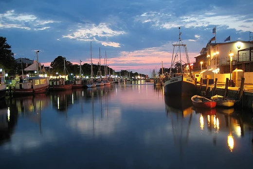
Amsterdam–Rhine Canal
A vital Dutch waterway connecting Amsterdam to the Rhine.

The Amsterdam–Rhine Canal links the port and capital city of Amsterdam to the Rhine River, the main shipping route. It runs 72 kilometers, is over 100 meters wide, and 6 meters deep. The canal heads generally southeast, passing through Utrecht to Wijk bij Duurstede, where it meets the Lek branch of the Rhine, and continues to the Waal River near Tiel. A branch called the Lek Canal connects to the Lek near Nieuwegein. It is among the busiest canals globally. In 2016, 91,495 vessels—including 5,541 recreational boats—used it, moving 77,172,454 tons of cargo.
The canal replaced the Merwede Canal, which ran from Amsterdam to Gorinchem. Excavation for the Merwede began in 1883, and it opened in 1892, but growing ship traffic and larger vessels made it unsuitable. From 1915 onward, seven replacement plans were proposed, until an eighth plan was created by Anton Mussert, a young engineer for the provincial water board who later became notorious. Construction of the Amsterdam–Rhine Canal started in 1933. The section between Utrecht and the Lek Canal was finished first, in 1938. The northern part, from Amsterdam to Douwe Egberts in Utrecht, reused the widened bed of the old Merwede Canal, while the southern part was newly built past Houten and Wijk bij Duurstede to Tiel. World War II slowed work, and the canal officially opened on 21 May 1952 by Queen Juliana. As ships grew larger, widening was needed, completed between 1965 and 1981. Planned work includes widening the Demka bend for safety, expected to finish in 2030.
Bridges over the canal include: Amsterdam Bridge (road, connecting Zeeburgereiland to Zeeburgerdijk); Zeeburgerrug (road, part of the Amsterdam Ring Road); Nescio Bridge (cycle and pedestrian, the longest cycle bridge in the Netherlands); Uyllander Bridge (connecting Diemen to IJburg); Muider Bridge (part of the A1); Bethlem Bridge (connecting Amstelveen to Muiden); Muiderspoorbrug (for the Amsterdam–Zutphen railway); Weesper Bridge (road); Line Bridge (cycle and pedestrian); Loenerslootse Bridge (road, linking local roads in Loenersloot); Breukeler Bridge (road); Maarsser Bridge (also called The High Bridge); Demka Railway Bridge (for the Amsterdam–Arnhem railway); Dafne Schippers Bridge (cycle and pedestrian); Galecopper Bridge (part of the Utrecht Ring Road); Schalkwijk Railway Bridge (for the Utrecht–Boxtel railway); Princess Irene Locks (road, part of the lock complex); Princess Marijke Lock Bridge (road, on the Prinses Marykesluisweg); and Rooijenstein Bridge (road, connecting roads in Zoelen).
Temporary closures have occurred. On 22 October 2010, a collision between a freight ship and a passenger boat briefly stopped shipping. On 17 February 2025, shipping was halted after electrical cables became entangled in a barge, causing two 150,000-volt cables to fall into the water; they were safely removed.
- designer_of_final_plan
- Rijkswaterstaat with chief engineer Johan van Veen
Lore & Background
The southern part, from the Lek to Tiel, was completed later and was newly constructed past Houten and Wijk bij Duurstede. Planned construction includes widening the Demka bend for safety, with a completion date not yet confirmed as of the last known updates.
Reader's Guide
The Amsterdam–Rhine Canal is a critical infrastructure asset in the Netherlands, serving as a direct link between Amsterdam and the Rhine river system. Its legacy is as a key artery for Dutch and European waterborne commerce, facilitating the movement of goods to and from one of the world's major ports.
Did You Know?
- The canal's final plan was created by Rijkswaterstaat, with chief engineer Johan van Veen playing a key role.
Engineering & Structural Design
As an artificial waterway, the Amsterdam–Rhine Canal operates as an engineered channel carrying free, calm surface flow under atmospheric pressure—essentially functioning as a constructed river. Like most canals of this kind, it relies on a series of dams and locks to establish reservoirs of slow-moving water, commonly referred to as slack water levels. Because the canal must traverse changes in elevation between the Amsterdam basin and the Rhine system, it requires external water sources above its highest point to maintain navigable depths. The engineering works involved include weirs and dams to raise water levels to usable depths, as well as locks that permit vessels to ascend and descend between levels. Where the route must cross a drainage divide atop a ridge, the construction becomes considerably more complex than a simple navigation that merely parallels a natural river. True canals of this type often demand additional infrastructure such as viaducts and aqueducts to maintain the waterway's integrity across uneven terrain. The finished cross-sectional shape of the channel is known as the canal prism, and the entire system must be supplied with water from streams, reservoirs, or other external sources to remain operational.
Commercial & Industrial Significance
Canals of the type represented by the Amsterdam–Rhine Canal have historically played an indispensable role in the commerce, development, and vitality of civilizations. The movement of bulk raw materials—coal, ores, and other heavy commodities—was practically a prerequisite for further urbanization and industrialization, yet it remained difficult and only marginally affordable without water transport. By providing a calm, reliable channel for barges and vessels, canals made the large-scale movement of these materials feasible, and in doing so they fueled the Industrial Revolution. This transformation gave rise to new research disciplines, new industries, and economies of scale that collectively raised the standard of living across industrialized societies. In the Dutch context, Amsterdam's own network of grachten illustrates how waterways became woven into the urban fabric, serving both as transport arteries and as the structural backbone of the city. The Amsterdam–Rhine Canal, as a waterway connecting existing rivers and other canals, fits squarely into this tradition of engineered channels that carry vessels transporting goods and people across a region, linking the capital's commercial infrastructure to the broader Rhine waterway system.
Decline & Modern Relevance
The canal network that once formed the commercial backbone of Europe and North America has undergone a long, gradual decline. The process began in the United Kingdom in the 1840s, where canal shipping was first supplemented and then superseded by the railway system—faster, less geographically constrained, and cheaper to maintain. By the early 1880s, many canals could not compete with rail transport and were abandoned. The twentieth century brought further pressure: oil increasingly replaced coal as the preferred heating fuel, reducing the volume of coal shipments that had sustained inland waterway traffic. After the First World War, advances in motor truck technology combined with expanding road networks shifted growing amounts of freight onto highways, and the last small barge canals in the United States experienced a steady decline in cargo ton-miles. Today, canals still in operation represent only a small fraction of those maintained during the height of the Industrial Revolution. Many smaller inland waterways have been filled in, left to deteriorate, or repurposed for flood control and pleasure boating. The Amsterdam–Rhine Canal, as part of a still-active waterway system, stands as a reminder of this once-dominant mode of bulk transport.
Classification & Construction Methods
The Amsterdam–Rhine Canal falls within the broader category of waterway canals—engineered channels for carrying vessels that transport goods and people. Within this category, it belongs to the sub-type connecting existing rivers, other canals, or seas, as opposed to city-network canals such as Amsterdam's grachten or the waterways of Bangkok. In terms of construction, canals are built using one of three methods, or a combination, depending on available water and the chosen path. One approach creates a canal where no stream exists, either by digging the channel body or raising its sides with dykes and levees of dirt, stone, or concrete. A second method dredges a channel through the bottom of an existing lake, then drains the lake so the channel becomes a new waterway serving both drainage and transport. A third approach, used for the eastern and central parts of the North Sea Canal, builds two parallel dikes within an existing lake to form the canal between them, then drains the remaining water. In all cases, pumping stations are typically required to keep surrounding land dry, and where elevation changes are involved, locks, lifts, or elevators must be constructed to raise and lower vessels between levels.
Frequently Asked Questions
What is the Amsterdam–Rhine Canal?
It is a major Dutch waterway that links the port and capital city of Amsterdam directly to the Rhine, the country's principal inland shipping artery.
Who was behind the final engineering plan for the Amsterdam–Rhine Canal?
Rijkswaterstaat, the Dutch water-management agency, produced the definitive design, with Johan van Veen serving as the project's chief engineer.
How much traffic does the Amsterdam–Rhine Canal handle?
It is consistently ranked among the busiest canals on the planet, moving millions of tons of cargo across its locks and channels every single year.
Why is the Amsterdam–Rhine Canal important to Dutch trade?
It gives Amsterdam a direct, high-capacity route into the Rhine corridor, which is essential for the port's container and bulk-cargo operations and for the broader national logistics network.
What role does the Amsterdam–Rhine Canal play in European shipping?
It bridges the North Sea port of Amsterdam with inland Rhine shipping routes, making it a critical artery for cargo moving between the sea and continental Europe.
More in Canals And Artificial Waterways 1-19
Related in Canals And Artificial Waterways
Links follow this subject's own source article.
Spotted an error? Know more?
This is a living reference — every entry is fact-audited, and reader corrections feed straight into our audit queue. Suggest an edit · See this site's audit record