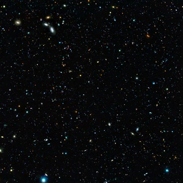
Deep Lens Survey
Ultra-deep multi-band survey for weak-lensing mass maps.
Last updated
The Deep Lens Survey used mosaic cameras on two telescopes in Chile and Arizona to image seven patches of sky, each four square degrees, over five years starting in 2001. It observed in four color bands, reaching surface brightnesses of 29th magnitude in B, V, and R, and 28th magnitude in z'. The survey’s primary aim was mapping dark matter via weak gravitational lensing, but it also released real-time alerts for optical transients, including moving objects like minor planets and comets, as well as supernova candidates.
Quick Facts
- Fields
- seven 4 square degree fields
- Telescopes
- Blanco (Cerro Tololo) and Mayall (Kitt Peak)
- Surface brightness limits
- 29/29/29/28 mag per square arcsecond
- Duration
- 2001–2006
Facts from the source article.
Survey
The Deep Lens Survey, also known as the Deep Gravitational Lensing Survey, is an optical survey that images seven fields, each covering four square degrees, to extreme depths. Observations were carried out over five years, from 2001 to 2006, using mosaic CCD cameras on the Blanco and Mayall telescopes at Cerro Tololo and Kitt Peak. The survey captures data in four bands—B, V, R, and z'—reaching surface brightness limits of 29, 29, 29, and 28 magnitudes per square arcsecond, respectively.
Real-time alerts are issued for optical transients, including supernova candidates and moving objects like comets and minor planets. Its primary purpose is to create unbiased maps of how mass is distributed on large scales beyond our local universe. This is achieved through extremely deep multicolor imaging of seven two-degree fields, using color-based redshift estimates. By measuring the gravitational shear of background galaxies caused by foreground mass, the survey can detect all forms of clumped matter.
These weak-lensing observations will produce mass maps with a resolution of one arcminute on the sky, roughly 120 kiloparsecs per h at a redshift of 0.2, across several redshift slices. For the first time, such maps will track how large-scale structure has evolved from a redshift of one to the present day, testing theories that predict low-redshift mass forms filamentary or sheetlike patterns. The data will also constrain how matter clusters and, alongside cosmic microwave background results, test the gravitational instability model of structure formation.
Beyond this core goal, the survey’s wide-field design supports many other studies. By spreading observations of individual subfields across four separate observing runs over two years, the team can detect objects that vary over timescales from hours to months.
Did You Know?
- The survey covers seven 4 square degree fields, not 2-degree fields as stated in the survey description—the source gives both numbers.
- Observations of individual subfields are spread over 4 runs across two years to detect variable objects on scales from hours to months.
More in Astronomical Surveys
Sources
Compiled from Wikipedia and the sources listed below. Text from Wikipedia is available under CC BY-SA 4.0; this entry is adapted from it.
- Wikipedia: Deep Lens Survey (CC BY-SA 4.0).
- Word definitions: the , each quoted from its Wikipedia article.
Spotted an error? Know more?
Reader corrections go straight into our review queue. Suggest an edit · How this site is sourced